Volume 3 - Zoning maps
|
Zoning Amendments - Table Maps A-H
|
||||||
|
Map Sheet A |
||||||
|
Site Address |
Zoning From |
Zoning To |
Map Sheet |
Map Reference |
||
|
Patrickswell Court, Finglas, Dublin 11 |
Z9 |
Z1 |
Map A |
A-0002 |
||
|
Church of the Annunciation, Finglas West, Dublin 11 |
Z15 |
Z1 |
Map A |
A-0008 |
||
|
Map Sheet B |
||||||
|
Site Address |
Zoning From |
Zoning To |
Map Sheet |
Map Reference |
||
|
Blessed Margaret Ball Church, Santry |
Z1 |
Z15 |
Map B |
B-0001 |
||
|
Cadbury's Pitch and Putt, Coolock, Dublin 5 |
Z6 |
Z10 |
Map B |
B-0004 |
||
|
Circle K Nevin, Ballymun Road, Dublin 9 |
Z1 |
Z3 |
Map B |
B-0007 |
||
|
Corpus Christi Parochial Hall, Home Farm Road, Drumcondra, Dublin 9 |
Z1 |
Z15 |
Map B |
B-0010 |
||
|
Grass Verge adjacent to DCU lands, Griffith Avenue Dublin 9 |
Z9 |
White Land |
Map B |
B-0012 |
||
|
Site at Malahide Road Industrial Estate, Coolock, Dublin 17 |
Z6 |
Z10 |
Map B |
B-0017 |
||
|
Airvista Office Park, Swords Road, Santry |
Z3/ Z6 |
Z3 |
Map B |
B-0018 |
||
|
Holy Child Roman Catholic Church and Margaret Aylward Community College, Whitehall |
Z1 |
Z15 |
Map B |
B-0019 |
||
|
Slademore Avenue, Ard Na Greine, Dublin 13 |
Z9 |
Z15 |
Map B |
B-0033 |
||
|
Shanowen (northern part), Santry, Dublin 9 |
Z1 |
Z6 |
Map B |
B-0034 |
||
|
St. Brigid’s Church and Community Hall, Howth Road, Killester |
Z1 |
Z15 |
Map B |
B-0038 |
||
|
St. Francis of Assisi, Priorswood, Dublin 17 |
Z15 |
Z1 |
Map B |
B-0042 |
||
|
St. John Vianney |
Z12 |
Z15 |
Map B |
B-0044 |
||
|
St. Joseph the Artisan, Greencastle Road, Dublin 17 |
Z15 |
Z1 |
Map B |
B-0045 |
||
|
St. Paul's Pitches |
Z15 |
Z9 |
Map B |
B-0053 |
||
|
St. Paul’s Special School, Beaumount Woods, Beaumount, Dublin 5 |
Z1 |
Z15 |
Map B |
B-0055 |
||
|
Tolka House Pub, Finglas |
Z1 |
Z3 / Z9 |
Map B |
B-0058 |
||
|
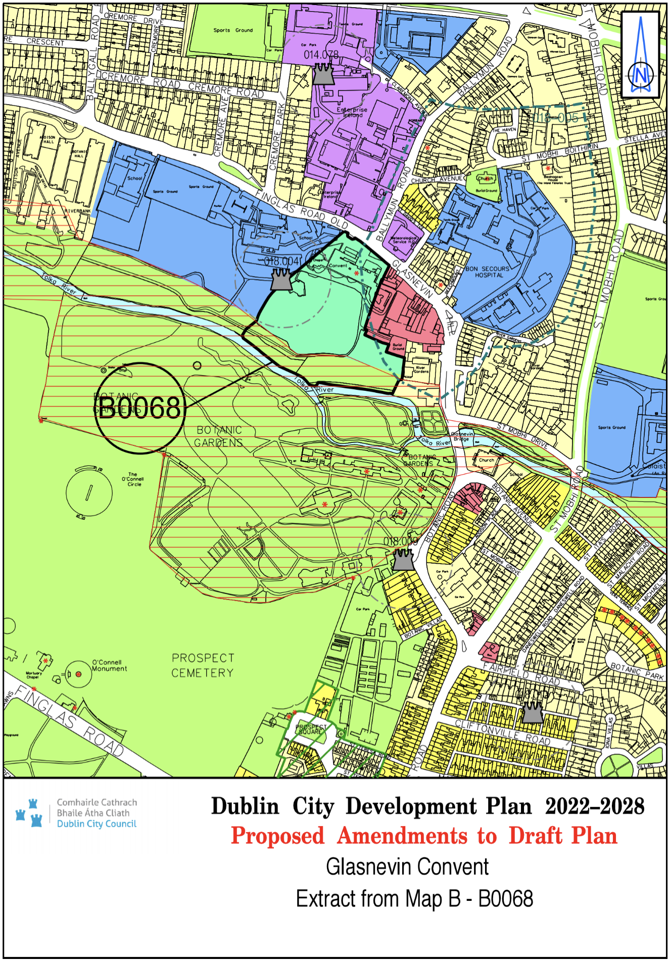
Glasnevin Convent |
Z9/Z15 |
Z9/Z12 |
Map B |
B-0068 |
||
|
Map Sheet C |
||||||
|
Site Address |
Zoning From |
Zoning To |
Map Sheet |
Map Reference |
||
|
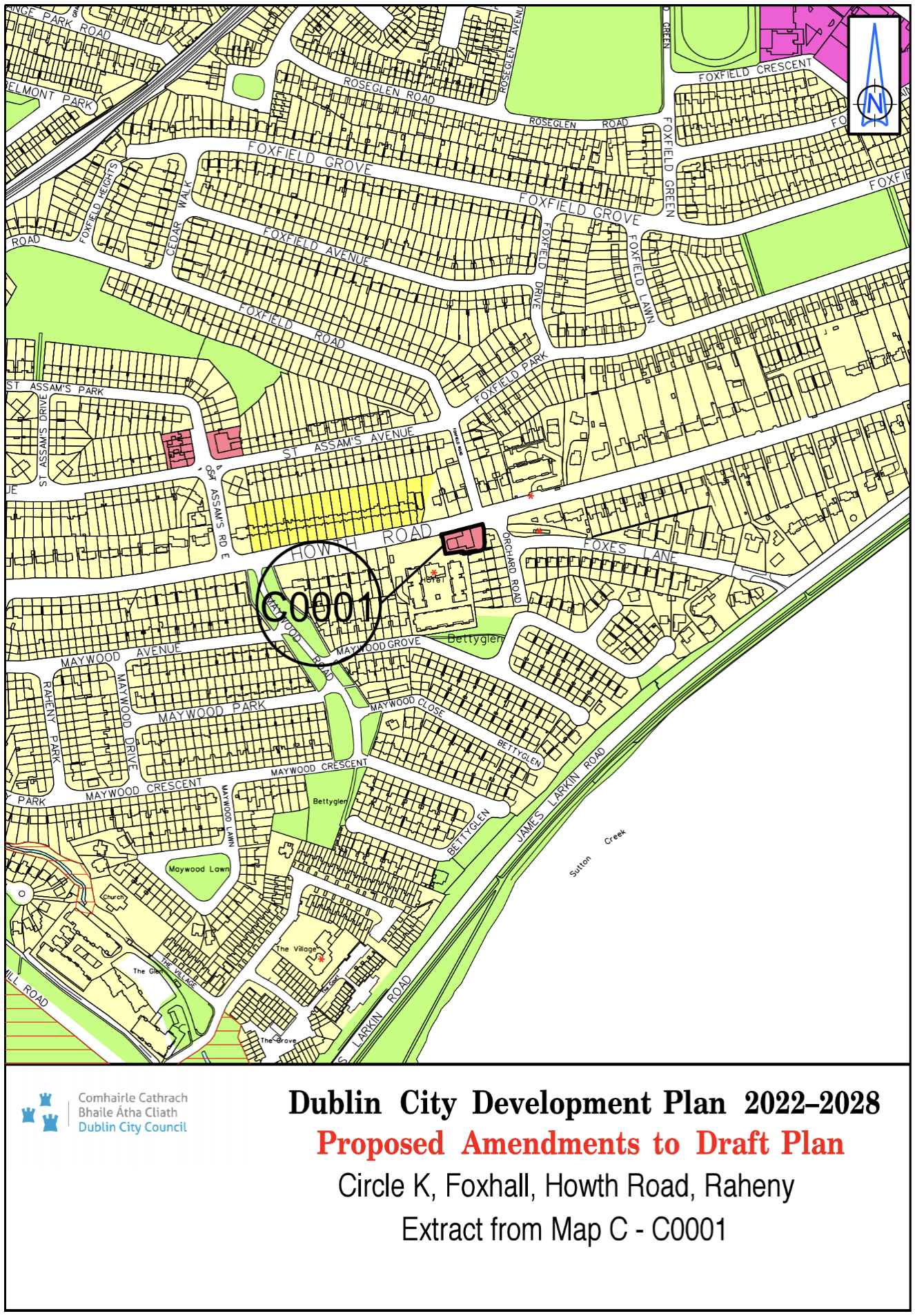
Circle K, Foxhall, Howth Road, Raheny |
Z1 |
Z3 |
Map C |
C-0001 |
||
|
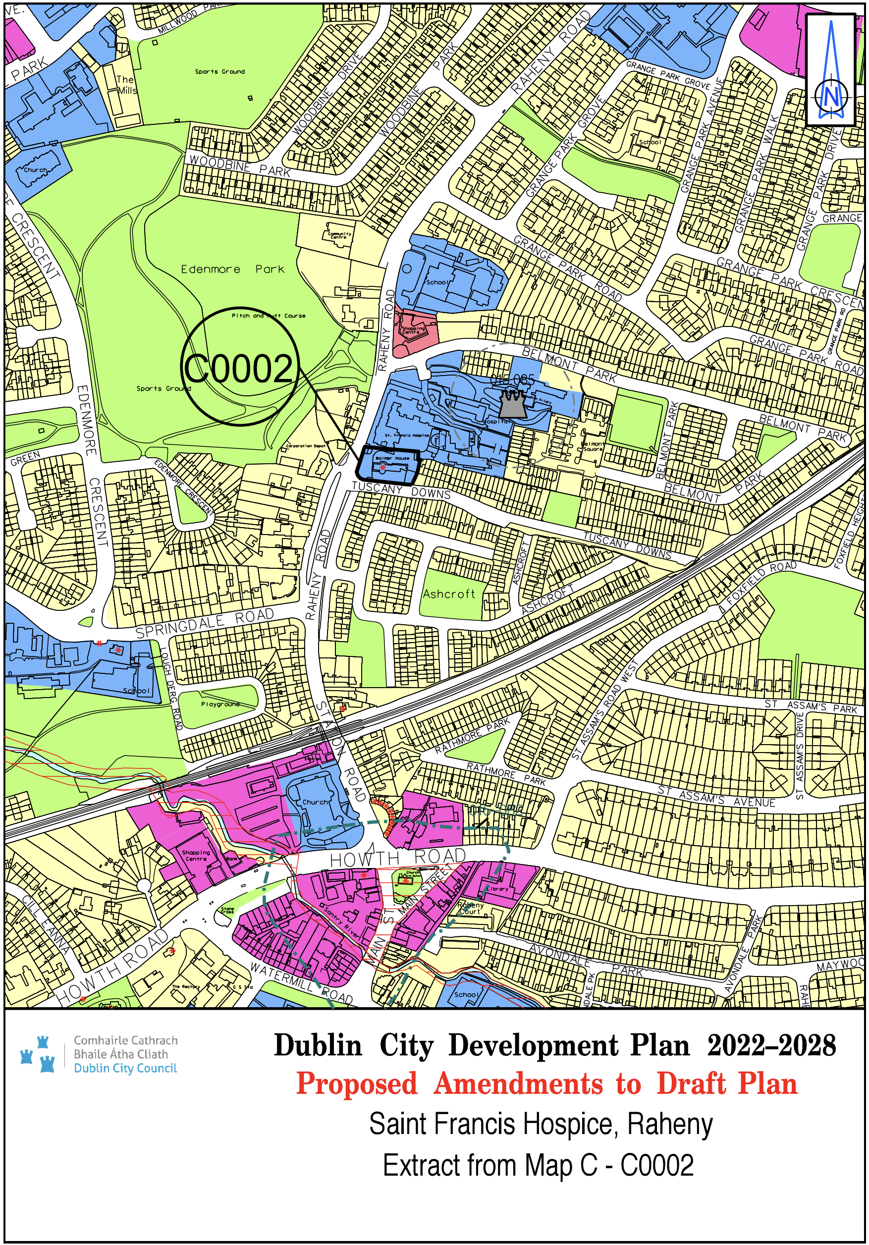
St. Francis Hospice, Raheny |
Z1 |
Z15 |
Map C |
C-0002 |
||
|
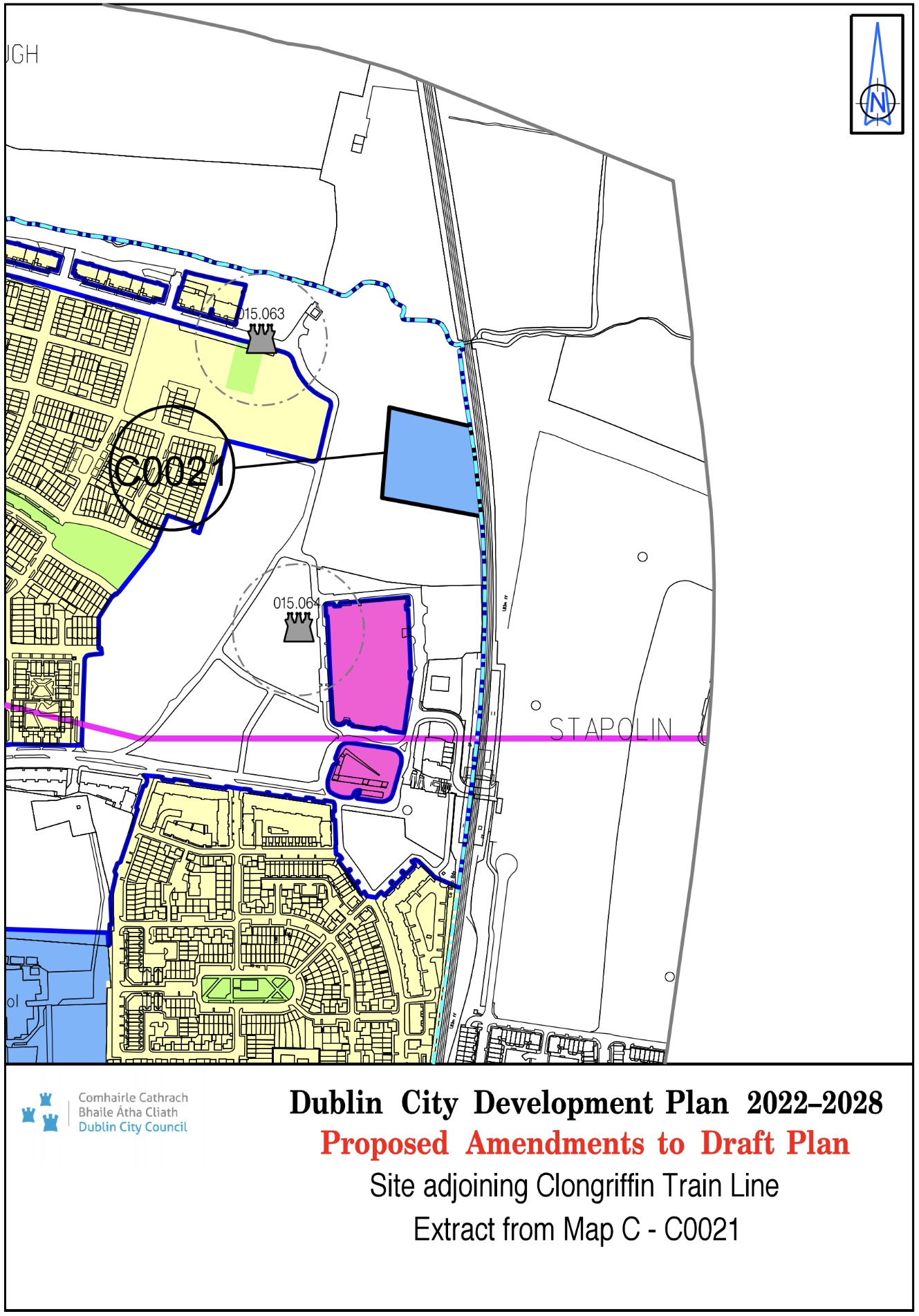
Site adjoining Clongriffin Train Line |
Z14 |
Z15 |
Map C |
C-0021 |
||
|
Lands at junction of Swan’s Nest Road and Raheny Road |
Z1 |
Z15 |
Map C |
C-0022 |
||
|
Map Sheet D |
||||||
|
Site Address |
Zoning From |
Zoning To |
Map Sheet |
Map Reference |
||
|
Chapelizod Bypass / Rossmore Drive, Kylemore Road, Dublin 20 |
Z6 |
Z10 |
Map D |
D-0004 |
||
|
Our Lady of the Wayside NS, Bluebell Road, Bluebell, Dublin 12 |
Z1 |
Z15 |
Map D |
D-0011 |
||
|
St. Patricks NS, Chapelizod Village, Dublin 20 |
Z1 |
Z15 |
Map D |
D-0012 |
||
|
Map Sheet E |
||||||
|
Site Address |
Zoning From |
Zoning To |
Map Sheet |
Map Reference |
||
|
The Black Church, St. Mary's Place North, Dublin 7 |
Z1 |
Z2 |
Map E |
E-0003 |
||
|
Thomas Brennan's Bar, 15 Dominick Street, Dublin 7. |
Z1 |
Z2 |
Map E |
E-0005 |
||
|
106-107 Dorset Street, Dublin 1 |
Z1 |
Z2 |
Map E |
E-0006 |
||
|
12 Manor Street , Stoneybatter, Dublin 7 |
Z15 |
Z3 |
Map E |
E-0007 |
||
|
134/135 Lower Baggot Street, Dublin 2 |
Z4/ Z8 |
Z4 |
Map E |
E-0010 |
||
|
16 and 17 Berkeley Street, Dublin 7 |
Z1 |
Z2 |
Map E |
E-0012 |
||
|
8/9/10 Prussia Street |
White land |
Z1 |
Map E |
E-0015 |
||
|
An Oige, 61 Mountjoy St., Dublin 7 |
Z15 |
Z2/Z15 |
Map E |
E-0018 |
||
|
Bailey Gibson |
Z4 |
Z14 |
Map E |
E-0019 |
||
|
Carrisbrook House, 112 Northumberland Road, Dublin 4 |
Z1/Z6 |
Z6 |
Map E |
E-0022 |
||
|
Charlemont Street, Harcourt Road and Richmond Street South |
Z10 |
Z6 |
Map E |
E-0026 |
||
|
Circle K Cabra Road, Dublin 7 |
Z1 |
Z3 |
Map E |
E-0028 |
||
|
Circle K Glasnevin, Finglas Road, Dublin 11 |
Z1 |
Z3 |
Map E |
E-0029 |
||
|
Construction House and Canal House, Canal Road, Dublin 6 |
Z10 |
Z6 |
Map E |
E-0033 |
||
|
Crosscare Wellington Centre, 24-26 Wellington Street Upper, Dublin 7 |
Z1 |
Z2 |
Map E |
E-0034 |
||
|
Francis Street CBS (Primary) Francis Street, Dublin 8 |
Z1 |
Z15 |
Map E |
E-0039 |
||
|
Gaelscoil Inse Chor, An Chur Bhothar Theas Droichead an Hinse, Baile Atha Cliath 8 |
Z9 |
Z15 |
Map E |
E-0040 |
||
|
Grand Canal Street Lower |
Z2 / White land |
Z1 |
Map E |
E-0043 |
||
|
Grattan Hall, Lower Mount Street |
Z10 |
Z1 |
Map E |
E-0044 |
||
|
Griffith Court, Fairview, Dublin 3 |
Z1 |
Z9 |
Map E |
E-0045 |
||
|
Hampton, Grace Park Road, Dublin 9 |
Z9/Z15 |
Z1/Z9 |
Map E |
E-0046 |
||
|
Holy Child Pre School, Rutland St Project, Lower Sean McDermott Street, Dublin 1 |
Z5 |
Z15 |
Map E |
E-0048 |
||
|
Le Touche House, IFSC |
Z5/Z9 |
Z5/Z9 |
Map E |
E-0052 |
||
|
Marrowbone Lane, Dublin 8 |
Z9/Z14 |
Z14 |
Map E |
E-0055 |
||
|
Maxol, 179 Navan Road, Dublin 7 |
Z15 |
Z1 |
Map E |
E-0057 |
||
|
ESB Polefield Site, Portside Business Centre, Aldi and MKN Hotel site, East Wall Road |
Z6 |
Z10 |
Map E |
E-0060 |
||
|
Our Lady of the Holy Rosary of Fatima, South Circular Road |
Z1 |
Z15 |
Map E |
E-0067 |
||
|
Presentation Primary School, George's Hill, Halston, Street, Dublin 7 |
Z5 |
Z15 |
Map E |
E-0069 |
||
|
Pembroke Gardens, Ballsbridge |
Z1 |
Z9 |
Map E |
E-0071 |
||
|
Rear of 1A Prussia Street Dublin 7 |
Z6 |
Z3 |
Map E |
E-0072 |
||
|
Rutland NS, Lower Gloucester Street, Dublin 1 |
Z5 |
Z15 |
Map E |
E-0073 |
||
|
Scoil Chaoimhin, Marlborough Street, Dublin 1 |
Z5 |
Z15 |
Map E |
E-0077 |
||
|
Scoil Iosagain CBS, Aughnannagh Road, Crumlin, Dublin 12 |
Z1 |
Z15 |
Map E |
E-0078 |
||
|
Shelbourne Greyhound Stadium |
Z9 |
Z9/Z14 |
Map E |
E-0082 |
||
|
St. Enda's Primary School, Whitefriar Street, Dublin 8 |
Z5 |
Z15 |
Map E |
E-0089 |
||
|
St. Joseph's NS, East Wall Road, East Wall, Dublin 3 |
Z14 |
Z15 |
Map E |
E-0099 |
||
|
St. Laurence O'Toole NS, Seville Place, North Strand, Dublin 1 |
Z1 |
Z15 |
Map E |
E-0102 |
||
|
Connolly House, Marino College of Further Education and St. Laurence O'Toole Special School, Aldborough Parade, North Strand, Dublin 1 |
Z5 |
Z15 |
Map E |
E-0103 |
||
|
St. Pauls CBS Primary, North Brunswick Street, Dublin 7 |
Z5 |
Z15 |
Map E |
E-0109 |
||
|
St. Peter's NS, St. Peters Road, Phibsborough, Dublin 7 |
Z2 |
Z15 |
Map E |
E-0111 |
||
|
West Side of Camden Street Lower (between Grantham Street and Pleasant’s Street) |
Z1 |
Z4 |
Map E |
E-0118 |
||
|
Damer Court, 35-47 Wellington Street Upper, D1 |
Z15 |
Z1 |
Map E |
E-0119 |
||
|
St. Teresa's, Donore Avenue |
Z15 |
Z14 |
Map E |
E-0122 |
||
|
Trinity - North Wall Quay |
Z5/Z9 |
Z5/Z9 |
Map E |
E-0123 |
||
|
2-3 Ballsbridge Park, Dublin 4 |
Z1 |
Z6 |
Map E |
E-0124 |
||
|
40 Old Kilmainham Road, Dublin 8 |
Z6 |
Z9/Z10 |
Map E |
E-0125 |
||
|
St. Auden’s NS, Cook Street, Dublin 8 |
Z5 |
Z15 |
Map E |
E-0129 |
||
|
CYMS Pitch and Putt, 80 Philipsburgh Avenue, Dublin 3 |
Z1 |
Z9 |
Map E |
E-0140 |
||
|
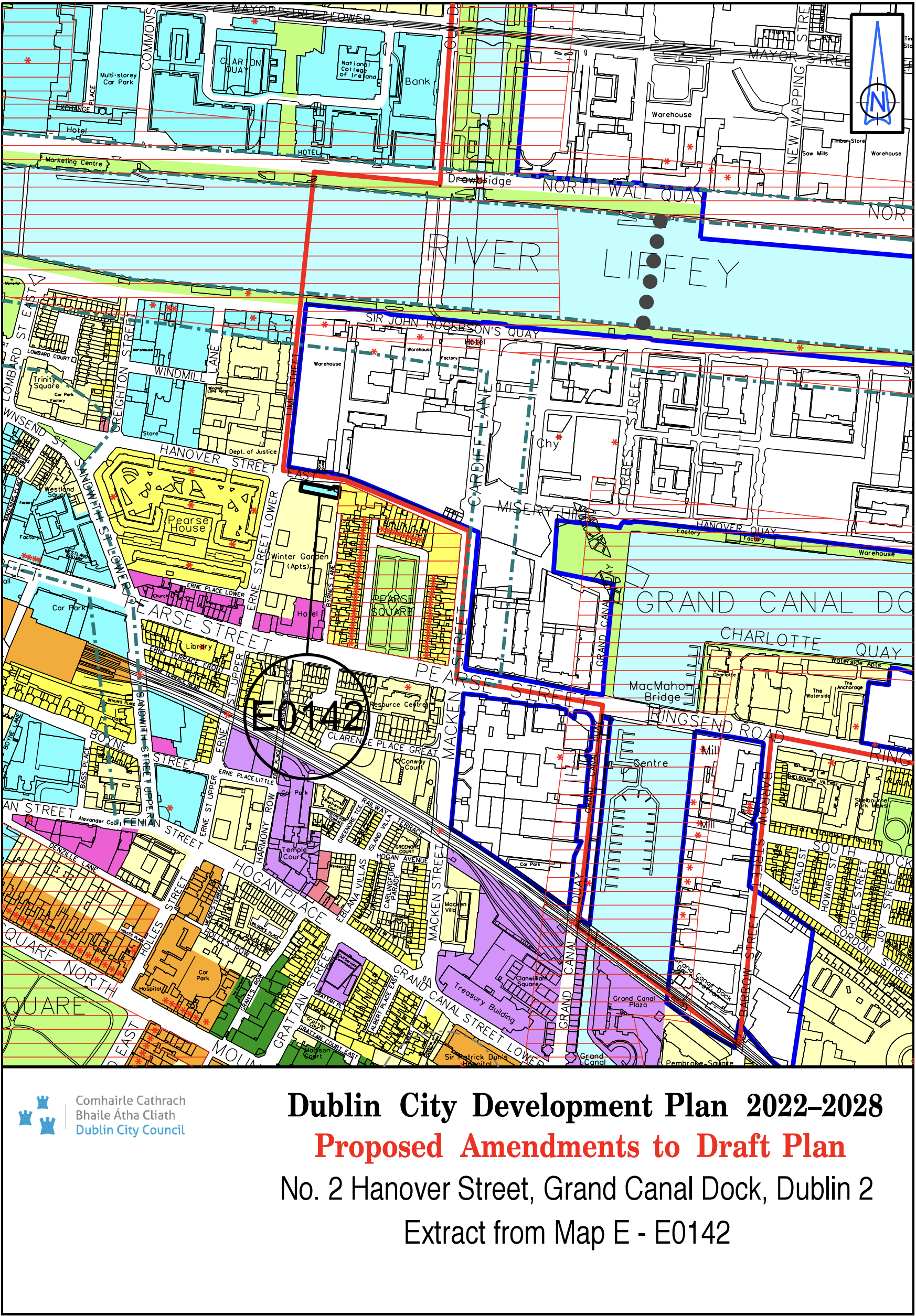
No. 2 Hanover Street, Grand Canal Dock, Dublin 2 (D02 E860) |
Z1 |
Z5 |
Map E |
E-0142 |
||
|
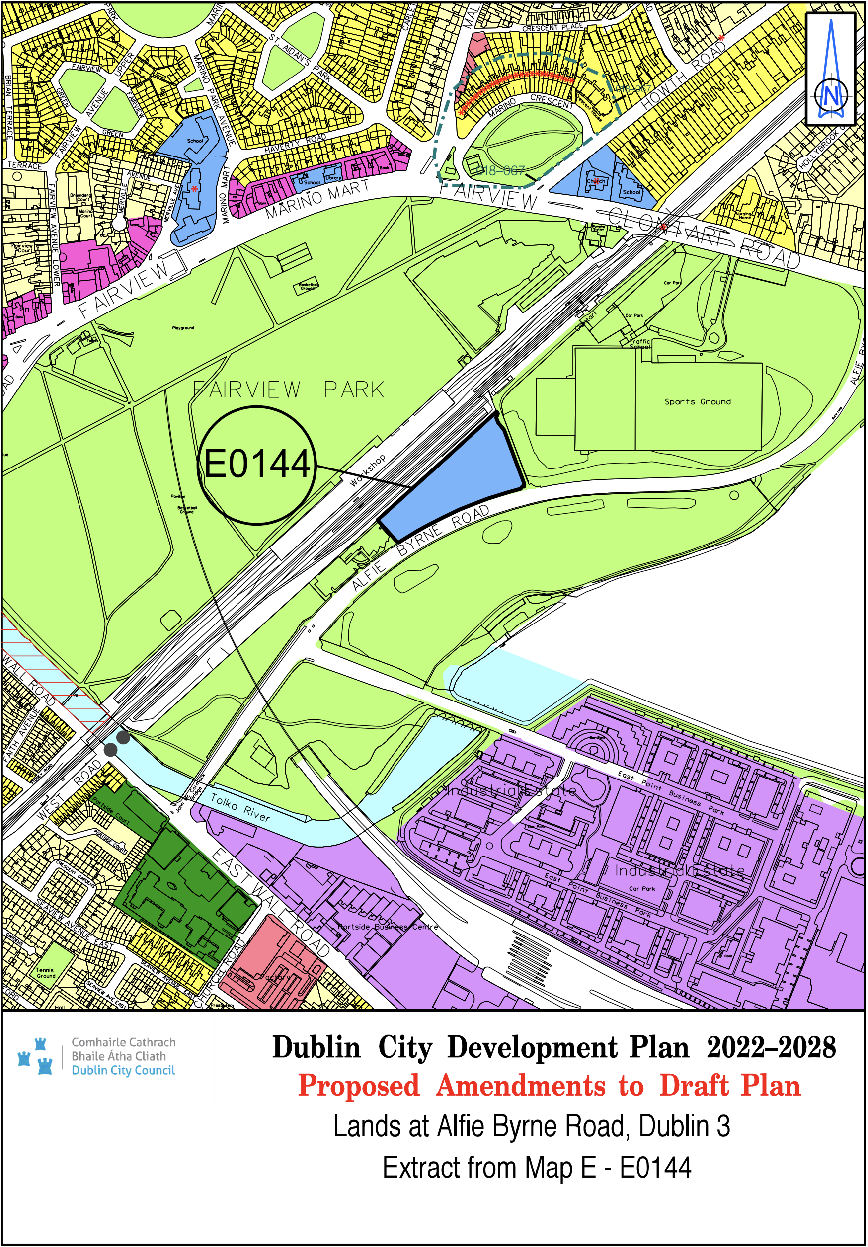
Lands at Alfie Byrne Road, Dublin 3 |
Z9 |
Z15 |
Map E |
E-0144 |
||
|
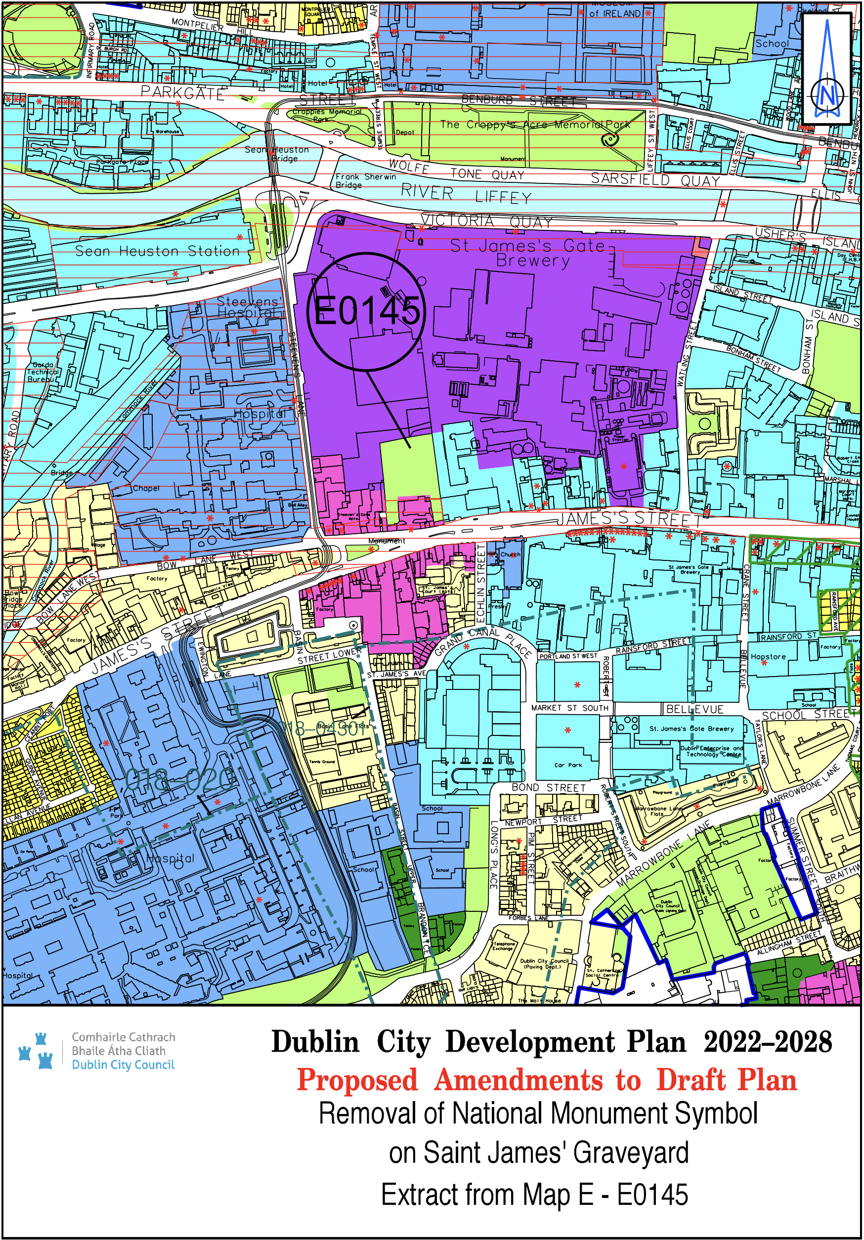
Remove National Monument symbol on St. James’ Graveyard |
N/A |
N/A |
Map E |
E-0145 |
||
|
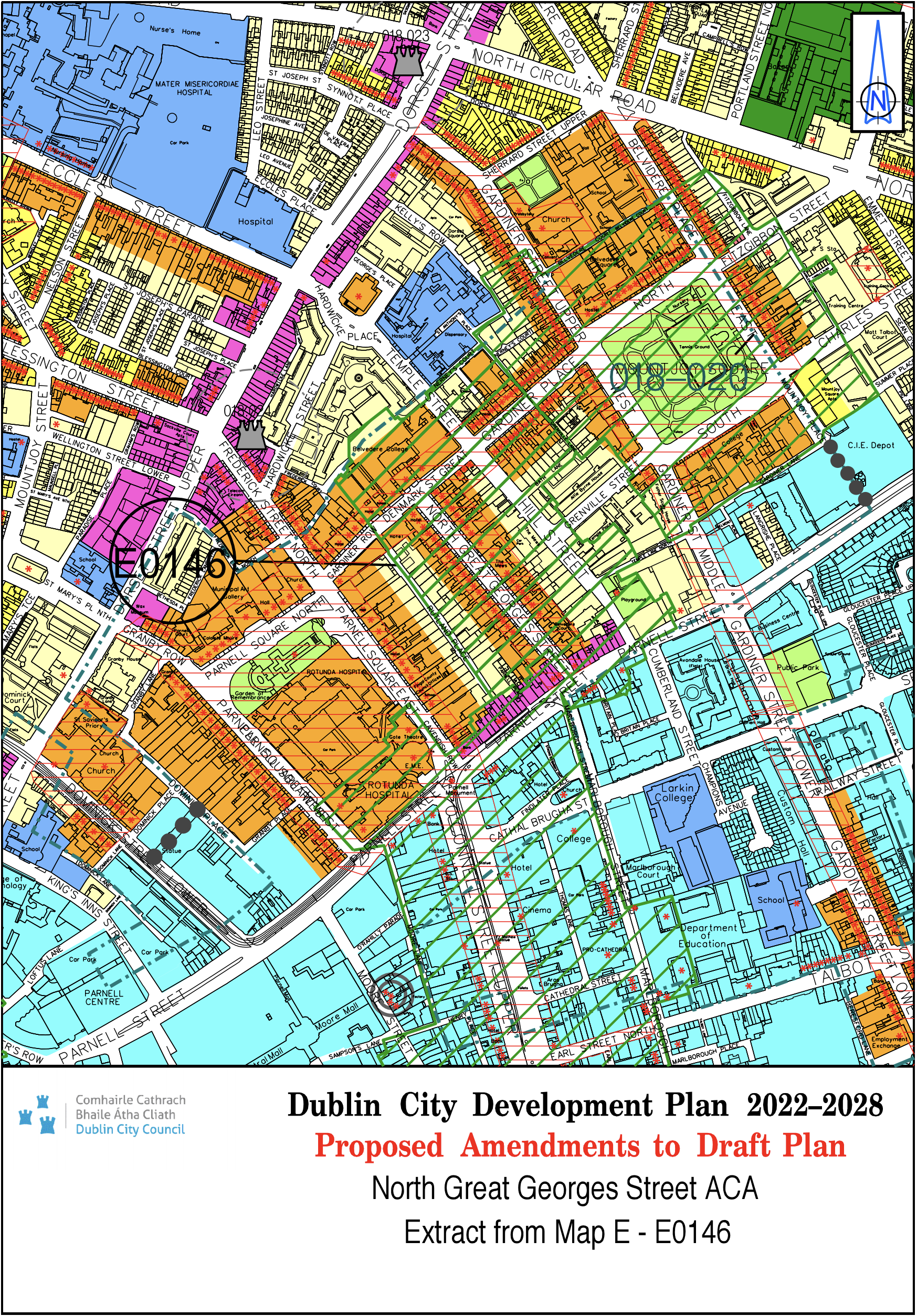
Map E updated to include North Great Georges Street ACA |
N/A |
N/A |
Map E |
E-0146 |
||
|
Map Sheet F |
||||||
|
Site Address |
Zoning From |
Zoning To |
Map Sheet |
Map Reference |
||
|
Circle K, Clontarf Road, Dublin 3 |
Z1 |
Z3 |
Map F |
F-0001 |
||
|
HSE Clinic, Vernon Avenue |
Z1 |
Z15 |
Map F |
F-0004 |
||
|
St. Anthony's Parish Church, Clontarf |
Z1 |
Z2/Z15 |
Map F |
F-0005 |
||
|
Redcourt, Clontarf |
Z2 |
Z1 |
Map F |
F-0006 |
||
|
Dublin Port - Terminal Yards west of Alexandra Basin and east/ north of Berth 51A |
White land |
Z7 |
Map F |
F-0012 |
||
|
Eastpoint Fairview |
Z6 / Z9 / White land |
Z6 |
Map F |
F-0013 |
||
|
St. Mathew’s National School, Sandymount |
Z15 |
Z1 |
Map F |
F-0019 |
||
|
Map updated to include Haddon Road/ Victoria Road, Hollybrook Road ACA |
N/A |
N/A |
Map F |
F-0020 |
||
|
Map Sheet G |
||||||
|
Site Address |
Zoning From |
Zoning To |
Map Sheet |
Map Reference |
||
|
Circle K, Sundrive Road, Kimmage Road Lower Dublin 6W |
Z1 |
Z3 |
Map G |
G-0002 |
||
|
Ben Dunne Gym and Former Art Gallery, Kimmage Road West |
Z1 / Z9 |
Z10 |
Map G |
G-0005 |
||
|
Brook’s Builders Merchants / Naas Road Industrial Estate, Naas Road |
Z6 |
Z14 |
Map G |
G-0009 |
||
|
Map Sheet H |
||||||
|
Site Address |
Zoning From |
Zoning To |
Map Sheet |
Map Reference |
||
|
Rathmines Library |
Z4 |
Z15 |
Map H |
H-0002 |
||
|
Rathmines Town Hall, Rathmines Road |
Z4 |
Z15 |
Map H |
H-0003 |
||
|
Cathal Brugha Barracks |
Z15 |
Z9 |
Map H |
H-0004 |
||
|
Merrion Graveyard - beside Tara Tower, Merrion Road |
Z1 |
Z9 |
Map H |
H-0007 |
||
|
Former St. Mary's College, Bloomfield Avenue, Donnybrook, Dublin 4 |
Z15 |
Z12 |
Map H |
H-0008 |
||
|
Circle K, Sandford Road |
Z1 |
Z3 |
Map H |
H-0011 |
||
|
Former Church of Ireland College Educational Lands, Rathmines Road Upper, Dublin 6 |
Z9 |
Z15 |
Map H |
H-0012 |
||
|
Circle K, Martello, Strand Road, Dublin 4 |
Z1 |
Z3 |
Map H |
H-0013 |
||
|
Embassy House Lane, Anglesea Road, Ballsbridge |
Z4/Z9 |
Z4 |
Map H |
H-0015 |
||
|
Energia Park, Donnybrook Road, Dublin 4 |
Z9 |
Z1 |
Map H |
H-0018 |
||
|
Milltown Park, Sandford Road, Dublin 6 |
Z15 |
Z12 |
Map H |
H-0023 |
||
|
Nullamore House, Richmond Avenue South and Milltown Road, Dartry, Dublin 6 |
Z15 |
Z12 |
Map H |
H-0024 |
||
|
Neville Road |
Z1 |
Z2 |
Map H |
H-0026 |
||
|
St. Conleth's College, 28 Clyde Road, Ballsbridge, Dublin 4 |
Z2 |
Z15 |
Map H |
H-0031 |
||
|
Muckross Park House, Marlborough Road, Donnybrook, Dublin 4 |
Z15 |
Z12 |
Map H |
H-0036 |
||
|
Catholic Church of the Mary Immaculate Rathmines Rd. Lower |
Z2 |
Z15 |
Map H |
H-0038 |
||
|
Rathgar Catholic Church of the Three Patrons |
Z2 |
Z15 |
Map H |
H-0039 |
||
|
Methodist Church, Brighton Road, Rathgar Road |
Z2 |
Z15 |
Map H |
H-0040 |
||
|
Christ Church of Ireland, Rathgar |
Z2 |
Z15 |
Map H |
H-0041 |
||
|
Church of Our Lady of the Rosary, Harold’s Cross Road |
Z2 |
Z15 |
Map H |
H-0042 |
||
|
Site Address |
Zoning From |
Zoning To |
Map Sheet |
Map Reference |
|
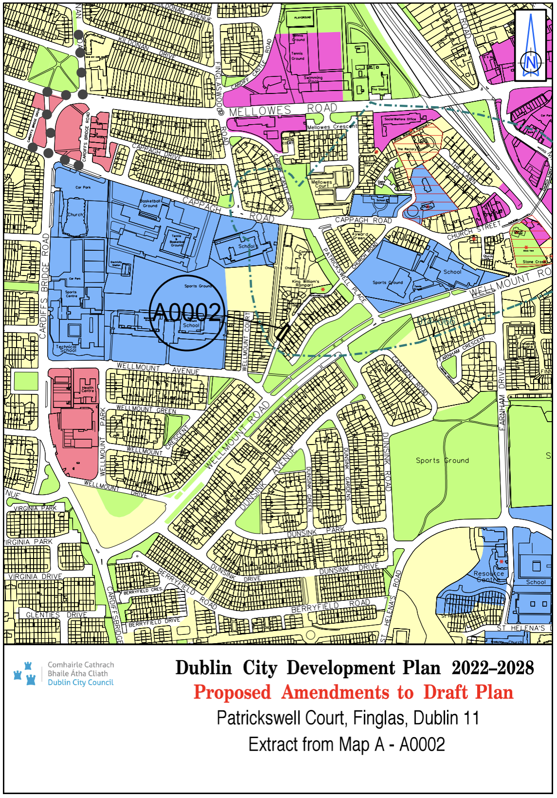
Patrickswell Court, Finglas, Dublin 11 |
Z9 |
Z1 |
Map A |
A-0002 |
|
Site Address |
Zoning From |
Zoning To |
Map Sheet |
Map Reference |
|
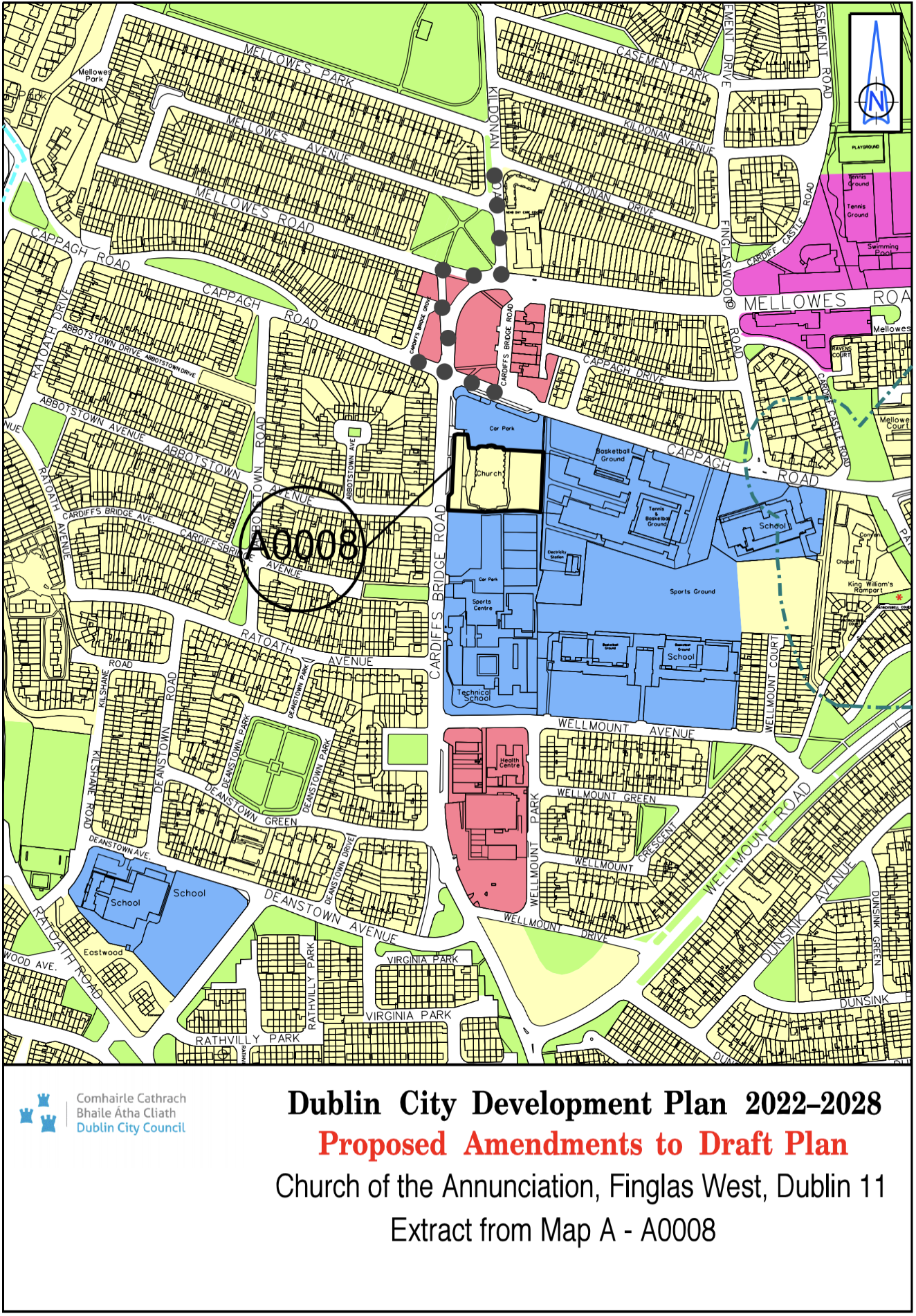
Church of the Annunciation, Finglas West, Dublin 11 |
Z15 |
Z1 |
Map A |
A-0008 |
|
Site Address |
Zoning From |
Zoning To |
Map Sheet |
Map Reference |
|
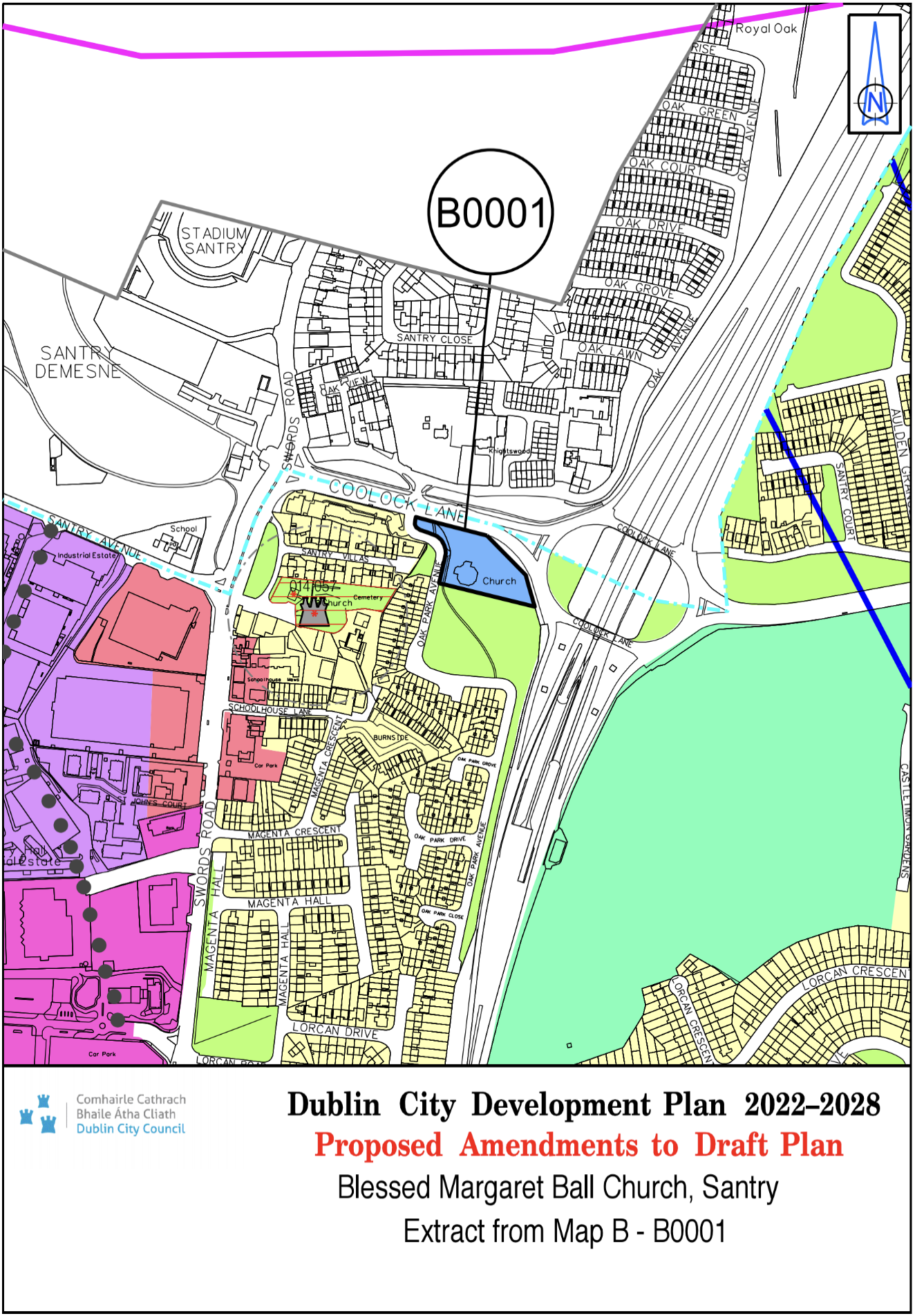
Blessed Margaret Ball Church, Santry |
Z1 |
Z15 |
Map B |
B-0001 |
|
Site Address |
Zoning From |
Zoning To |
Map Sheet |
Map Reference |
|
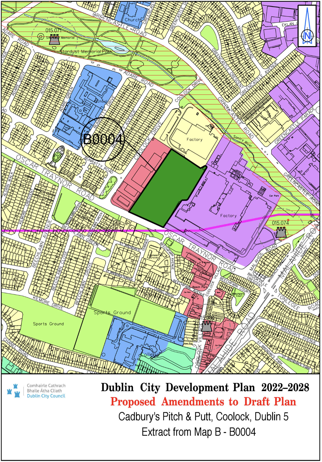
Cadbury's Pitch and Putt, Coolock, Dublin 5 |
Z6 |
Z10 |
Map B |
B-0004 |
|
Site Address |
Zoning From |
Zoning To |
Map Sheet |
Map Reference |
|
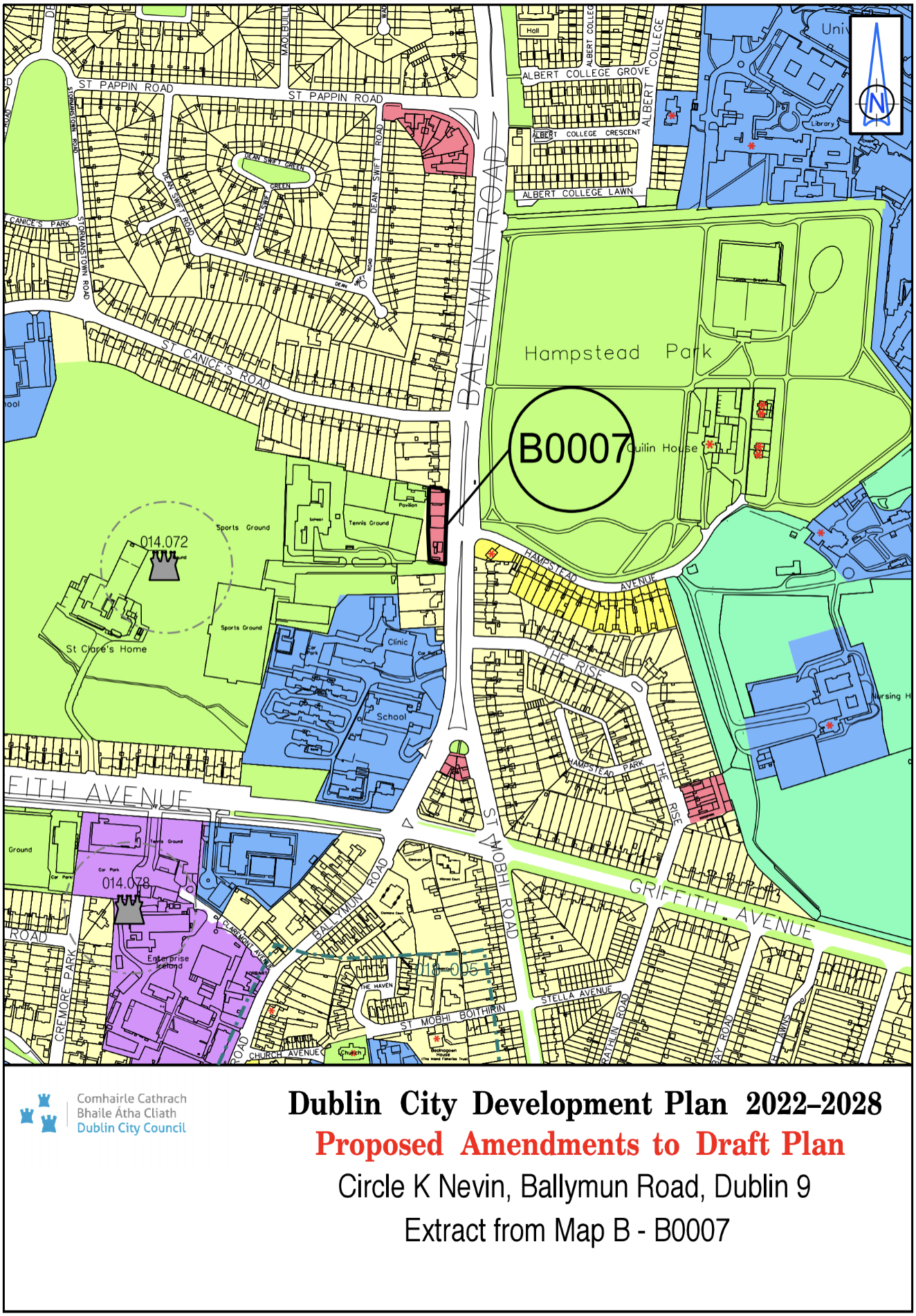
Circle K Nevin, Ballymun Road, Dublin 9 |
Z1 |
Z3 |
Map B |
B-0007 |
|
Site Address |
Zoning From |
Zoning To |
Map Sheet |
Map Reference |
|
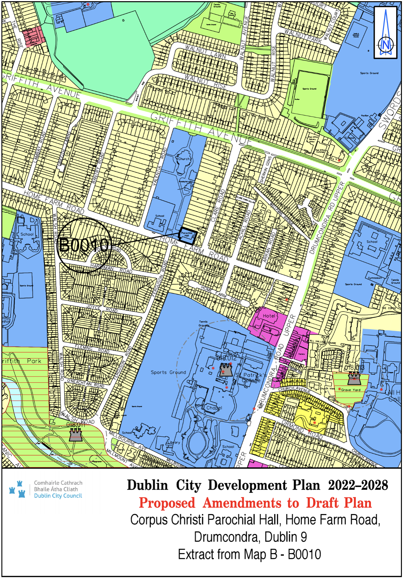
Corpus Christi Parochial Hall, Home Farm Road, Drumcondra, Dublin 9 |
Z1 |
Z15 |
Map B |
B-0010 |
|
Site Address |
Zoning From |
Zoning To |
Map Sheet |
Map Reference |
|
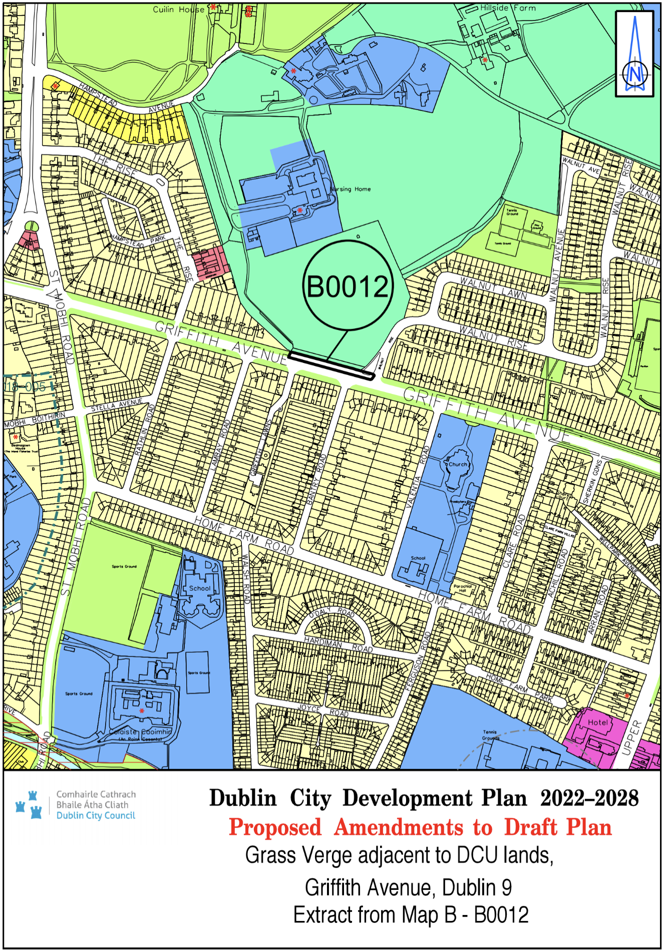
Grass Verge adjacent to DCU lands, Griffith Avenue Dublin 9 |
Z9 |
White Land |
Map B |
B-0012 |
|
Site Address |
Zoning From |
Zoning To |
Map Sheet |
Map Reference |
|
Site at Malahide Road Industrial Estate, Coolock, Dublin 17 |
Z6 |
Z10 |
Map B |
B-0017 |

|
Site Address |
Zoning From |
Zoning To |
Map Sheet |
Map Reference |
|
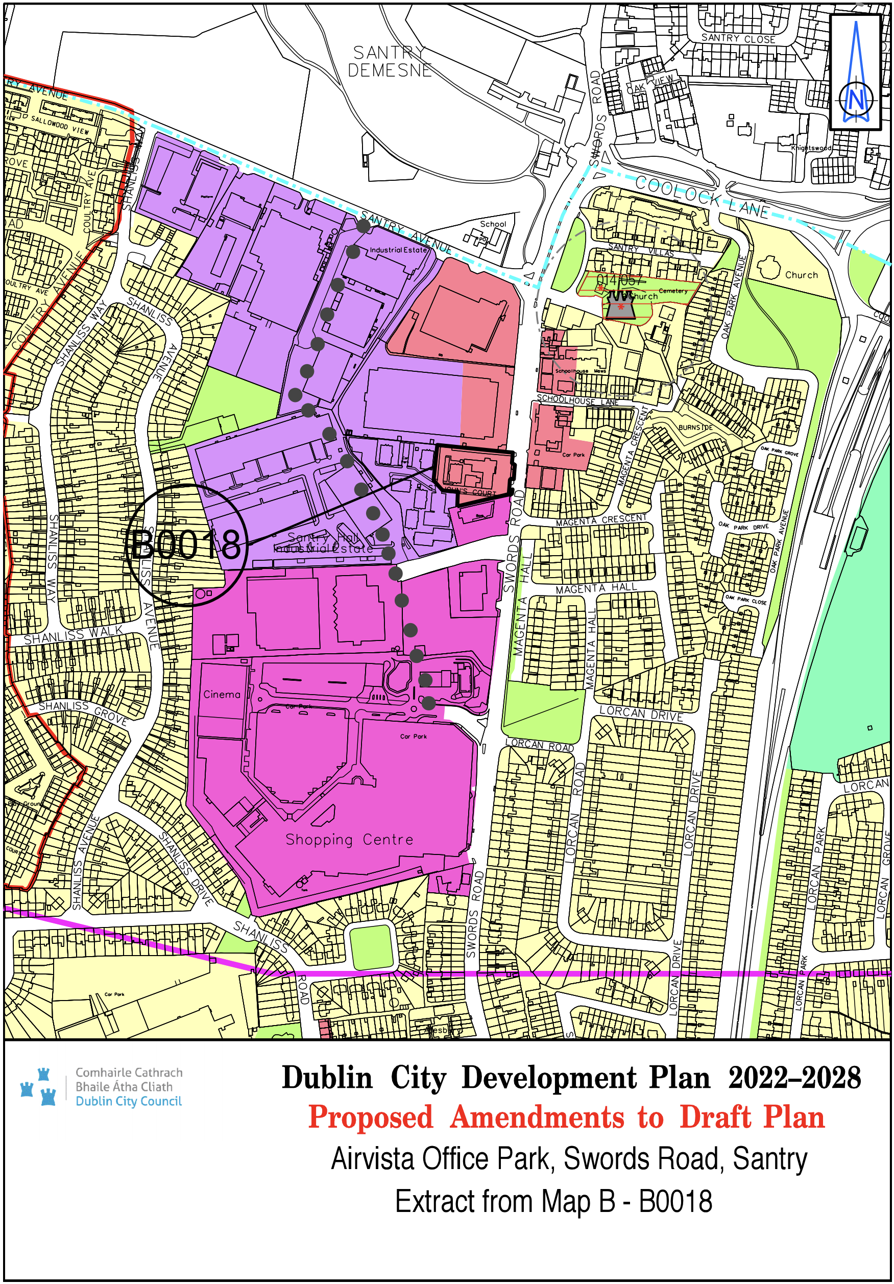
Airvista Office Park, Swords Road, Santry |
Z3/ Z6 |
Z3 |
Map B |
B-0018 |
|
Site Address |
Zoning From |
Zoning To |
Map Sheet |
Map Reference |
|
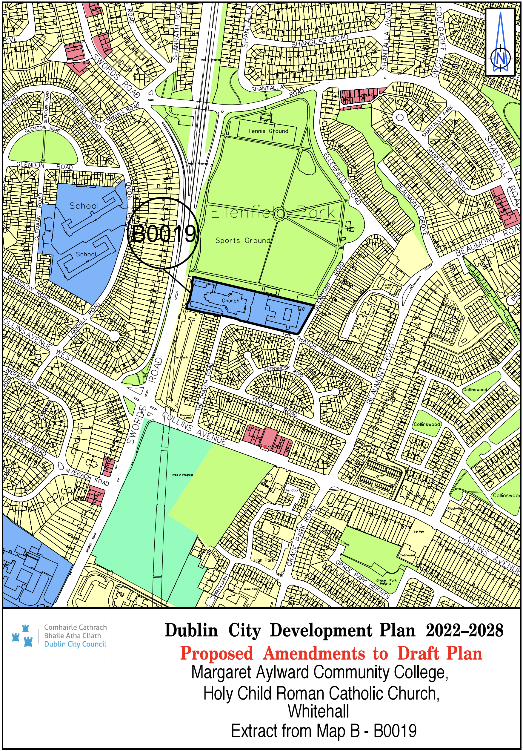
Holy Child Roman Catholic Church and Margaret Aylward Community College, Whitehall |
Z1 |
Z15 |
Map B |
B-0019 |
|
Site Address |
Zoning From |
Zoning To |
Map Sheet |
Map Reference |
|
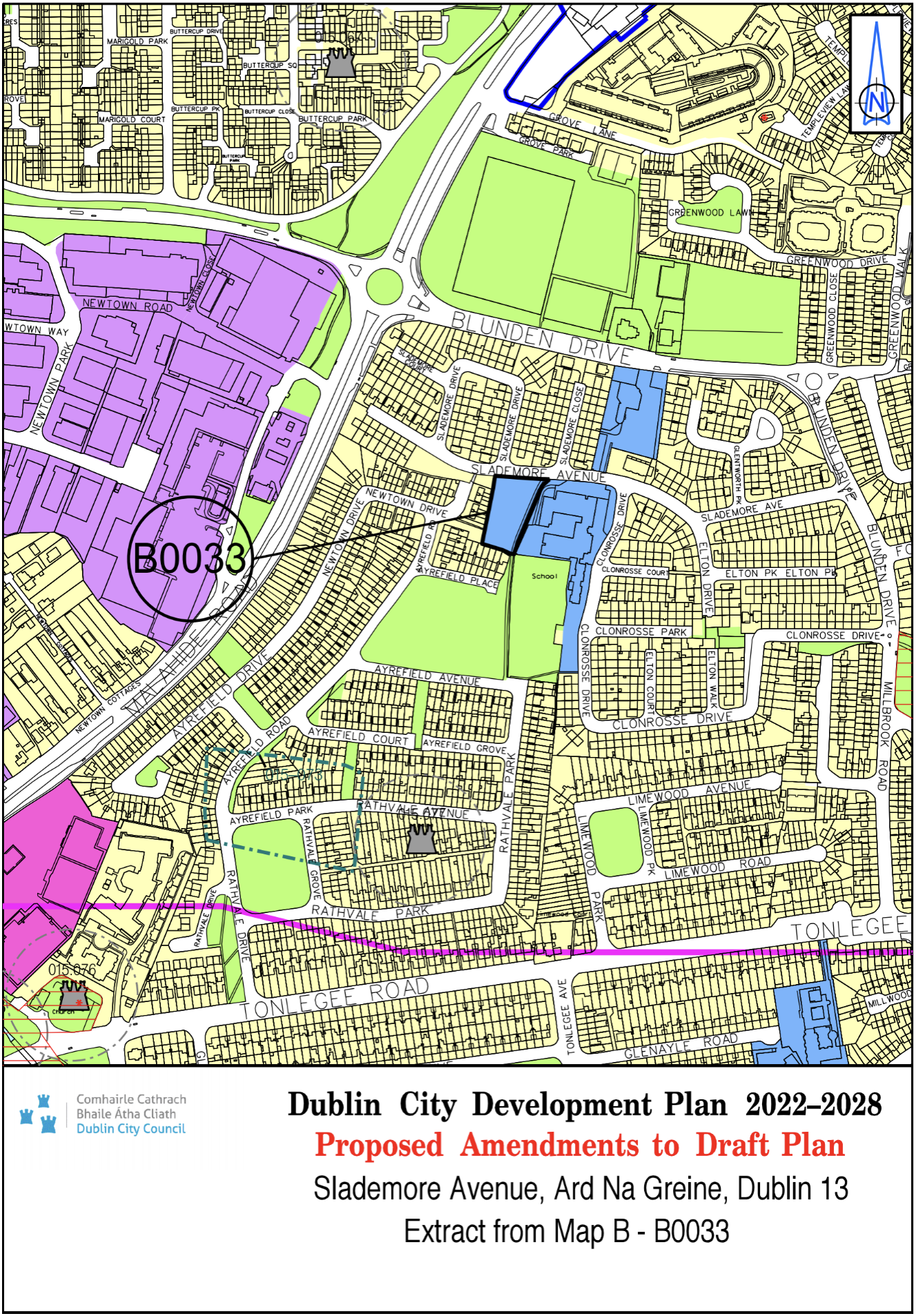
Slademore Avenue, Ard Na Greine, Dublin 13 |
Z9 |
Z15 |
Map B |
B-0033 |
|
Site Address |
Zoning From |
Zoning To |
Map Sheet |
Map Reference |
|
Shanowen (northern part), Santry, Dublin 9 |
Z1 |
Z6 |
Map B |
B-0034 |

|
Site Address |
Zoning From |
Zoning To |
Map Sheet |
Map Reference |
|
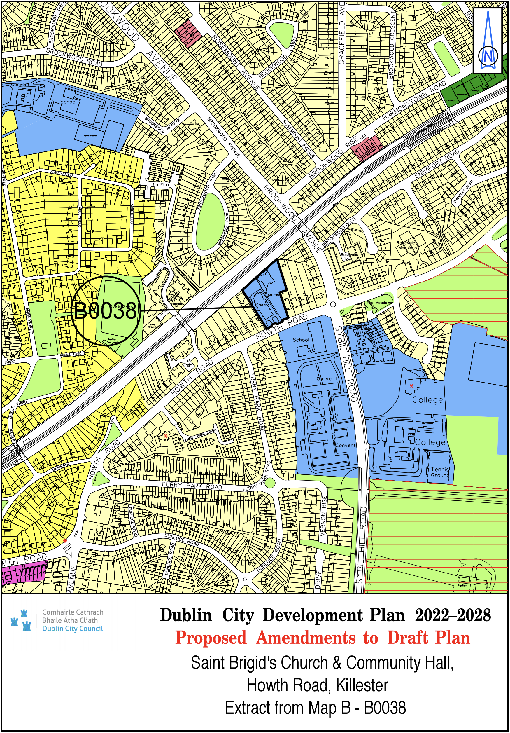
St. Brigid’s Church and Community Hall, Howth Road, Killester |
Z1 |
Z15 |
Map B |
B-0038 |
|
Site Address |
Zoning From |
Zoning To |
Map Sheet |
Map Reference |
|
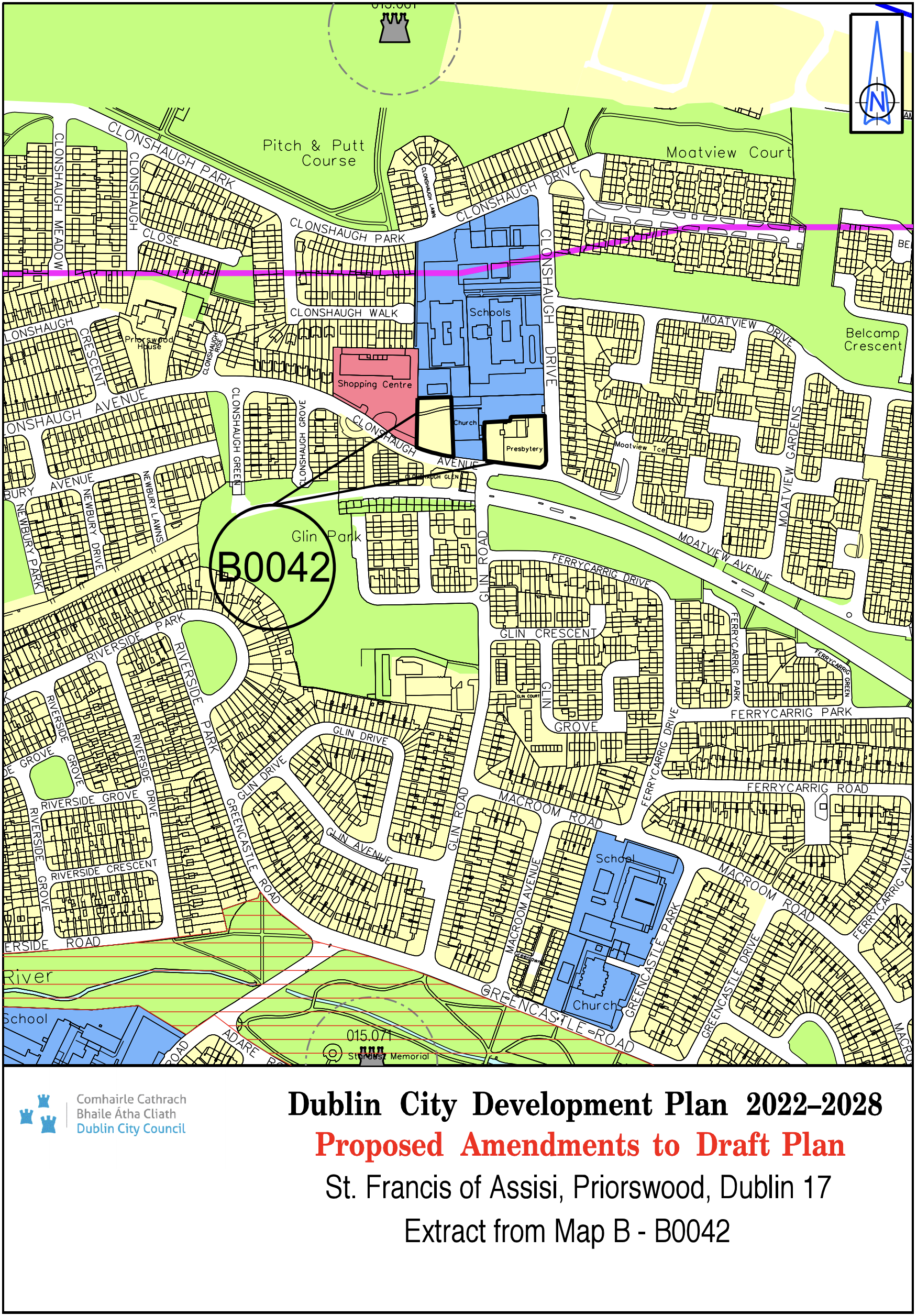
St. Francis of Assisi, Priorswood, Dublin 17 |
Z15 |
Z1 |
Map B |
B-0042 |
|
Site Address |
Zoning From |
Zoning To |
Map Sheet |
Map Reference |
|
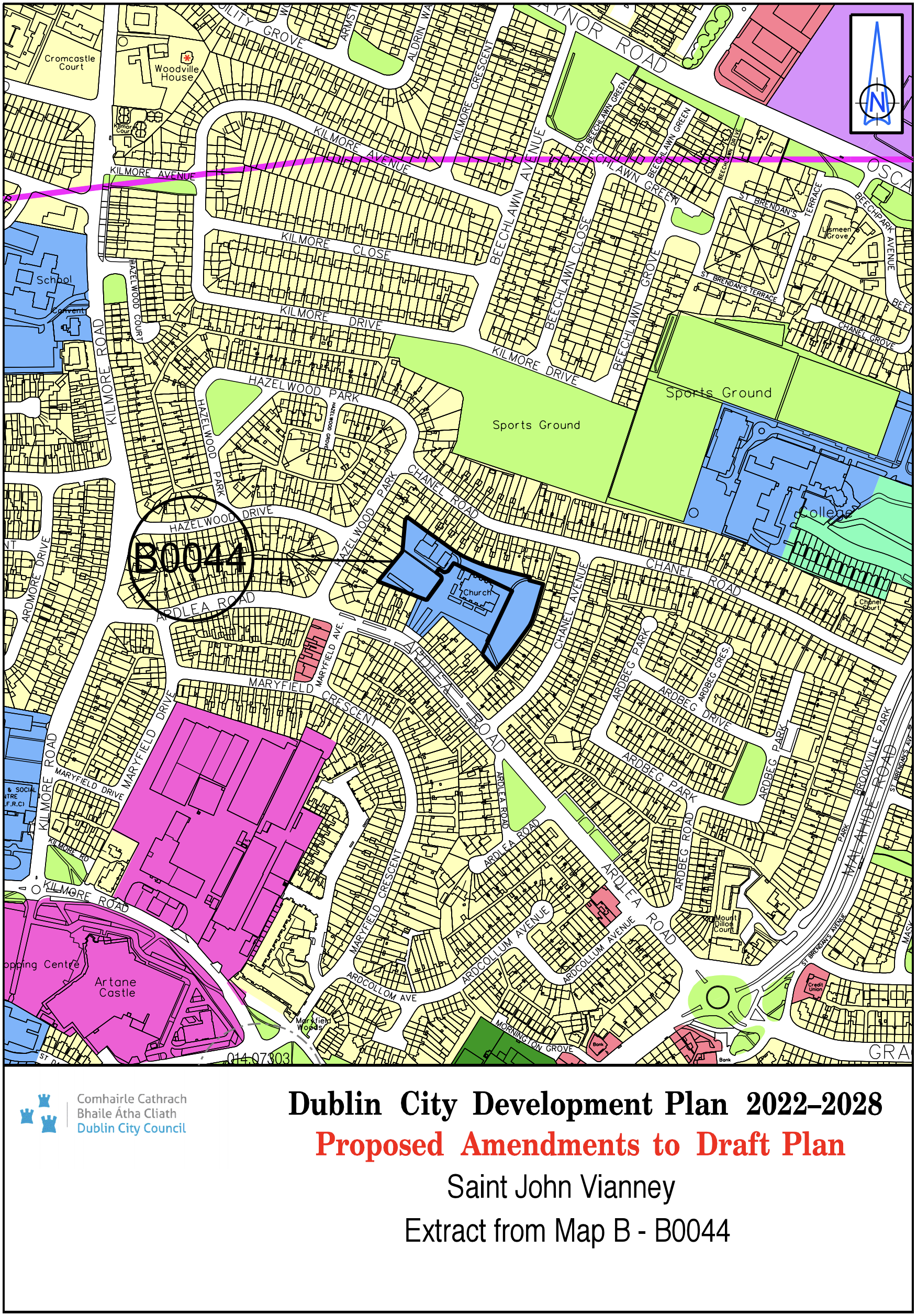
St. John Vianney |
Z12 |
Z15 |
Map B |
B-0044 |
|
Site Address |
Zoning From |
Zoning To |
Map Sheet |
Map Reference |
|
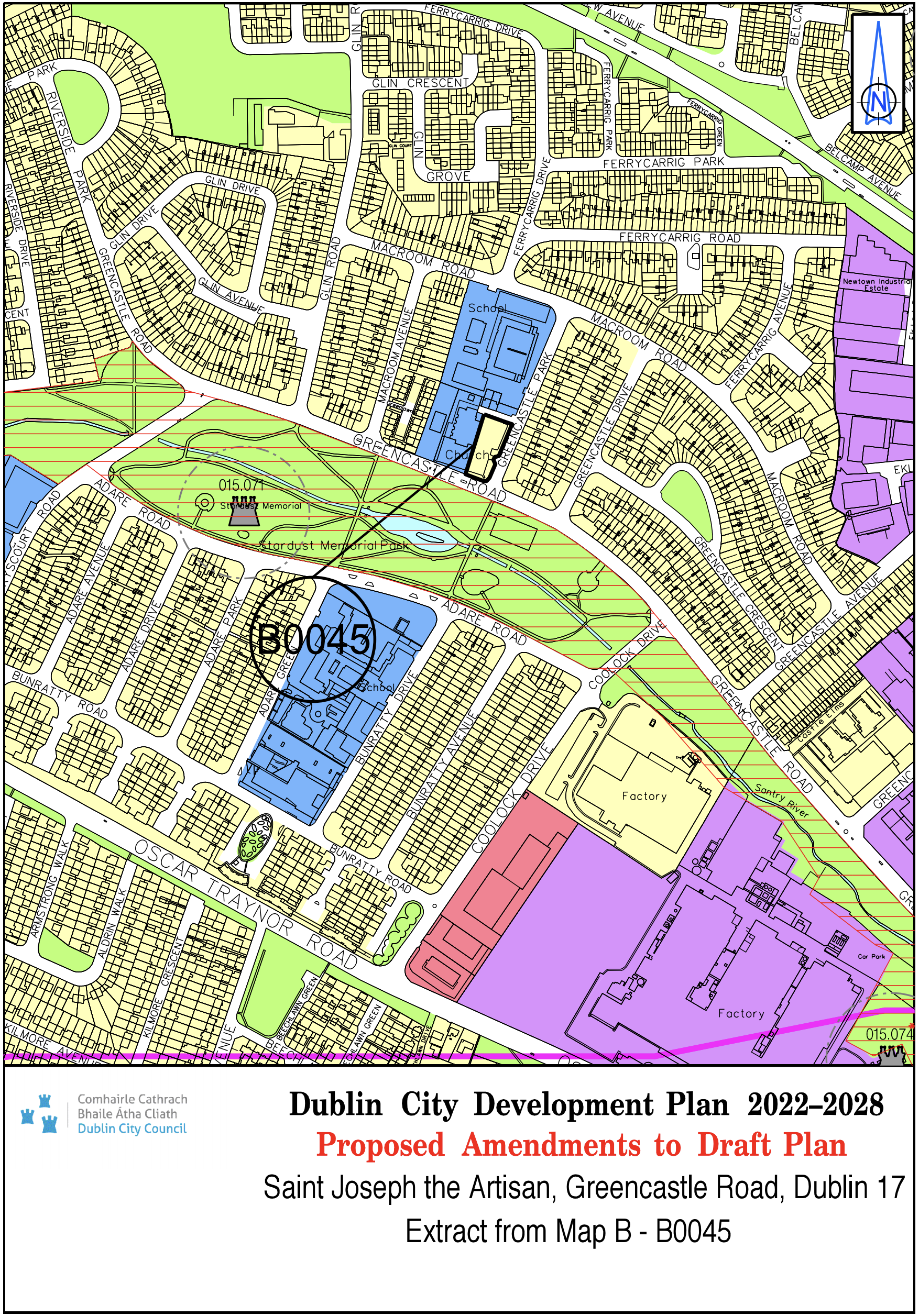
St. Joseph the Artisan, Greencastle Road, Dublin 17 |
Z15 |
Z1 |
Map B |
B-0045 |
|
Site Address |
Zoning From |
Zoning To |
Map Sheet |
Map Reference |
|
St. Paul's Pitches |
Z15 |
Z9 |
Map B |
B-0053 |

|
Site Address |
Zoning From |
Zoning To |
Map Sheet |
Map Reference |
|
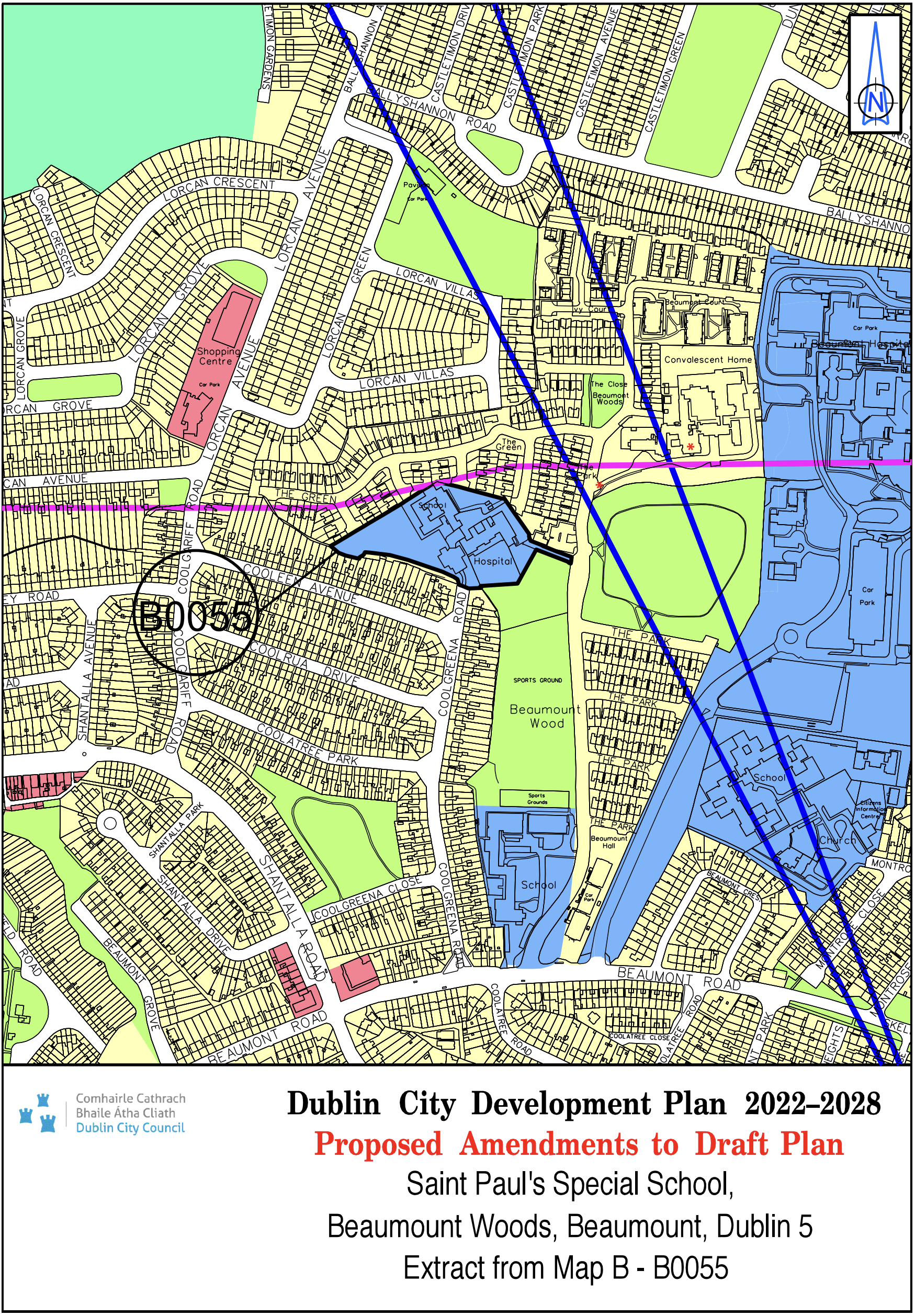
St. Paul’s Special School, Beaumount Woods, Beaumount, Dublin 5 |
Z1 |
Z15 |
Map B |
B-0055 |
|
Site Address |
Zoning From |
Zoning To |
Map Sheet |
Map Reference |
|
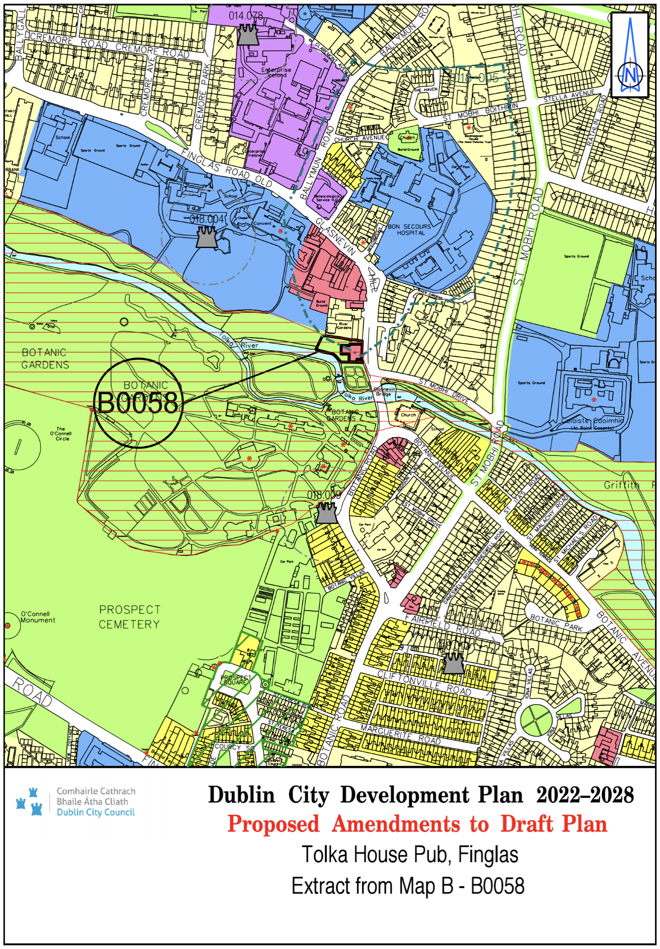
Tolka House Pub, Finglas |
Z1 |
Z3 / Z9 |
Map B |
B-0058 |
|
Site Address |
Zoning From |
Zoning To |
Map Sheet |
Map Reference |
|
Glasnevin Convent |
Z9/Z15 |
Z9/Z12 |
Map B |
B-0068 |
|
Site Address |
Zoning From |
Zoning To |
Map Sheet |
Map Reference |
|
Circle K, Foxhall, Howth Road, Raheny |
Z1 |
Z3 |
Map C |
C-0001 |
|
Site Address |
Zoning From |
Zoning To |
Map Sheet |
Map Reference |
|
St. Francis Hospice, Raheny |
Z1 |
Z15 |
Map C |
C-0002 |
|
Site Address |
Zoning From |
Zoning To |
Map Sheet |
Map Reference |
|
Site adjoining Clongriffin Train Line |
Z14 |
Z15 |
Map C |
C-0021 |
|
Site Address |
Zoning From |
Zoning To |
Map Sheet |
Map Reference |
|
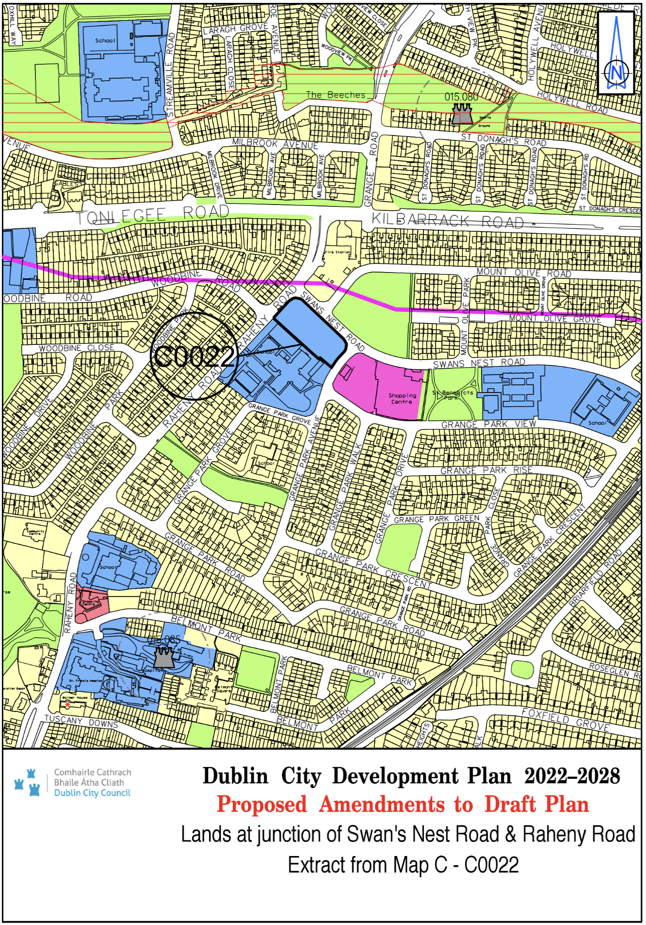
Lands at junction of Swan’s Nest Road and Raheny Road |
Z1 |
Z15 |
Map C |
C-0022 |
|
Site Address |
Zoning From |
Zoning To |
Map Sheet |
Map Reference |
|
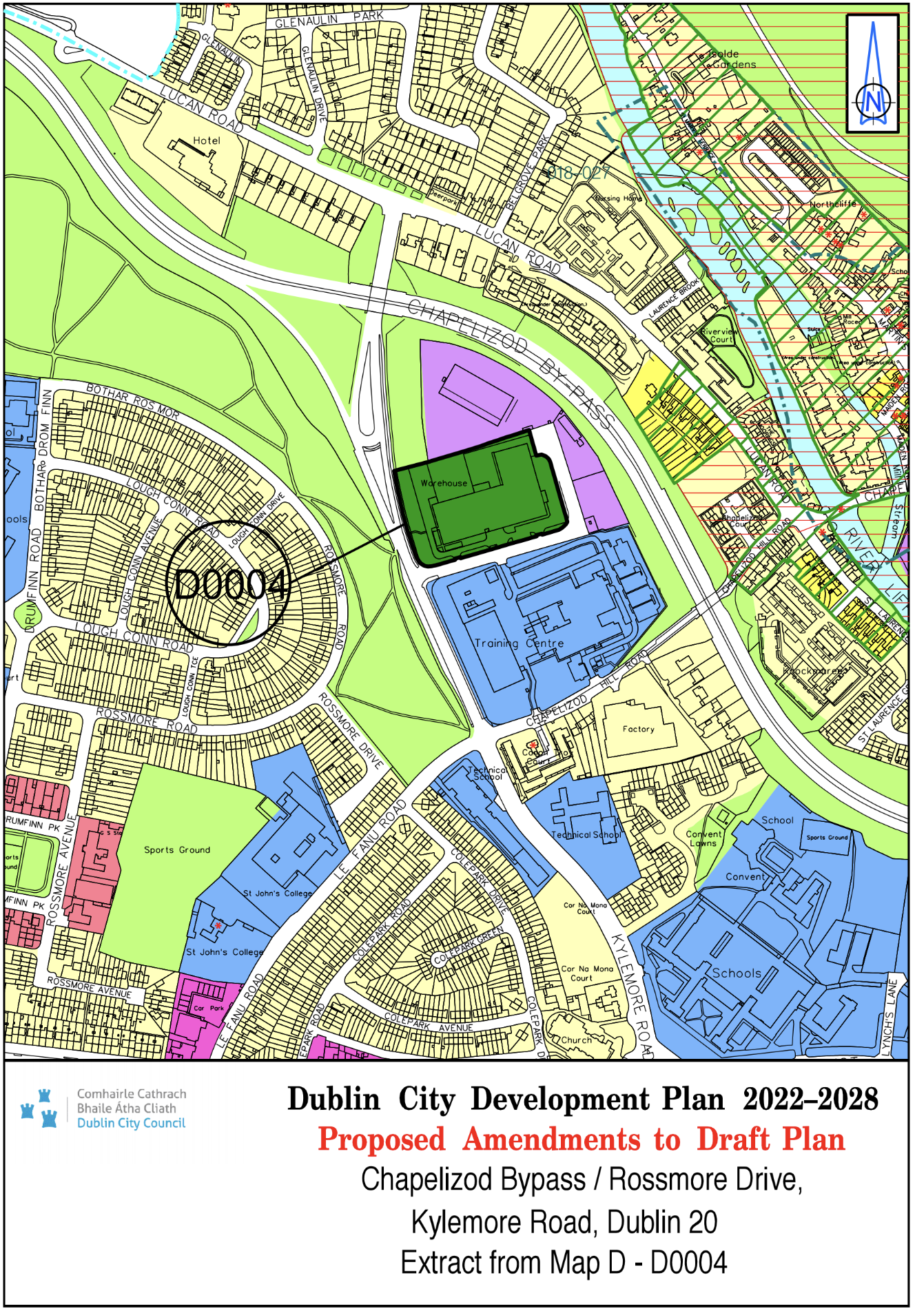
Chapelizod Bypass / Rossmore Drive, Kylemore Road, Dublin 20 |
Z6 |
Z10 |
Map D |
D-0004 |
|
Site Address |
Zoning From |
Zoning To |
Map Sheet |
Map Reference |
|
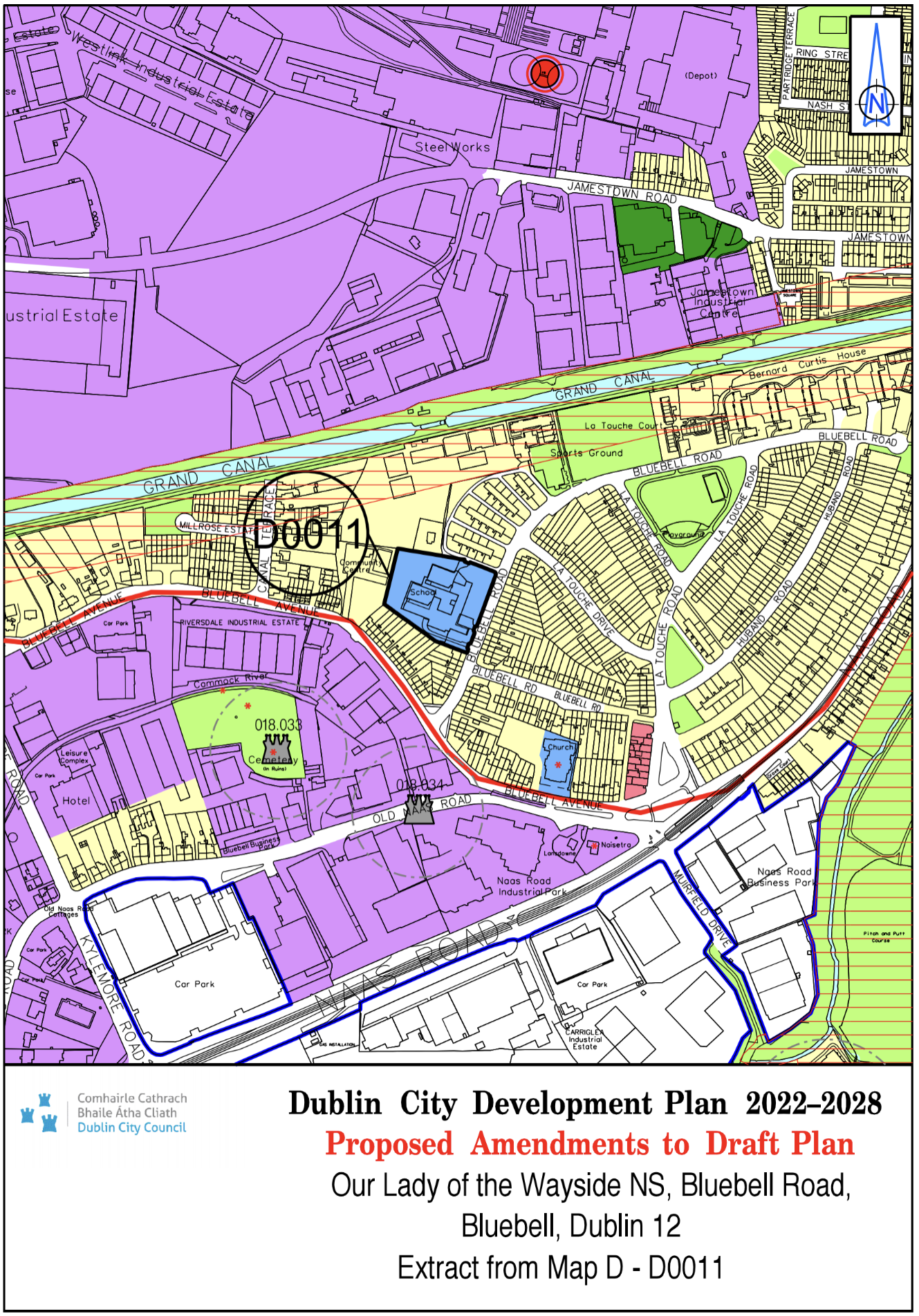
Our Lady of the Wayside NS, Bluebell Road, Bluebell, Dublin 12 |
Z1 |
Z15 |
Map D |
D-0011 |
|
Site Address |
Zoning From |
Zoning To |
Map Sheet |
Map Reference |
|
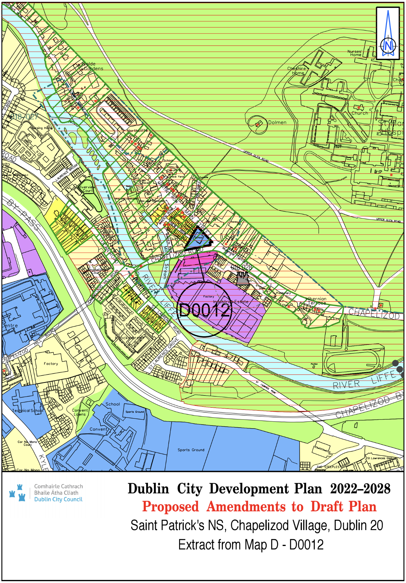
St. Patricks NS, Chapelizod Village, Dublin 20 |
Z1 |
Z15 |
Map D |
D-0012 |
|
Site Address |
Zoning From |
Zoning To |
Map Sheet |
Map Reference |
|
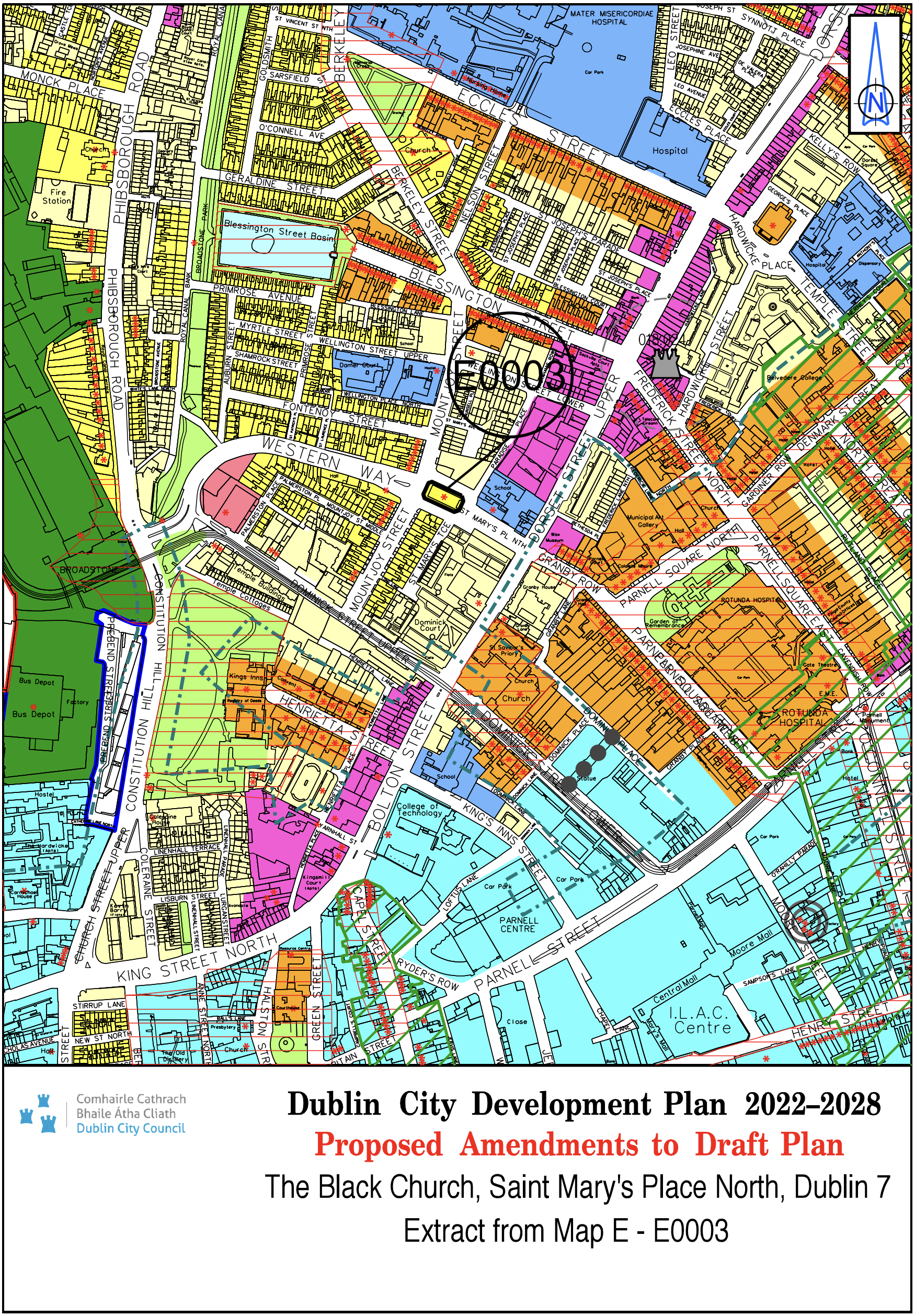
The Black Church, St. Mary's Place North, Dublin 7 |
Z1 |
Z2 |
Map E |
E-0003 |
|
Site Address |
Zoning From |
Zoning To |
Map Sheet |
Map Reference |
|
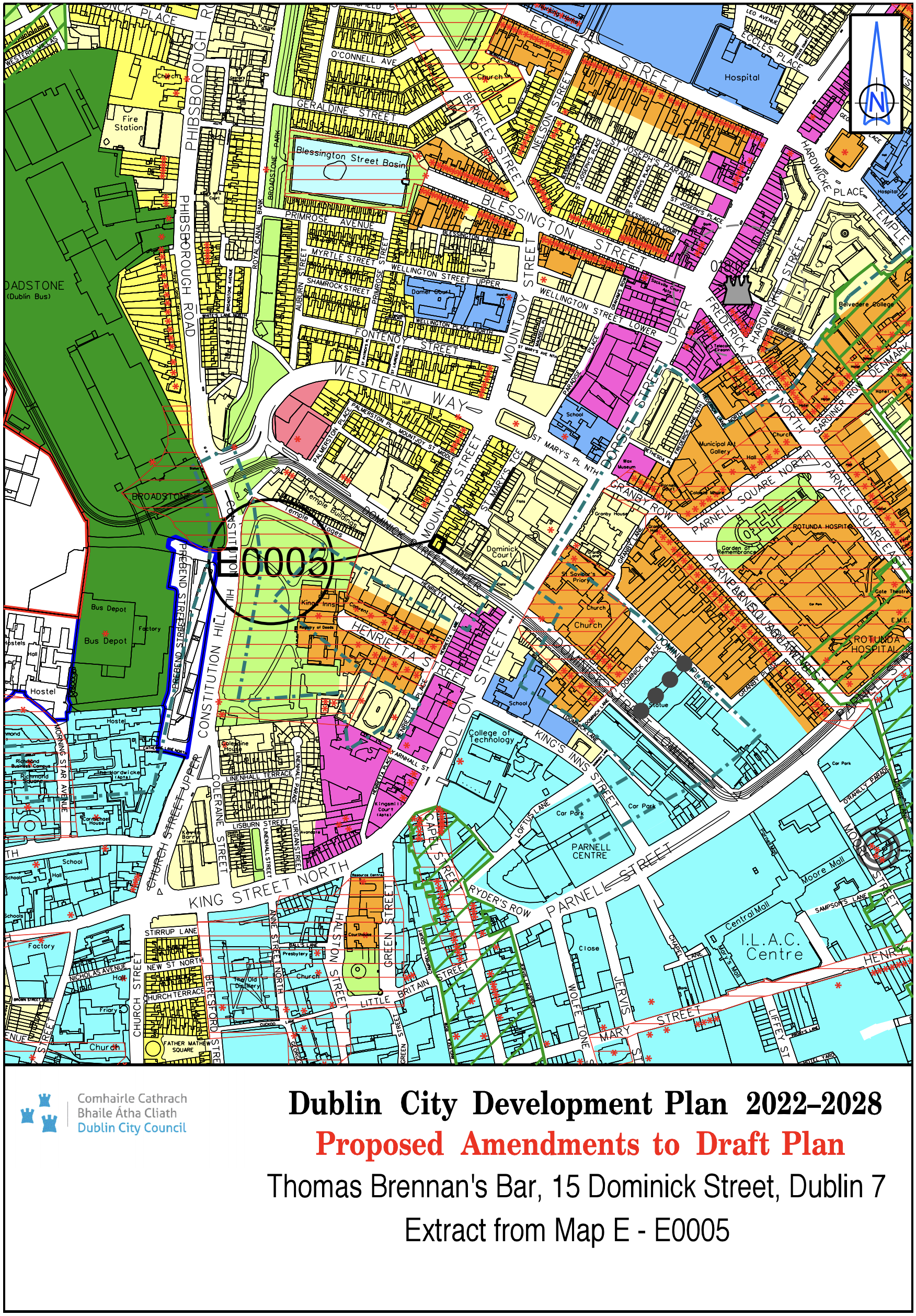
Thomas Brennan's Bar, 15 Dominick Street, Dublin 7. |
Z1 |
Z2 |
Map E |
E-0005 |
|
Site Address |
Zoning From |
Zoning To |
Map Sheet |
Map Reference |
|
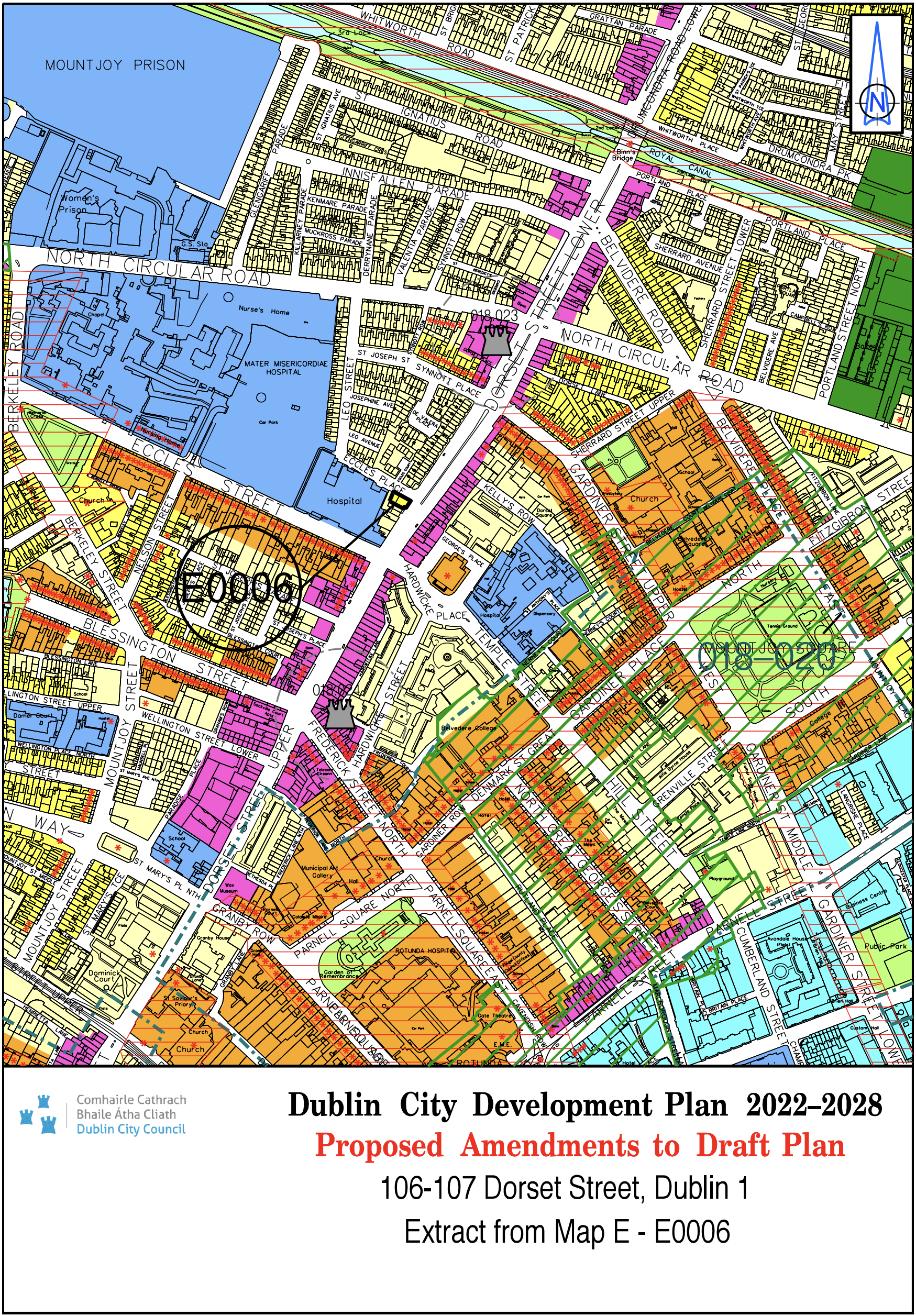
106-107 Dorset Street, Dublin 1 |
Z1 |
Z2 |
Map E |
E-0006 |
|
Site Address |
Zoning From |
Zoning To |
Map Sheet |
Map Reference |
|
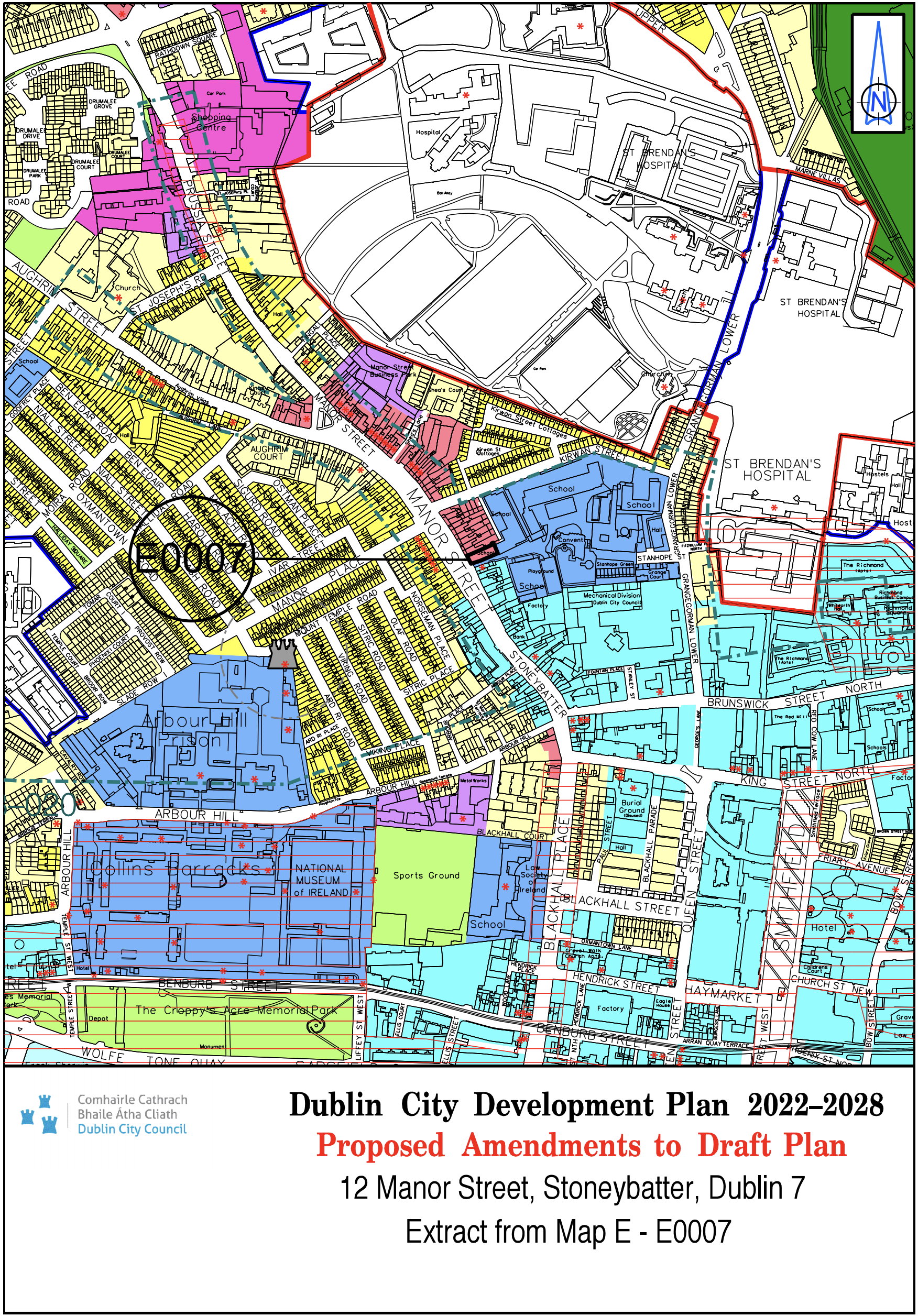
12 Manor Street , Stoneybatter, Dublin 7 |
Z15 |
Z3 |
Map E |
E-0007 |
|
Site Address |
Zoning From |
Zoning To |
Map Sheet |
Map Reference |
|
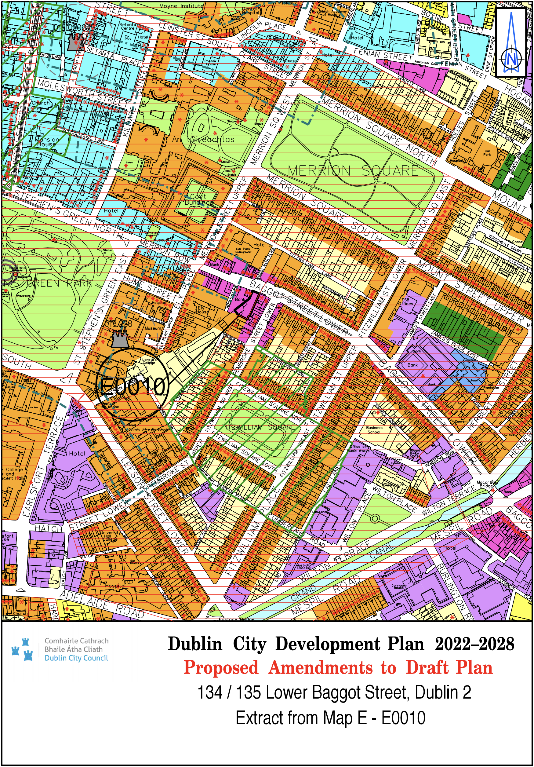
134/135 Lower Baggot Street, Dublin 2 |
Z4/ Z8 |
Z4 |
Map E |
E-0010 |
|
Site Address |
Zoning From |
Zoning To |
Map Sheet |
Map Reference |
|
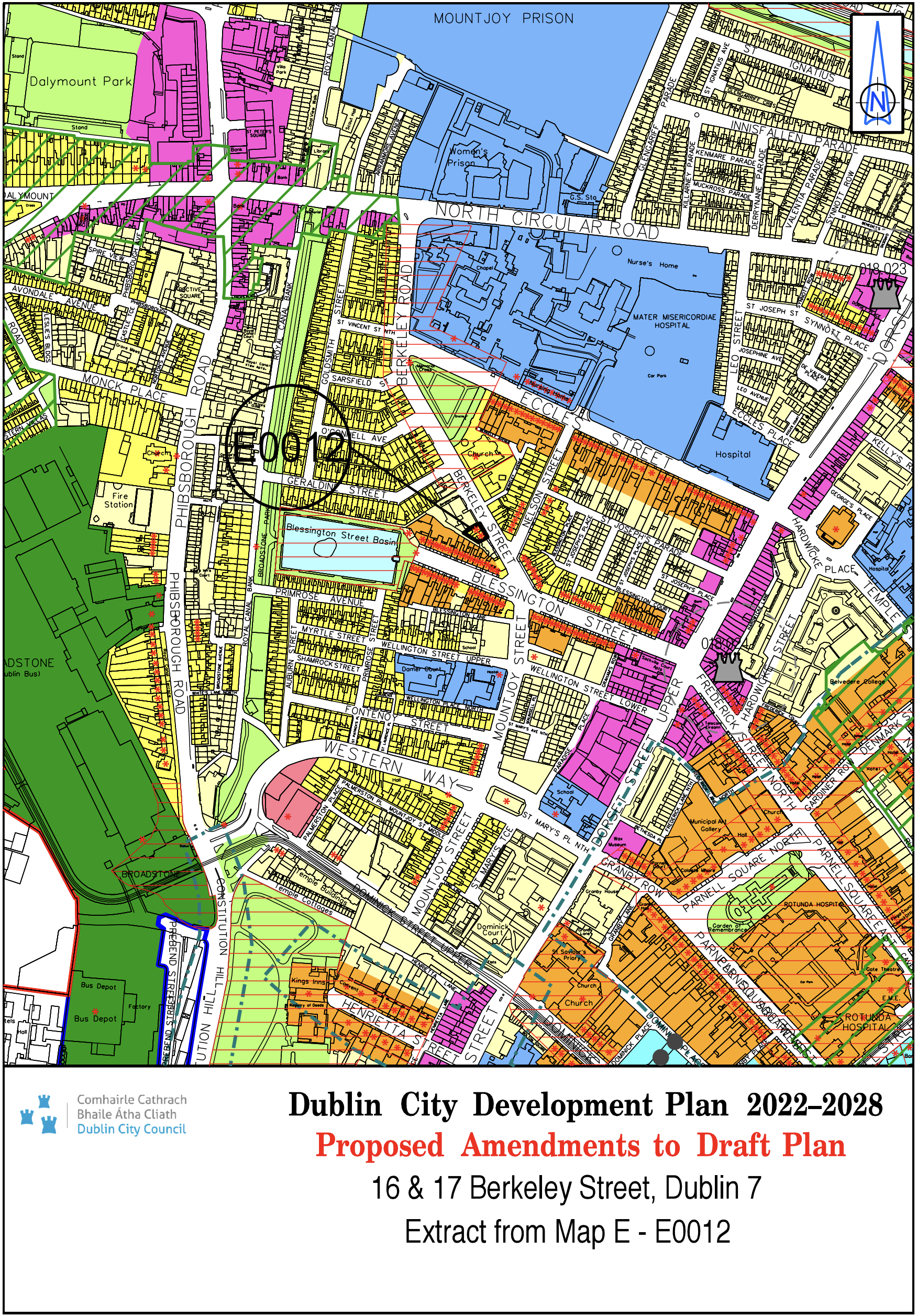
16 and 17 Berkeley Street, Dublin 7 |
Z1 |
Z2 |
Map E |
E-0012 |
|
Site Address |
Zoning From |
Zoning To |
Map Sheet |
Map Reference |
|
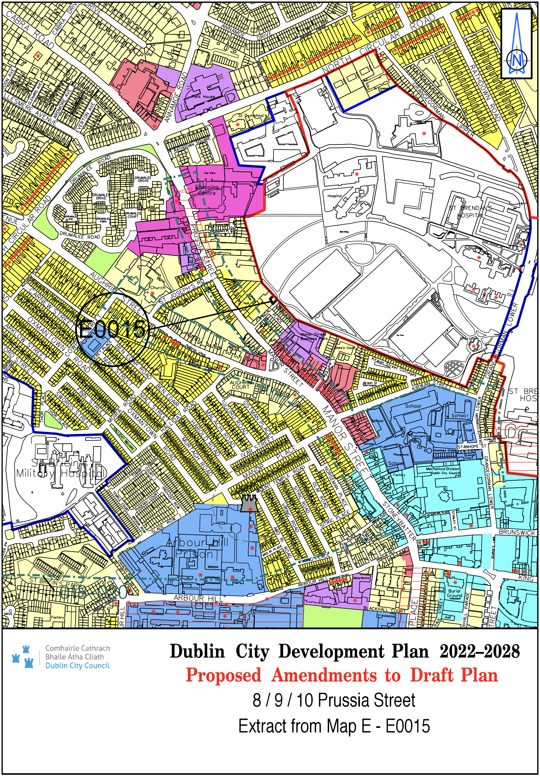
8/9/10 Prussia Street |
White land |
Z1 |
Map E |
E-0015 |
|
Site Address |
Zoning From |
Zoning To |
Map Sheet |
Map Reference |
|
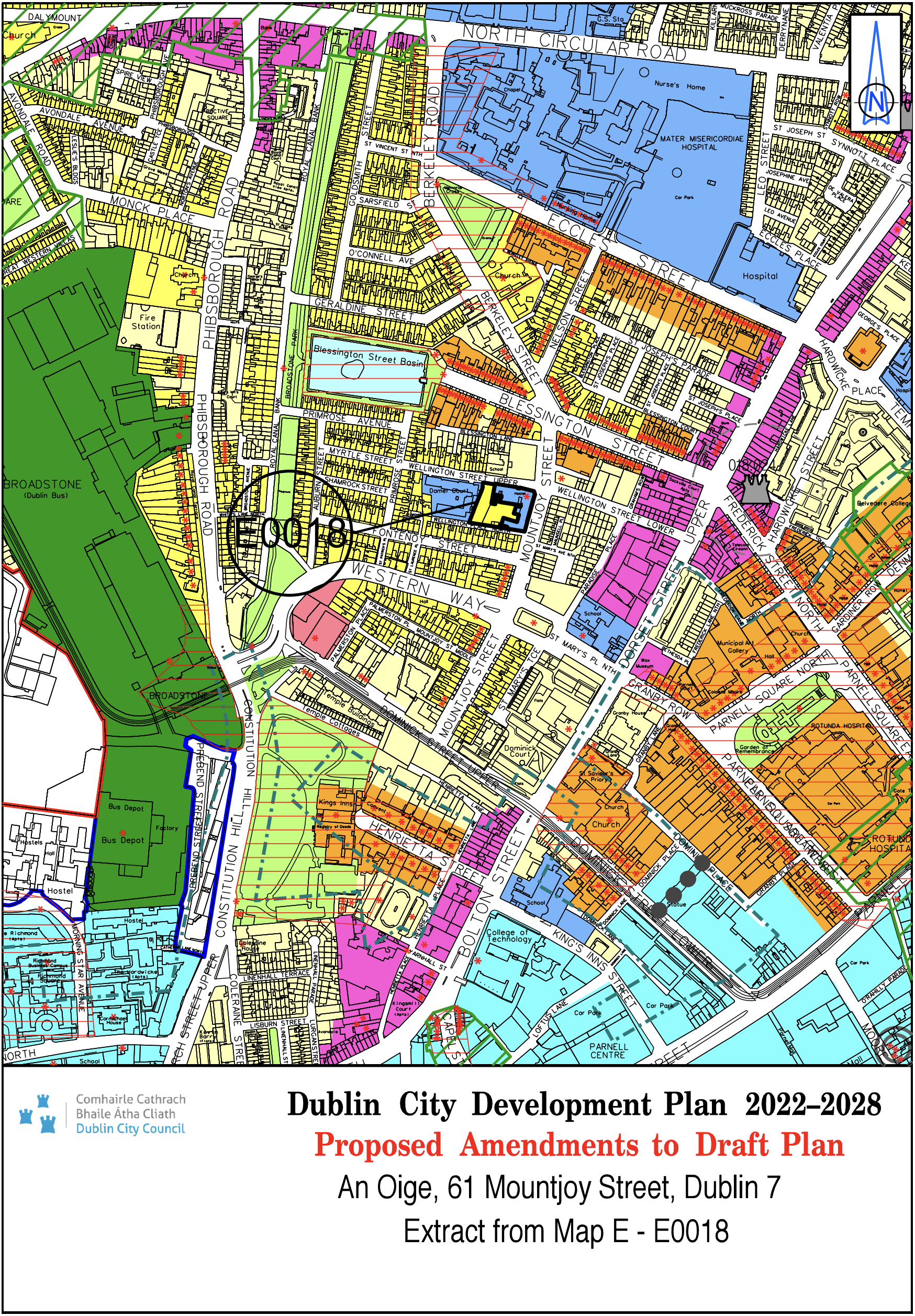
An Oige, 61 Mountjoy St., Dublin 7 |
Z15 |
Z2/Z15 |
Map E |
E-0018 |
|
Site Address |
Zoning From |
Zoning To |
Map Sheet |
Map Reference |
|
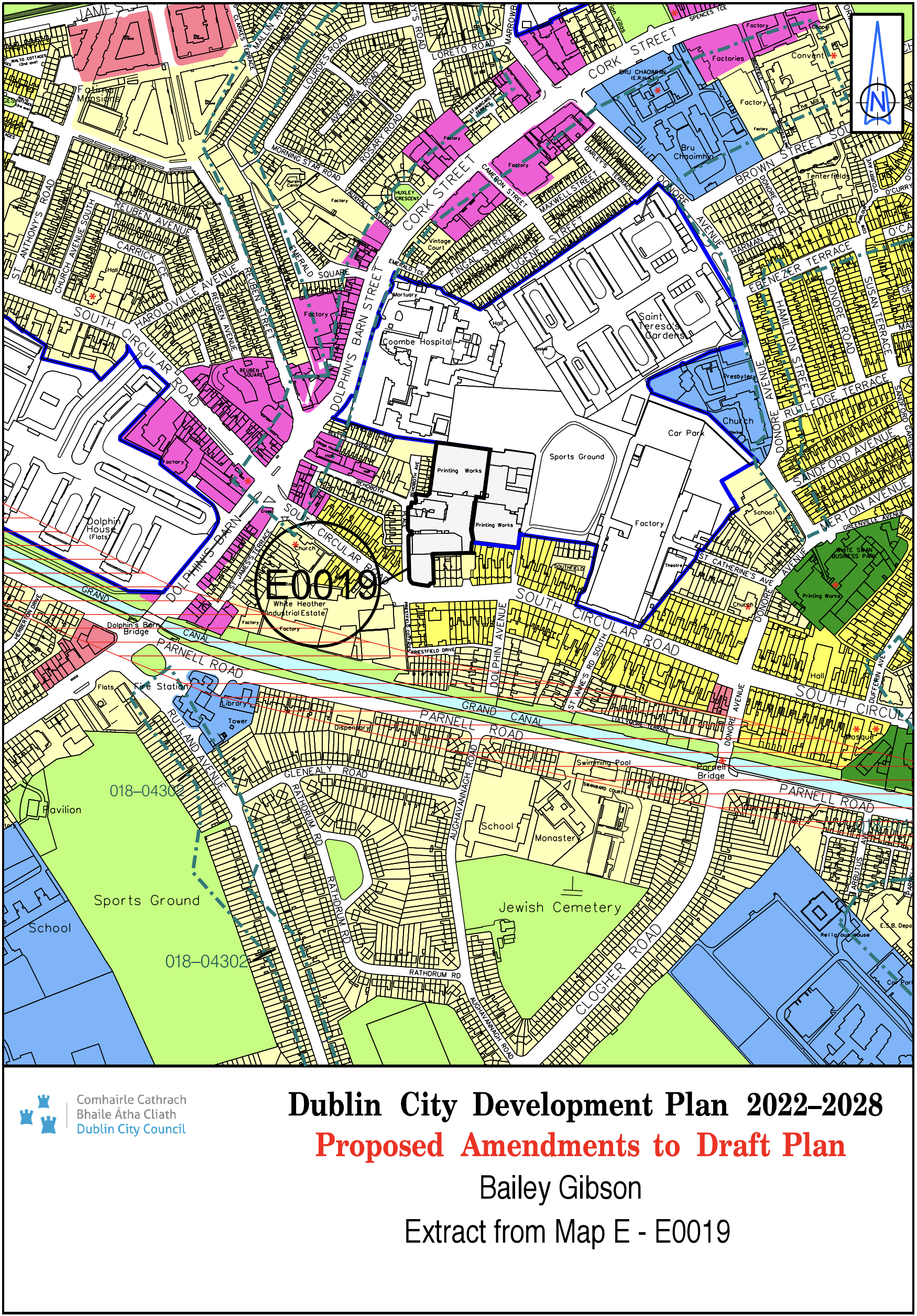
Bailey Gibson |
Z4 |
Z14 |
Map E |
E-0019 |
|
Site Address |
Zoning From |
Zoning To |
Map Sheet |
Map Reference |
|
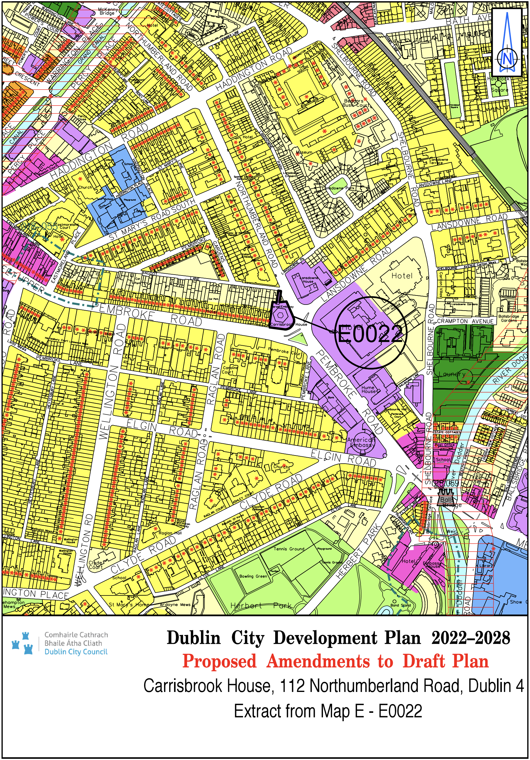
Carrisbrook House, 112 Northumberland Road, Dublin 4 |
Z1/Z6 |
Z6 |
Map E |
E-0022 |
|
Site Address |
Zoning From |
Zoning To |
Map Sheet |
Map Reference |
|
Charlemont Street, Harcourt Road and Richmond Street South |
Z10 |
Z6 |
Map E |
E-0026 |

|
Site Address |
Zoning From |
Zoning To |
Map Sheet |
Map Reference |
|
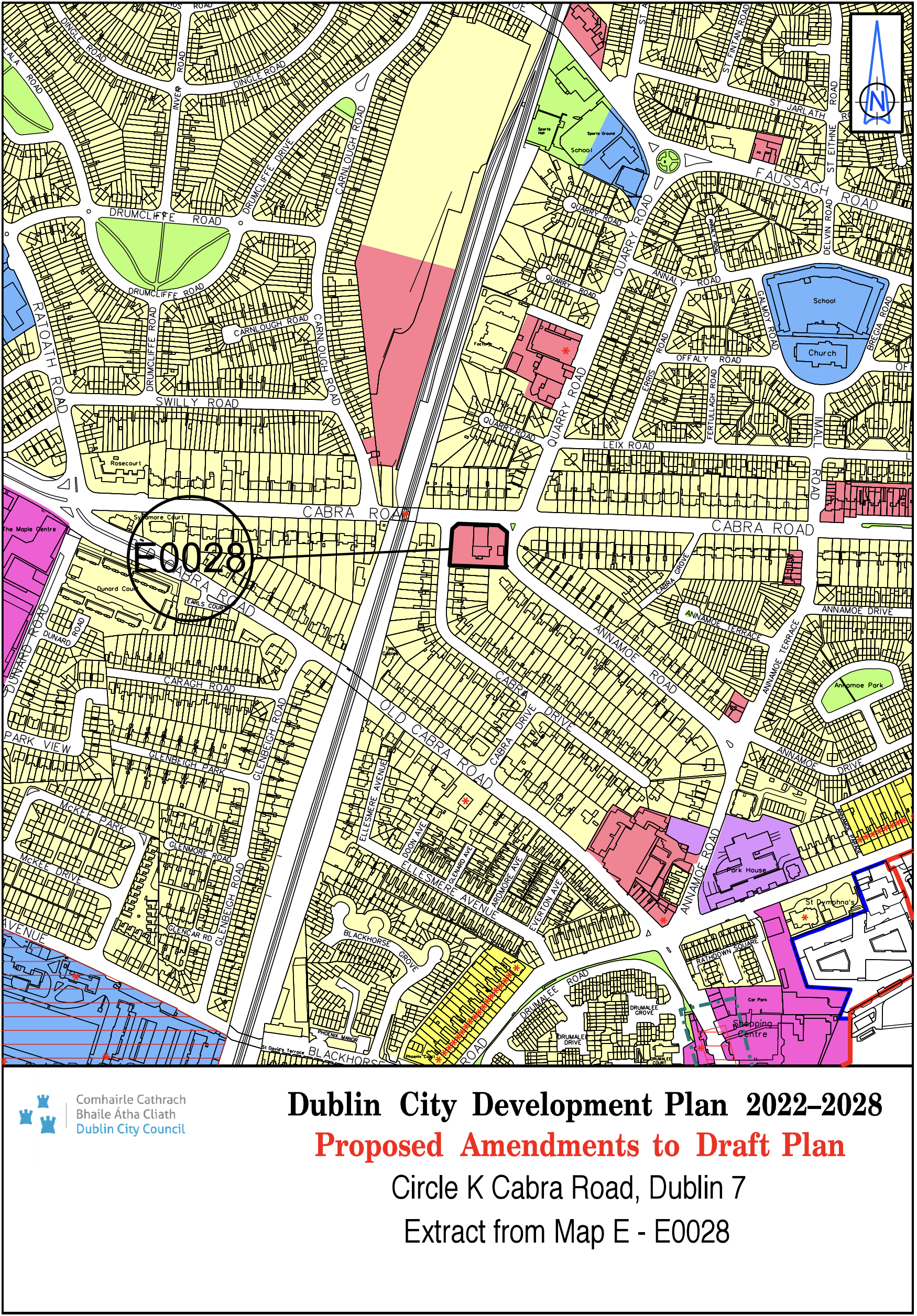
Circle K, Cabra Road, Dublin 7 |
Z1 |
Z3 |
Map E |
E-0028 |
|
Site Address |
Zoning From |
Zoning To |
Map Sheet |
Map Reference |
|
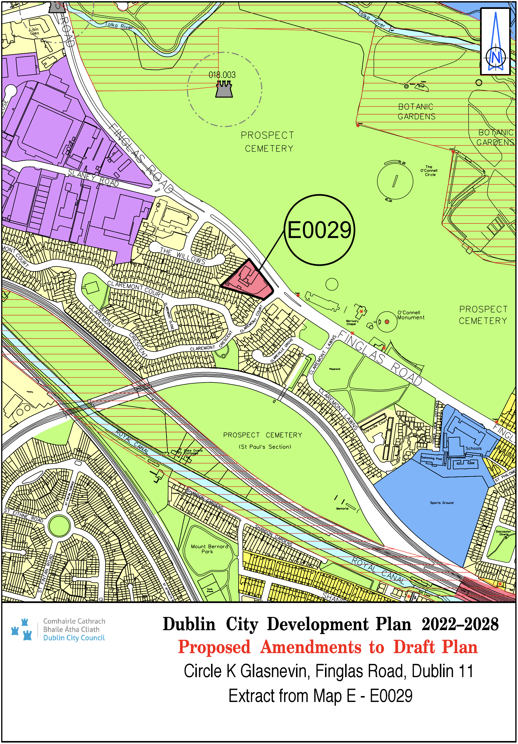
Circle K, Glasnevin, Finglas Road, Dublin 11 |
Z1 |
Z3 |
Map E |
E-0029 |
|
Site Address |
Zoning From |
Zoning To |
Map Sheet |
Map Reference |
|
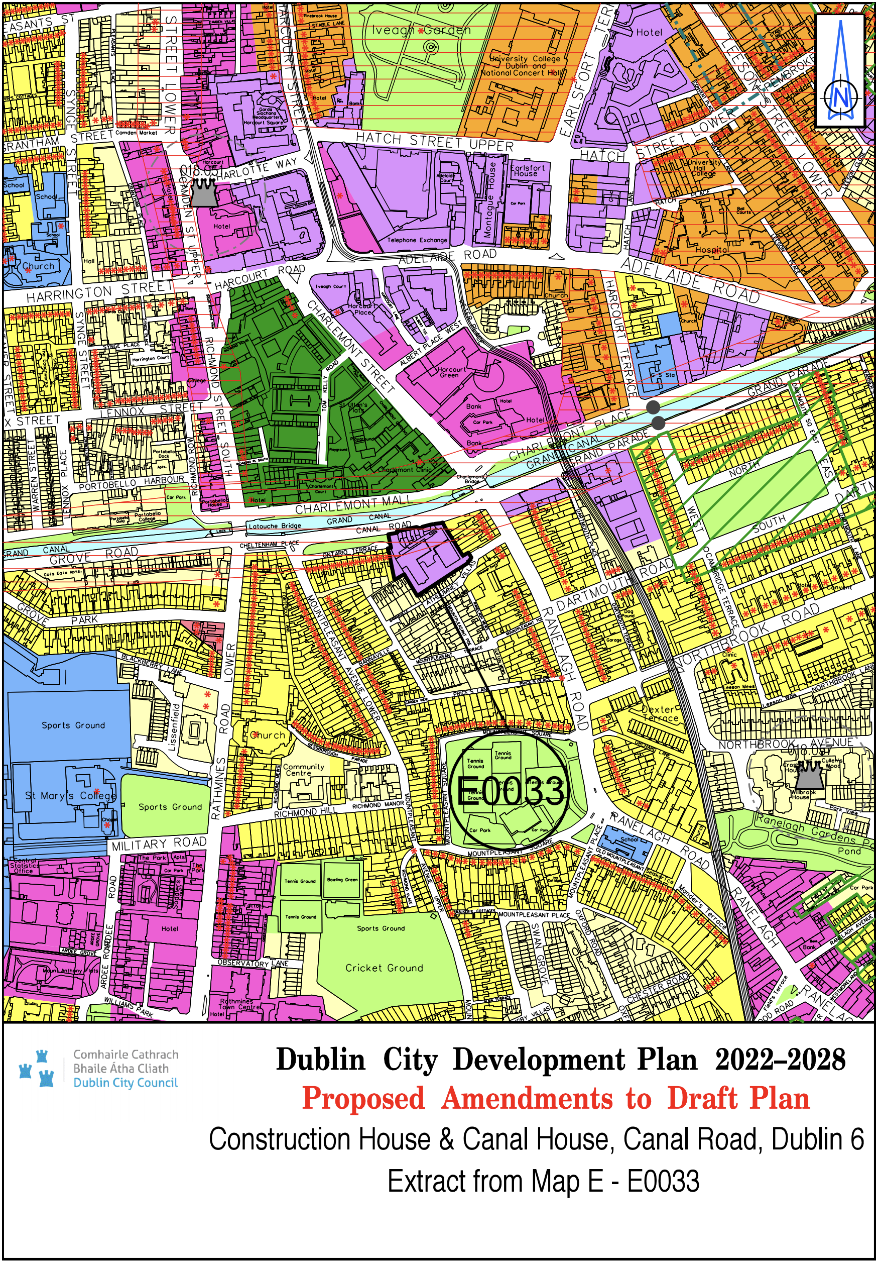
Construction House and Canal House, Canal Road, Dublin 6 |
Z10 |
Z6 |
Map E |
E-0033 |
|
Site Address |
Zoning From |
Zoning To |
Map Sheet |
Map Reference |
|
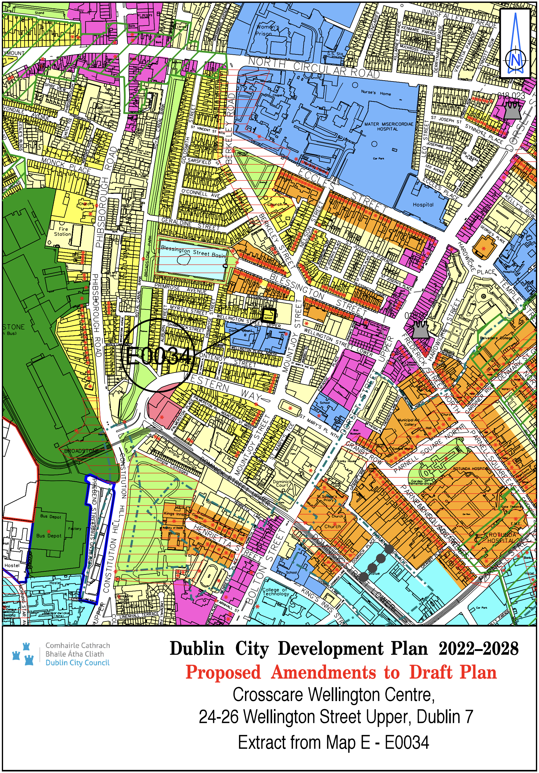
Crosscare Wellington Centre, 24-26 Wellington Street Upper, Dublin 7 |
Z1 |
Z2 |
Map E |
E-0034 |
|
Site Address |
Zoning From |
Zoning To |
Map Sheet |
Map Reference |
|
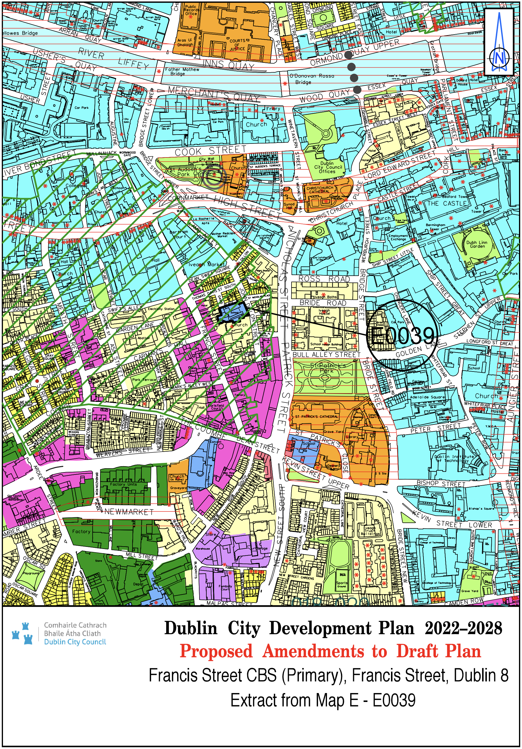
Francis Street CBS (Primary) Francis Street, Dublin 8 |
Z1 |
Z15 |
Map E |
E-0039 |
|
Site Address |
Zoning From |
Zoning To |
Map Sheet |
Map Reference |
|
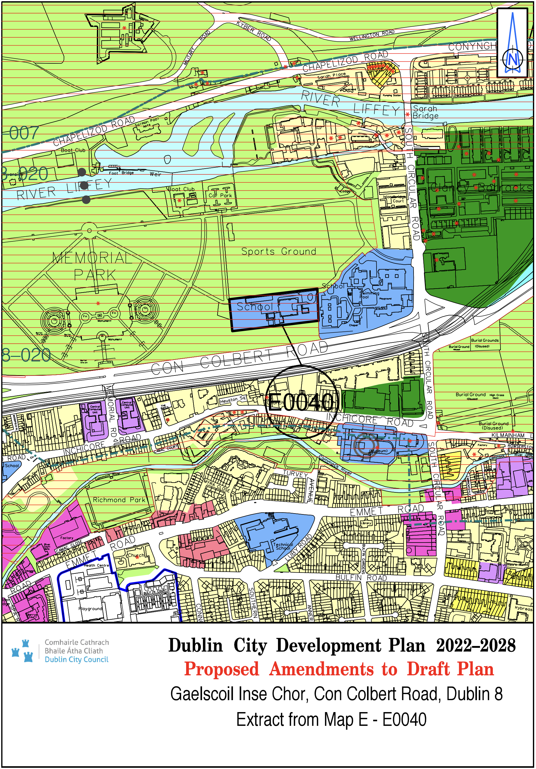
Gaelscoil Inse Chor, An Chur Bhothar Theas Droichead an Hinse, Baile Atha Cliath 8 |
Z9 |
Z15 |
Map E |
E-0040 |
|
Site Address |
Zoning From |
Zoning To |
Map Sheet |
Map Reference |
|
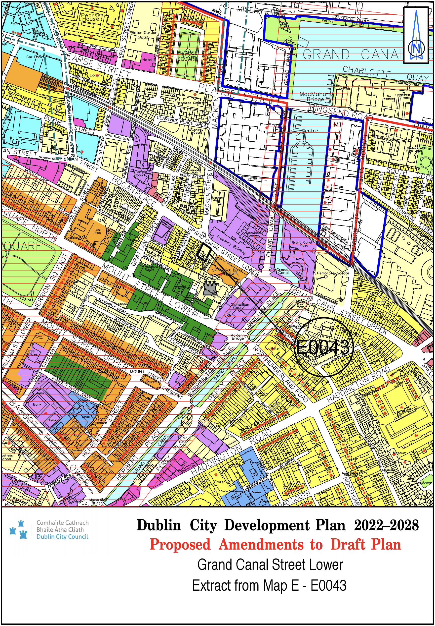
Grand Canal Street Lower |
Z2/ White land |
Z1 |
Map E |
E-0043 |
|
Site Address |
Zoning From |
Zoning To |
Map Sheet |
Map Reference |
|
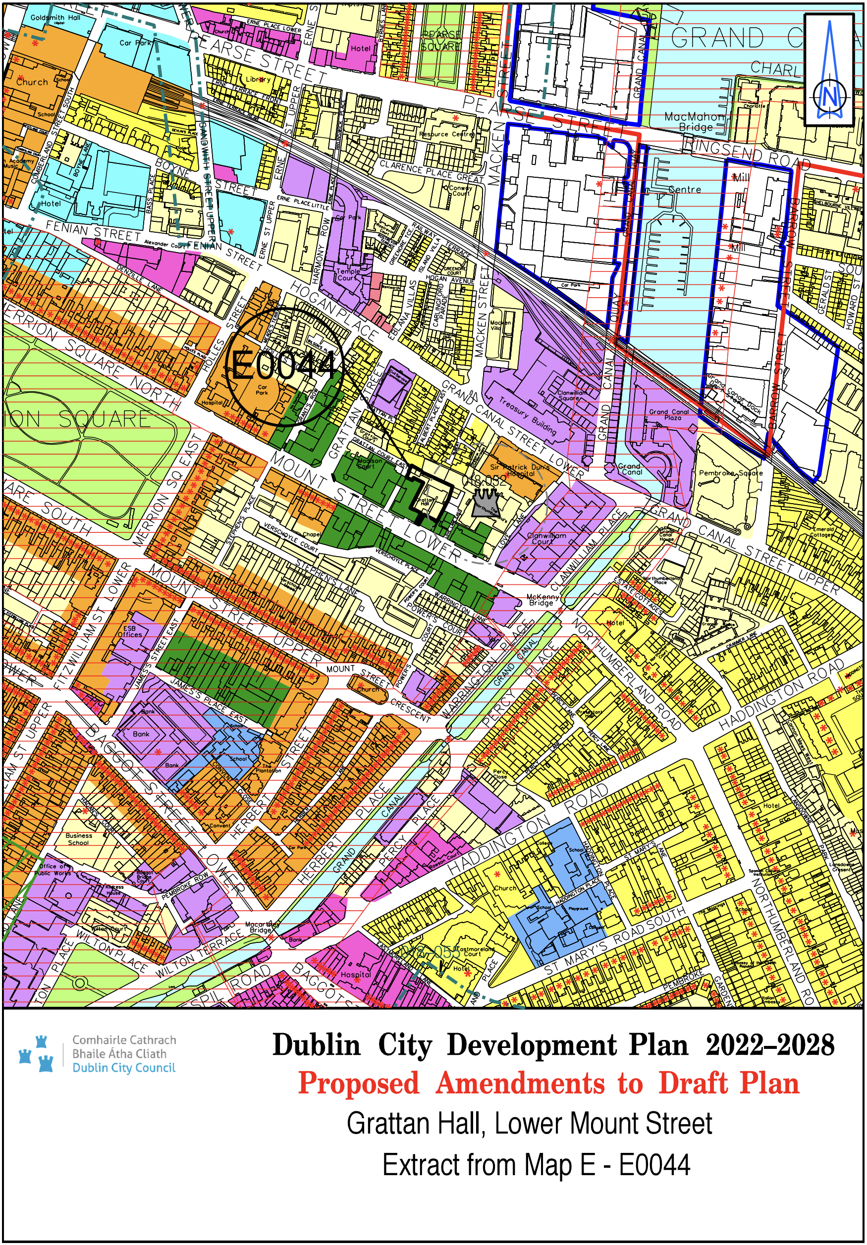
Grattan Hall, Lower Mount Street |
Z10 |
Z1 |
Map E |
E-0044 |
|
Site Address |
Zoning From |
Zoning To |
Map Sheet |
Map Reference |
|
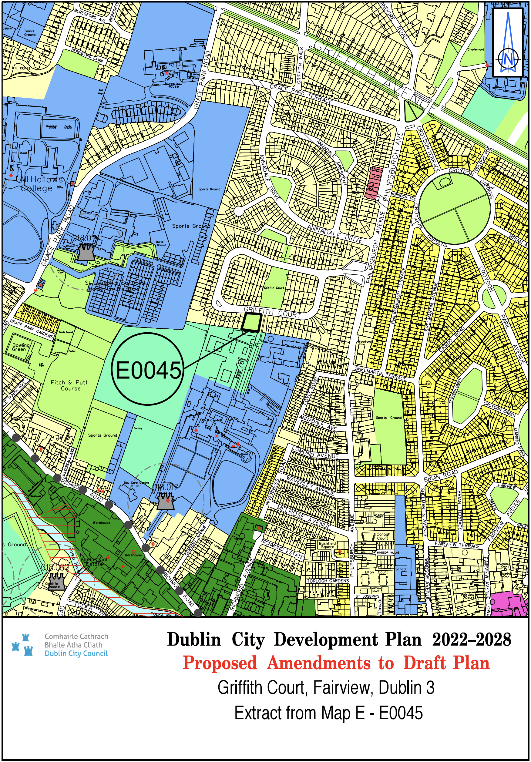
Griffith Court, Fairview, Dublin 3 |
Z1 |
Z9 |
Map E |
E-0045 |
|
Site Address |
Zoning From |
Zoning To |
Map Sheet |
Map Reference |
|
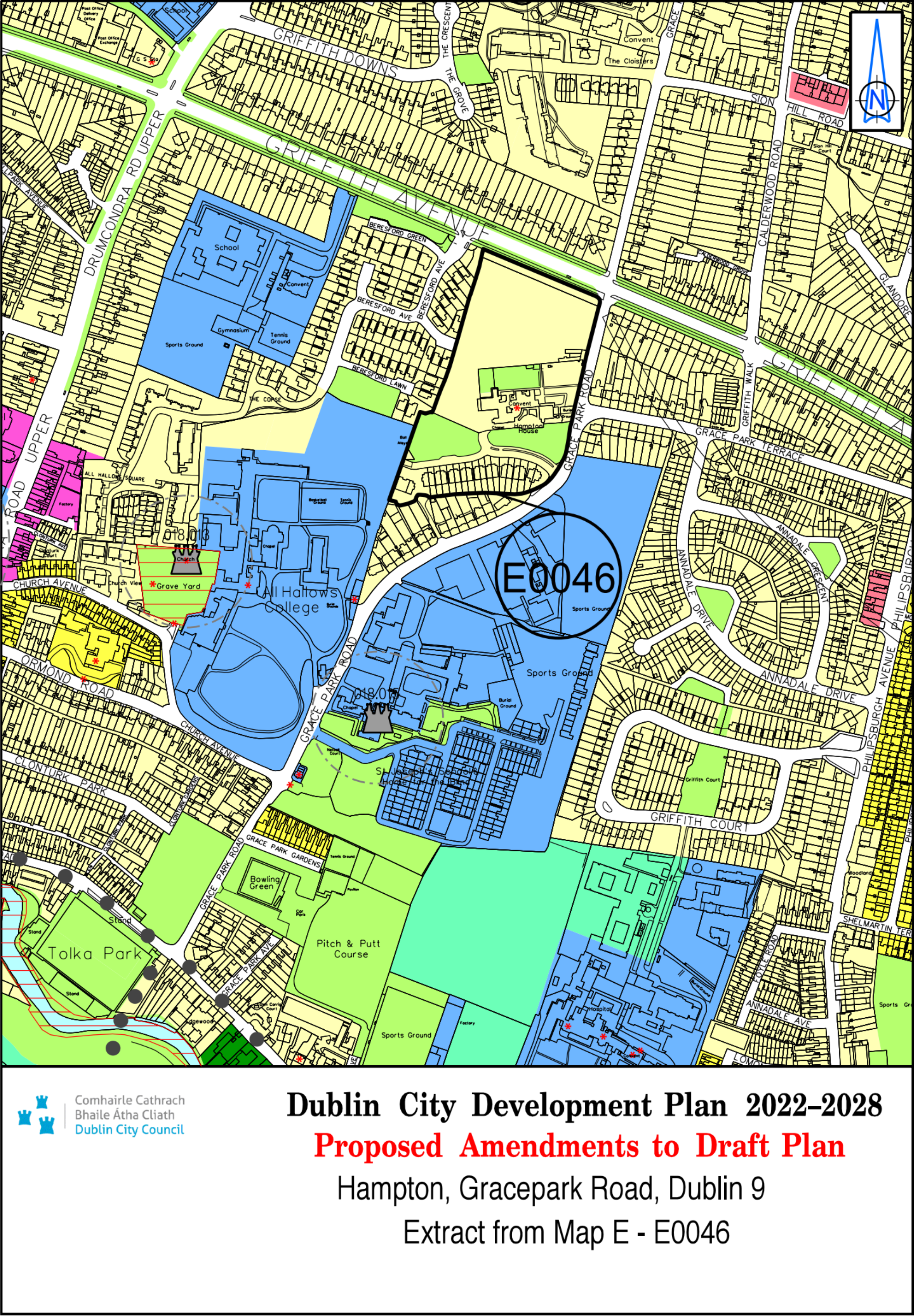
Hampton, Grace Park Road, Dublin 9 |
Z9/Z15 |
Z1/Z9 |
Map E |
E-0046 |
|
Site Address |
Zoning From |
Zoning To |
Map Sheet |
Map Reference |
|
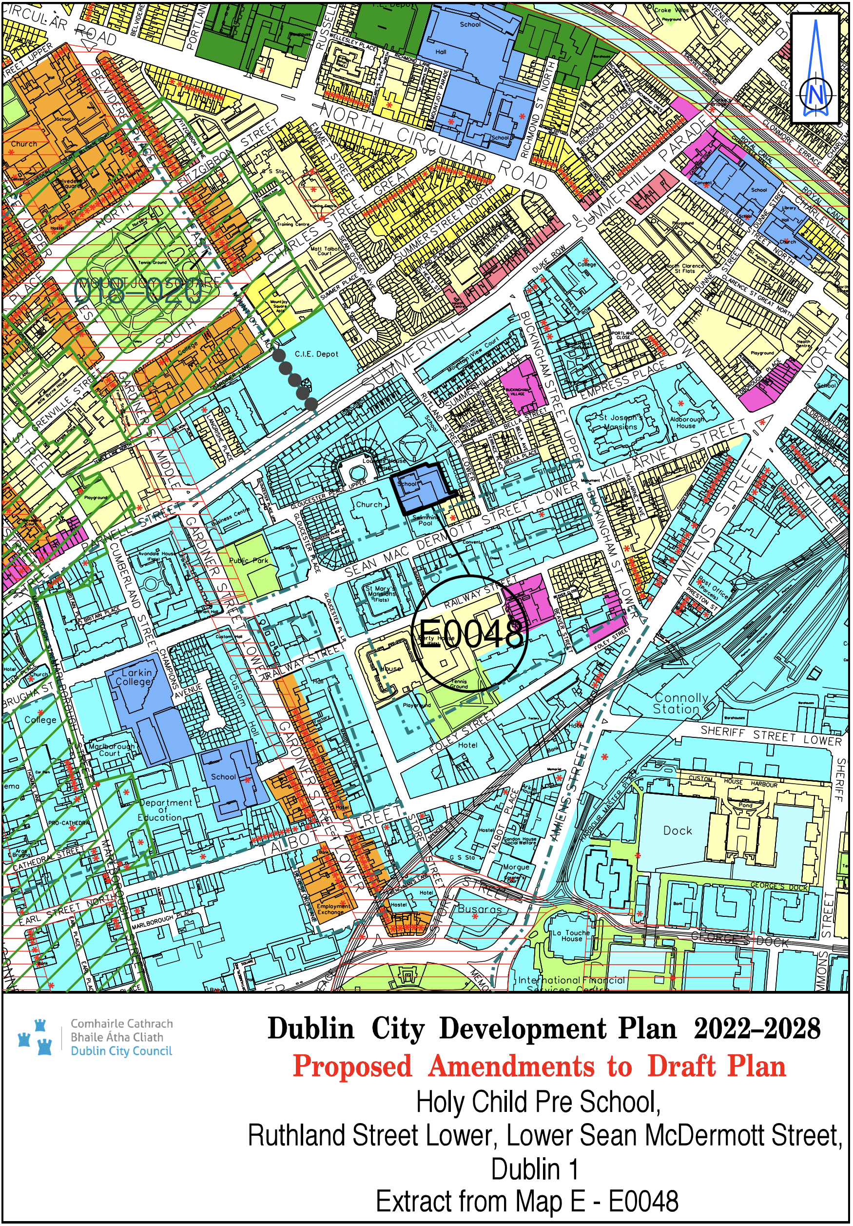
Holy Child Pre School, Rutland St Project, Lower Sean McDermott Street, Dublin 1 |
Z5 |
Z15 |
Map E |
E-0048 |
|
Site Address |
Zoning From |
Zoning To |
Map Sheet |
Map Reference |
|
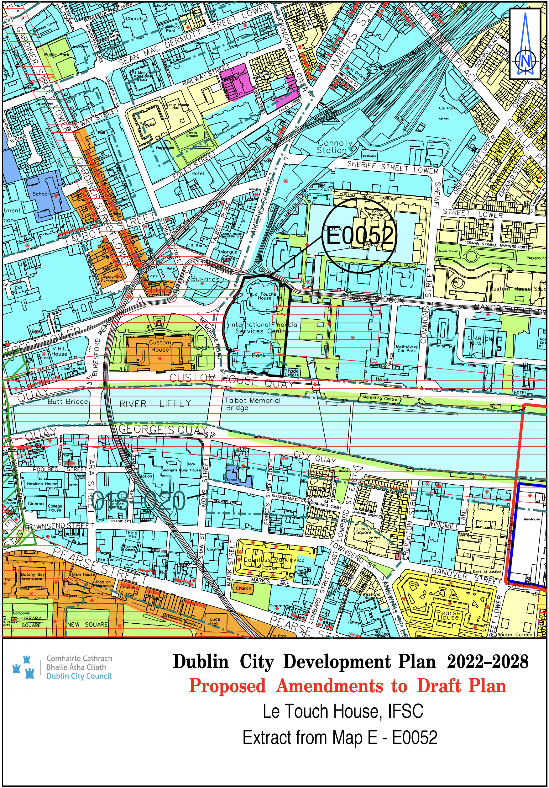
Le Touche House, IFSC |
Z5/Z9 |
Z9/Z5 |
Map E |
E-0052 |
|
Site Address |
Zoning From |
Zoning To |
Map Sheet |
Map Reference |
|
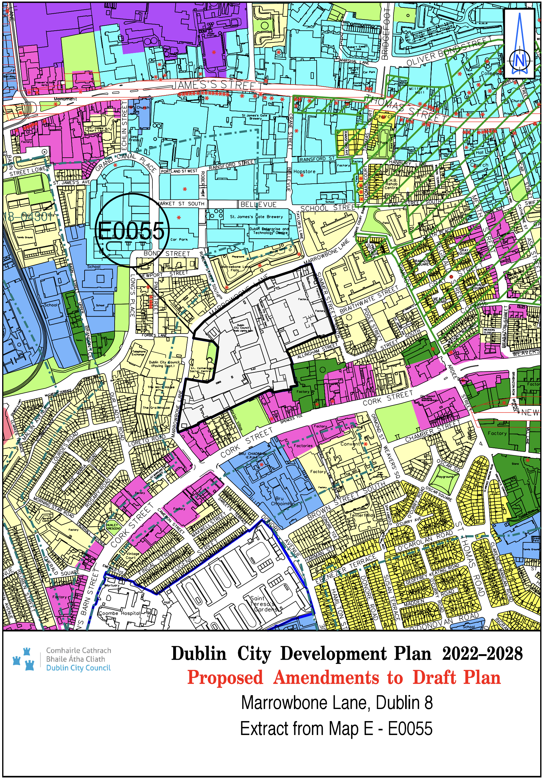
Marrowbone Lane, Dublin 8 |
Z9/Z14 |
Z14 |
Map E |
E-0055 |
|
Site Address |
Zoning From |
Zoning To |
Map Sheet |
Map Reference |
|
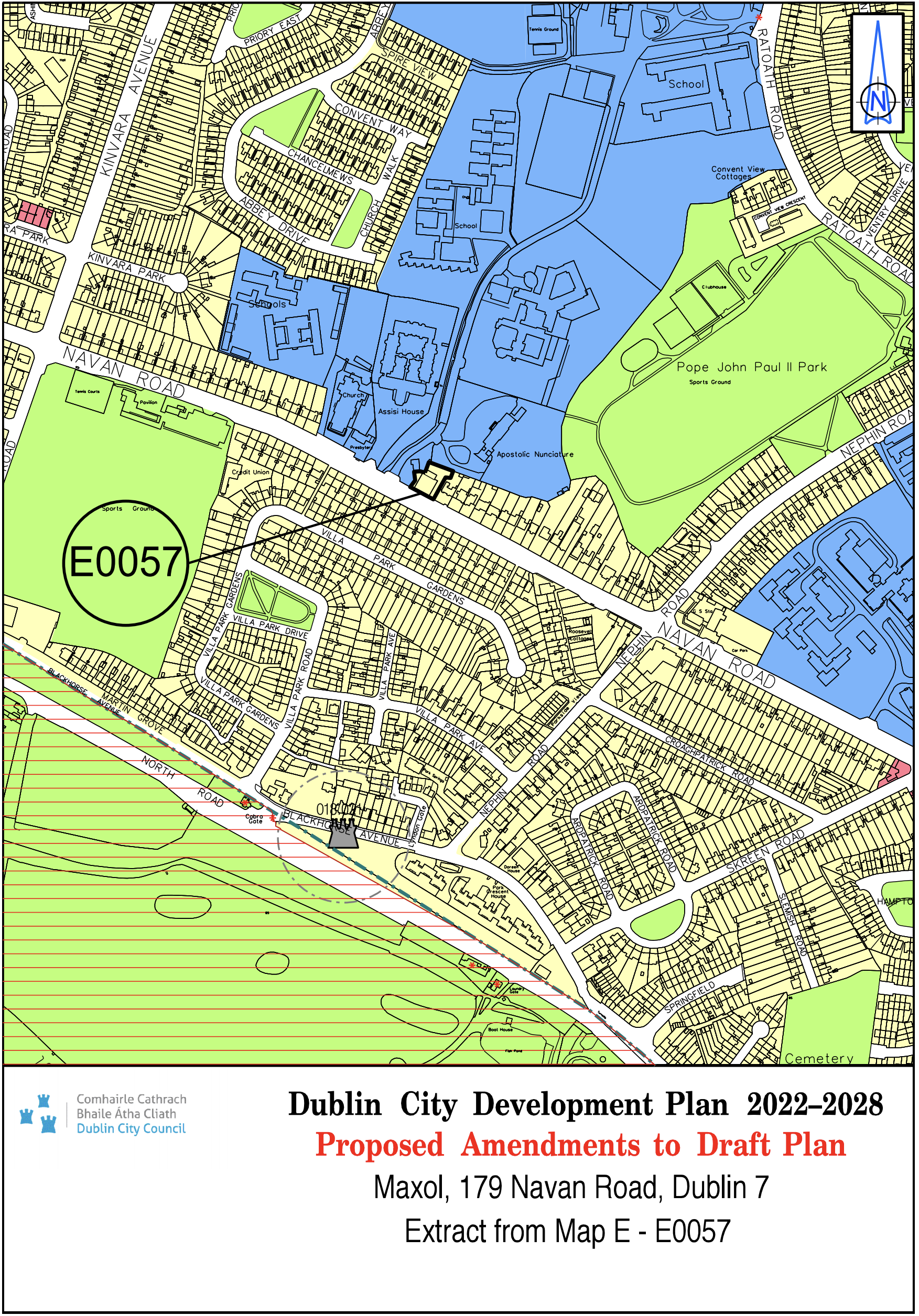
Maxol, 179 Navan Road, Dublin 7 |
Z15 |
Z1 |
Map E |
E-0057 |
|
Site Address |
Zoning From |
Zoning To |
Map Sheet |
Map Reference |
|
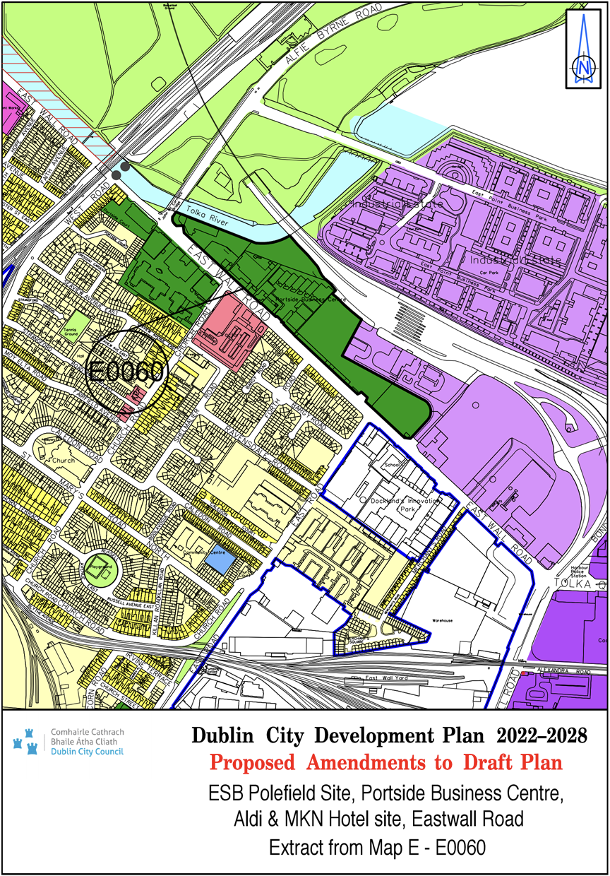
ESB Polefield Site, Portside Business Centre, Aldi and MKN Hotel site, East Wall Road |
Z6 |
Z10 |
Map E |
E-0060 |
|
Site Address |
Zoning From |
Zoning To |
Map Sheet |
Map Reference |
|
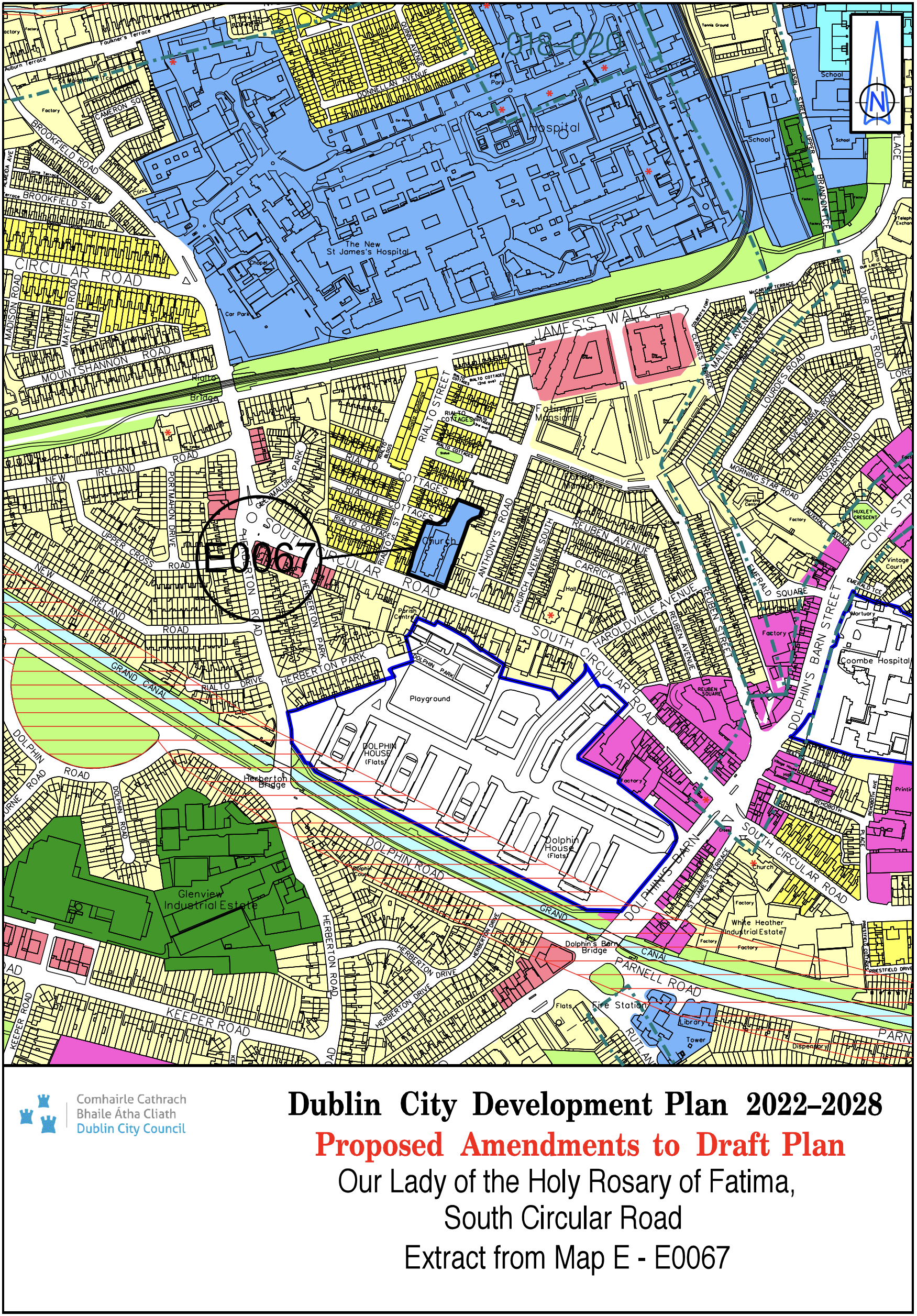
Our Lady of the Holy Rosary of Fatima, South Circular Road |
Z1 |
Z15 |
Map E |
E-0067 |
|
Site Address |
Zoning From |
Zoning To |
Map Sheet |
Map Reference |
|
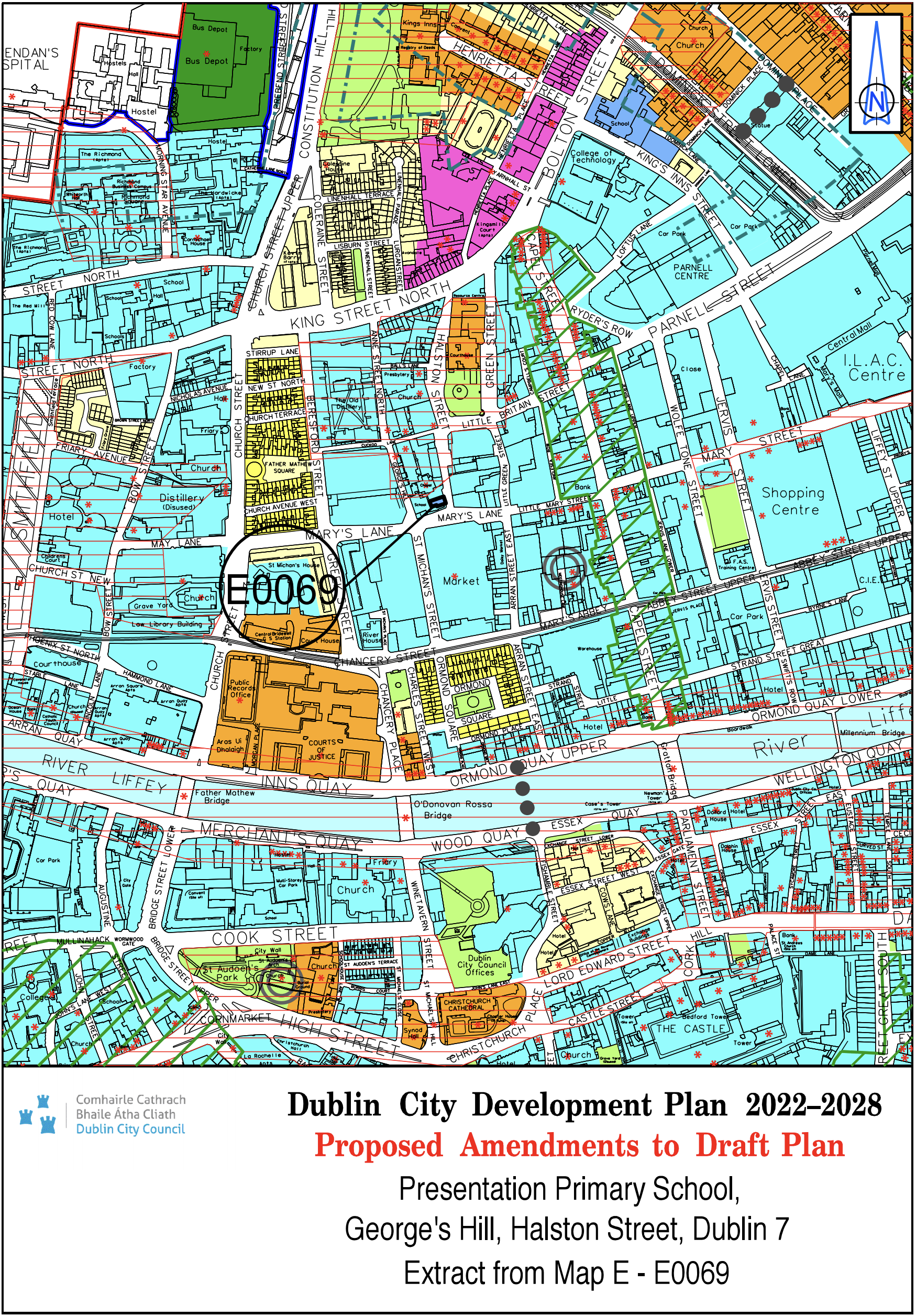
Presentation Primary School, George's Hill, Halston, Street, Dublin 7 |
Z5 |
Z15 |
Map E |
E-0069 |
|
Site Address |
Zoning From |
Zoning To |
Map Sheet |
Map Reference |
|
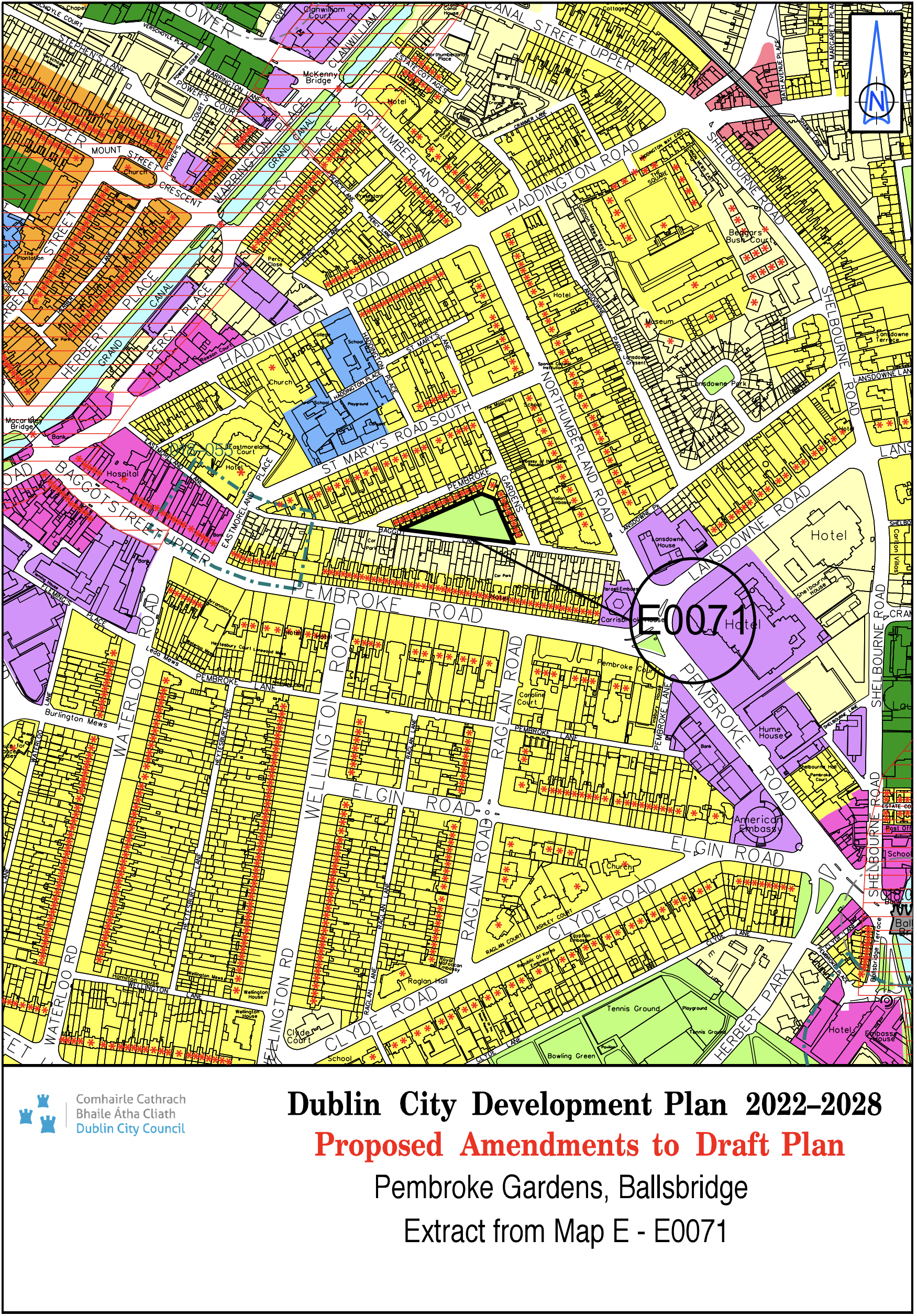
Pembroke Gardens, Ballsbridge |
Z1 |
Z9 |
Map E |
E-0071 |
|
Site Address |
Zoning From |
Zoning To |
Map Sheet |
Map Reference |
|
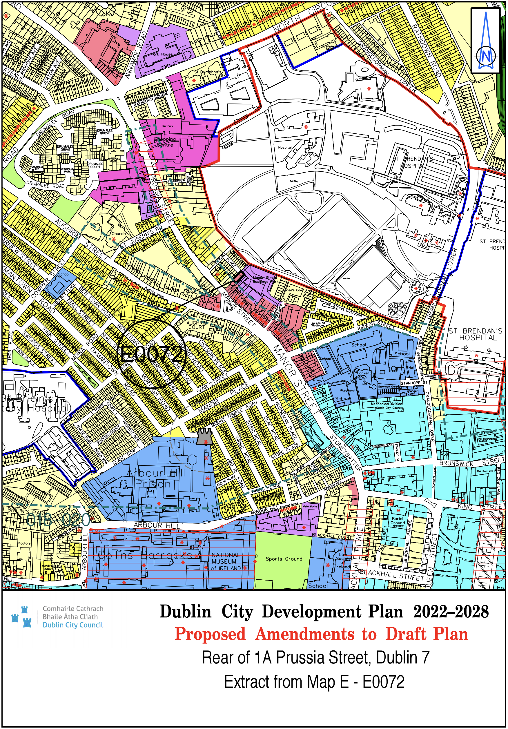
Rear of 1A Prussia Street Dublin 7 |
Z6 |
Z3 |
Map E |
E-0072 |
|
Site Address |
Zoning From |
Zoning To |
Map Sheet |
Map Reference |
|
Rutland NS, Lower Gloucester Street, Dublin 1 |
Z5 |
Z15 |
Map E |
E-0073 |

|
Site Address |
Zoning From |
Zoning To |
Map Sheet |
Map Reference |
|
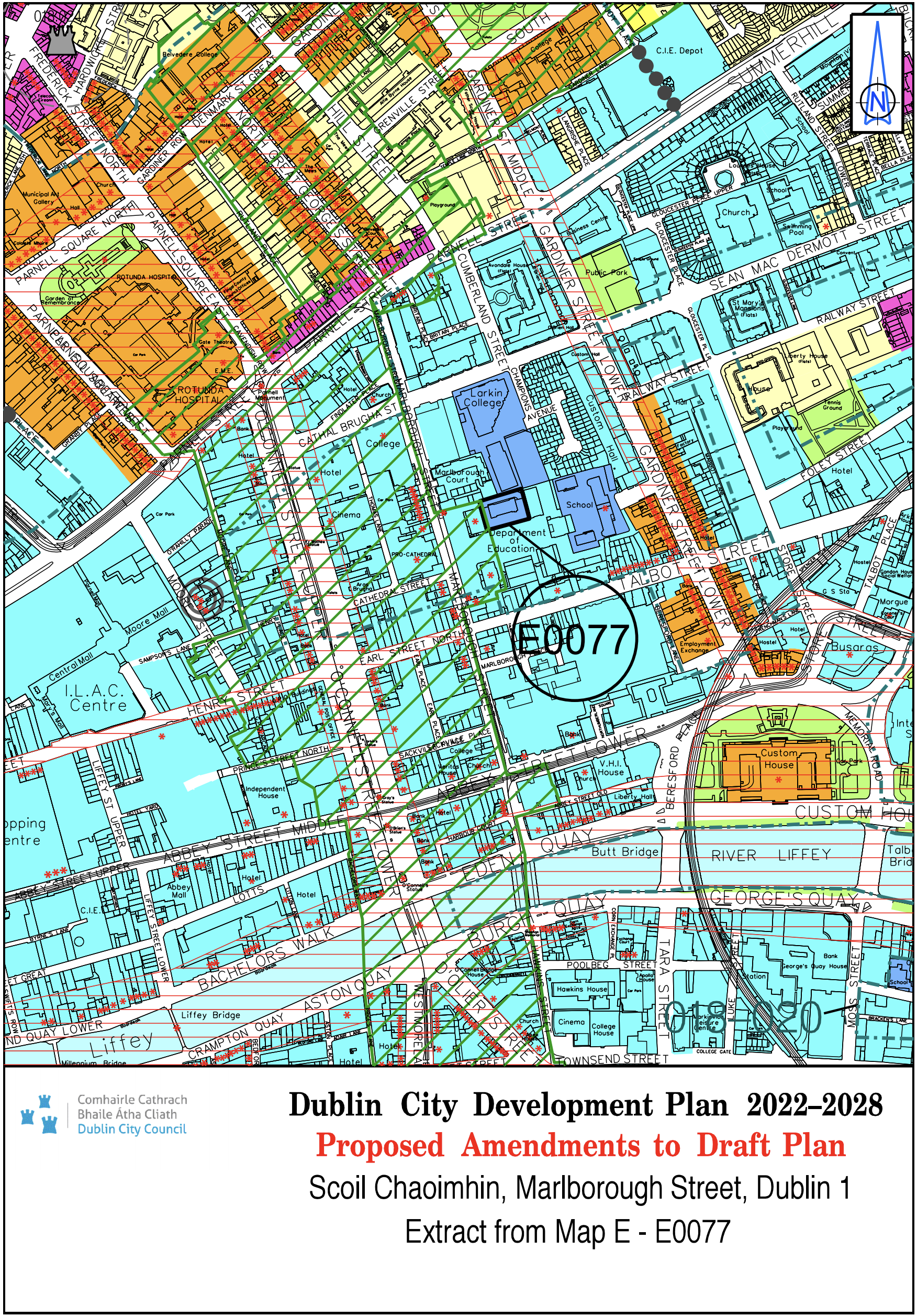
Scoil Chaoimhin, Marlborough Street, Dublin 1 |
Z5 |
Z15 |
Map E |
E-0077 |
|
Site Address |
Zoning From |
Zoning To |
Map Sheet |
Map Reference |
|
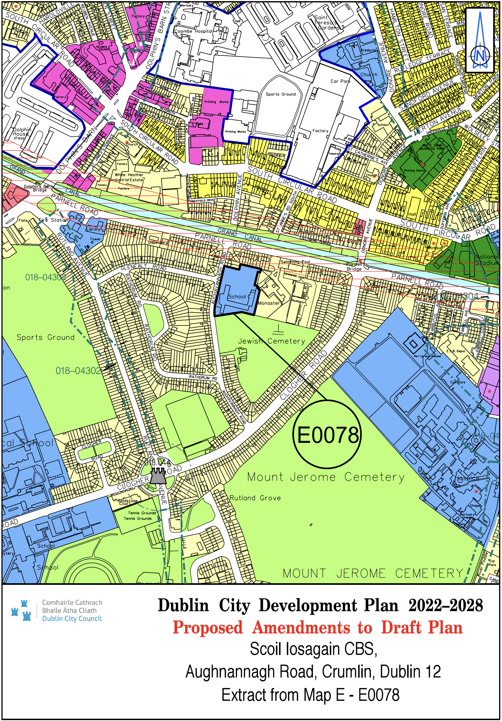
Scoil Iosagain CBS, Aughnannagh Road, Crumlin Dublin 12 |
Z1 |
Z15 |
Map E |
E-0078 |
|
Site Address |
Zoning From |
Zoning To |
Map Sheet |
Map Reference |
|
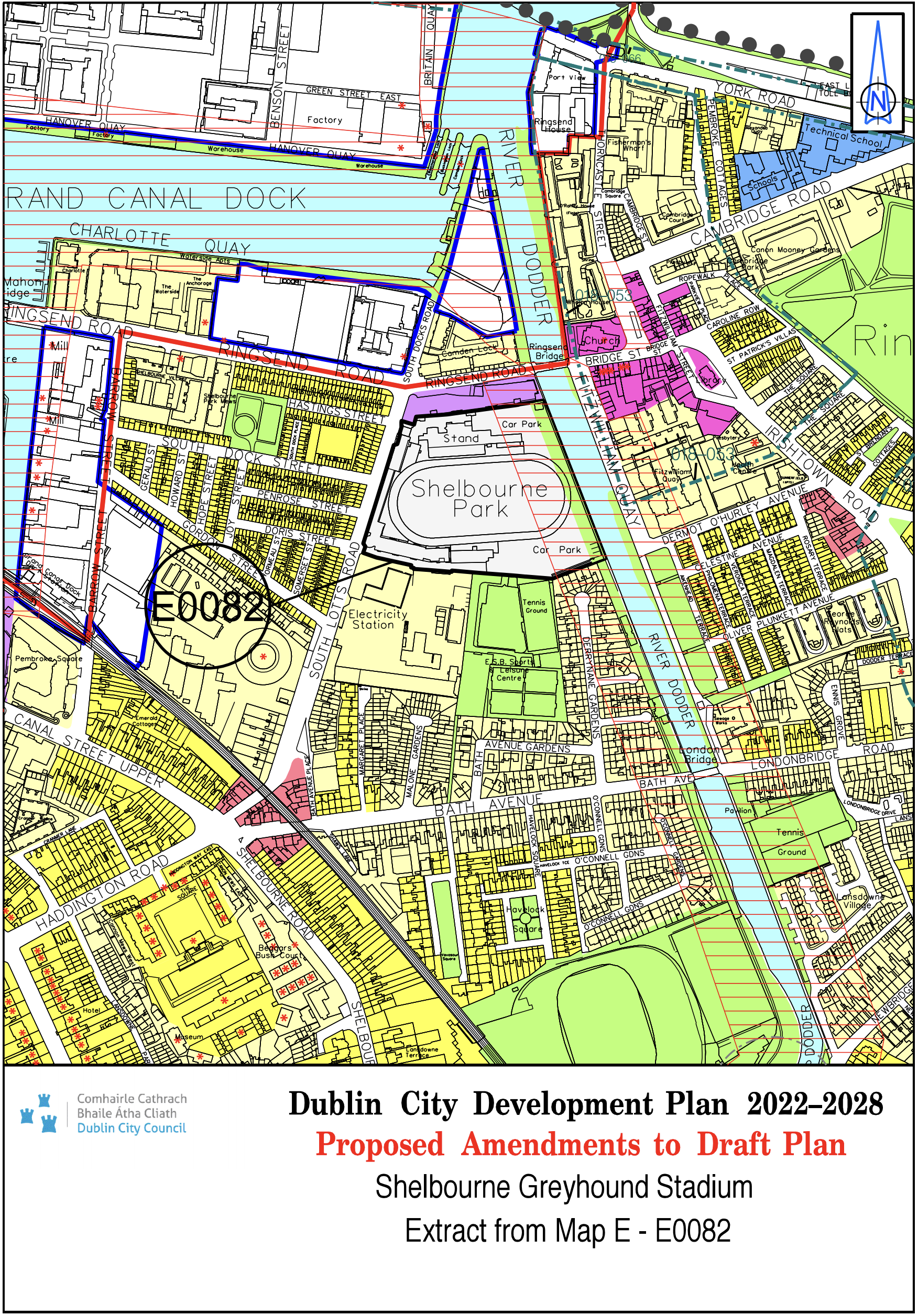
Shelbourne Greyhound Stadium |
Z9 |
Z9/Z14 |
Map E |
E-0082 |
|
Site Address |
Zoning From |
Zoning To |
Map Sheet |
Map Reference |
|
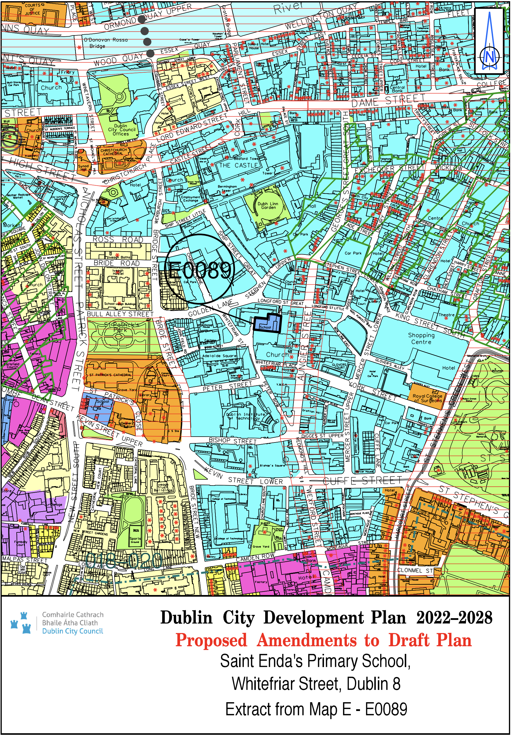
St. Enda's Primary School, Whitefriar Street, Dublin 8 |
Z5 |
Z15 |
Map E |
E-0089 |
|
Site Address |
Zoning From |
Zoning To |
Map Sheet |
Map Reference |
|
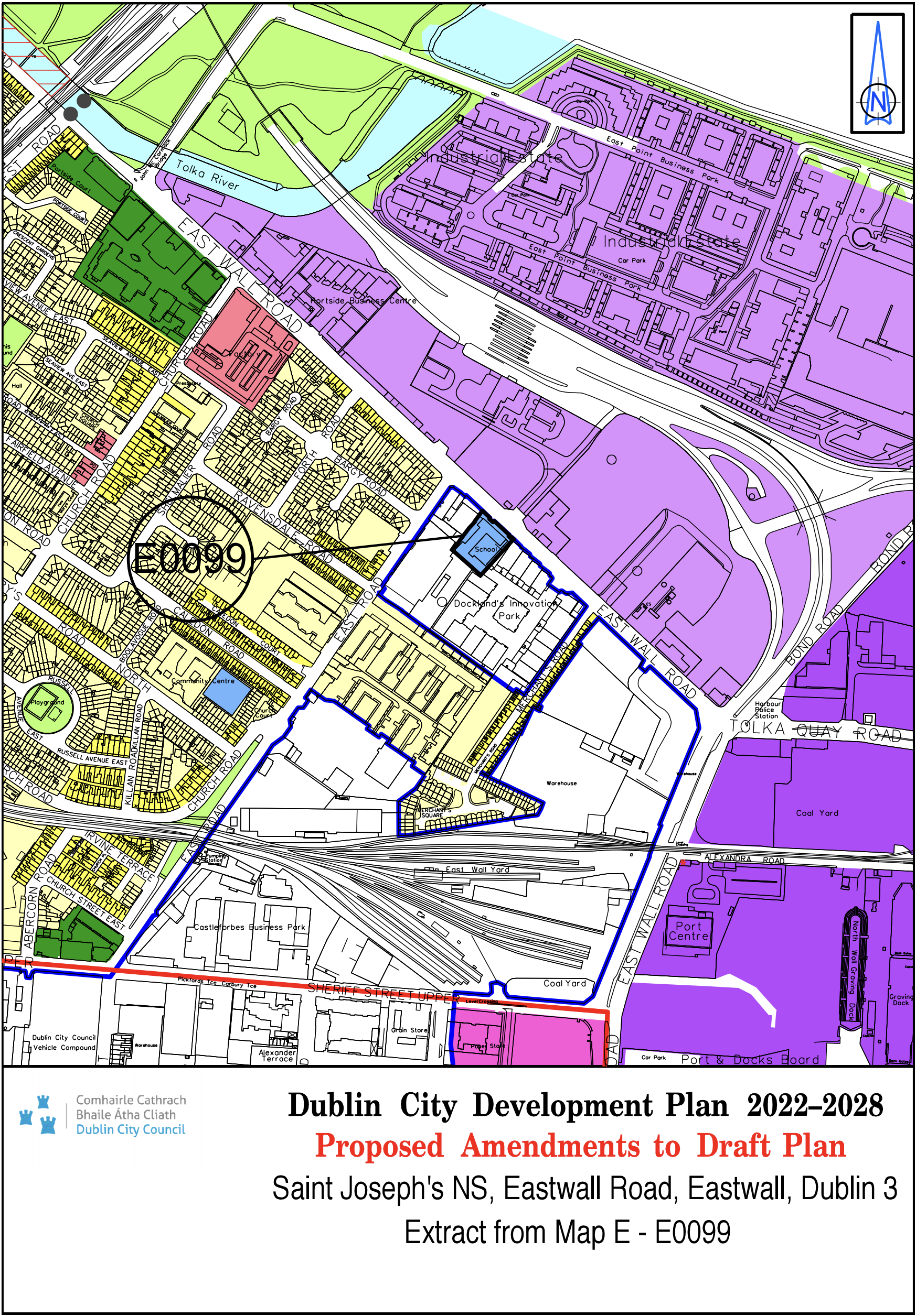
St. Joseph's NS, East Wall Road, East Wall, Dublin 3 |
Z14 |
Z15 |
Map E |
E-0099 |
|
Site Address |
Zoning From |
Zoning To |
Map Sheet |
Map Reference |
|
St. Laurence O'Toole NS, Seville Place, North Strand, Dublin 1 |
Z1 |
Z15 |
Map E |
E-0102 |

|
Site Address |
Zoning From |
Zoning To |
Map Sheet |
Map Reference |
|
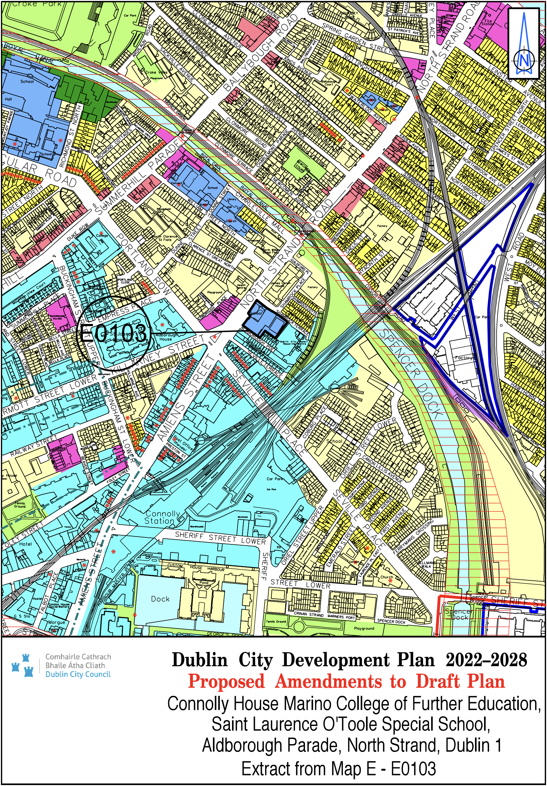
Connolly House, Marino College of Further Education & St. Laurence O'Toole Special School, Aldborough Parade, North Strand, D1 |
Z5 |
Z15 |
Map E |
E-0103 |
|
Site Address |
Zoning From |
Zoning To |
Map Sheet |
Map Reference |
|
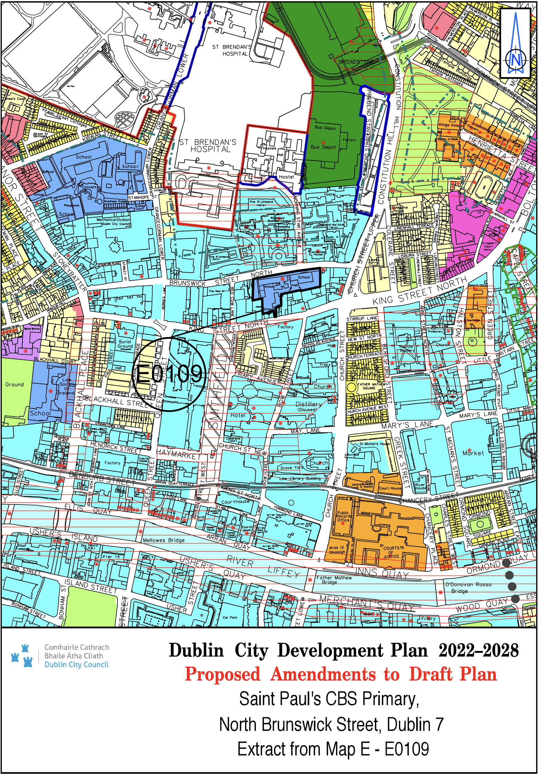
St. Pauls CBS Primary, North Brunswick Street, Dublin 7 |
Z5 |
Z15 |
Map E |
E-0109 |
|
Site Address |
Zoning From |
Zoning To |
Map Sheet |
Map Reference |
|
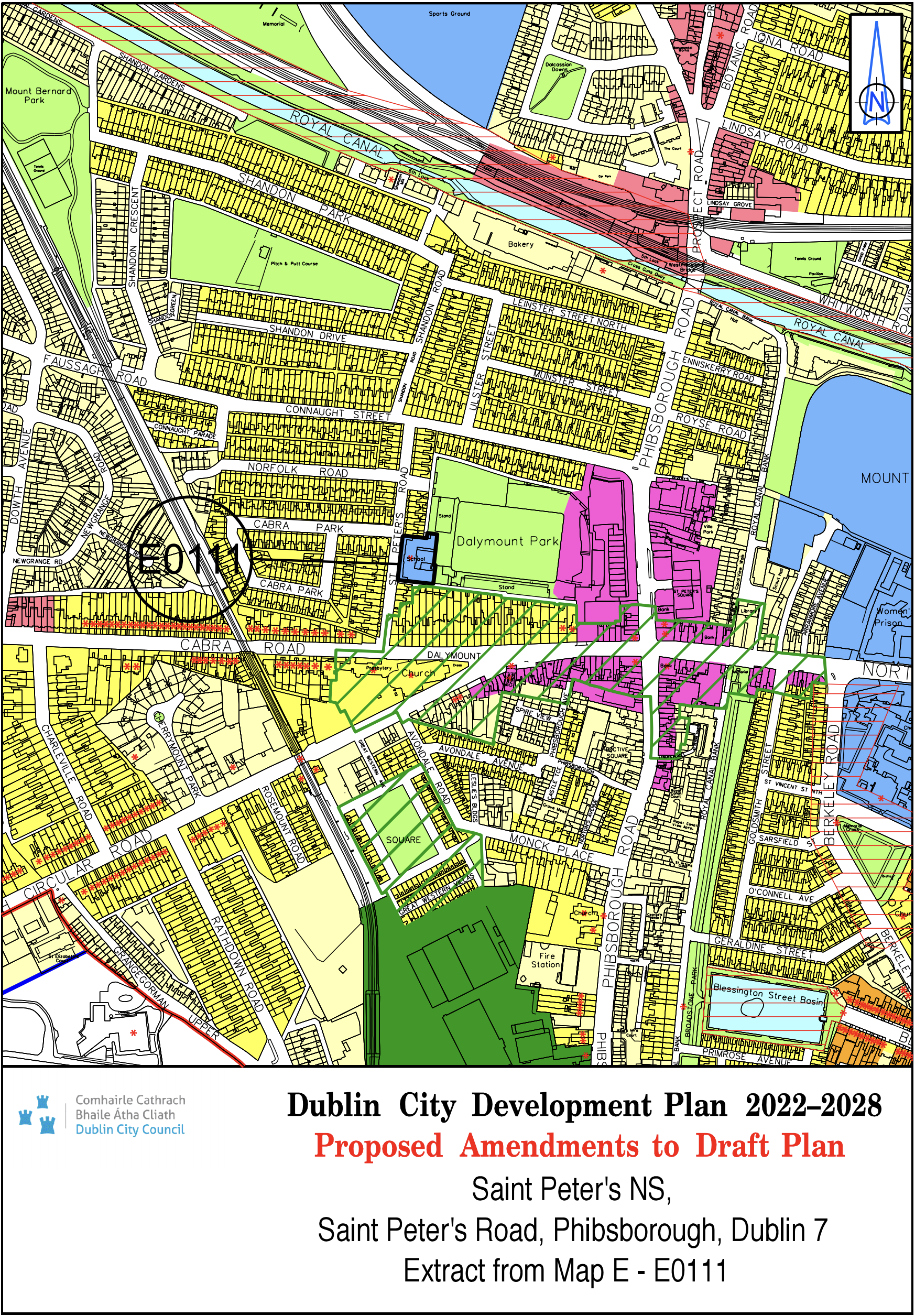
St. Peter's NS, St. Peters Road, Phibsborough Dublin 7 |
Z2 |
Z15 |
Map E |
E-0111 |
|
Site Address |
Zoning From |
Zoning To |
Map Sheet |
Map Reference |
|
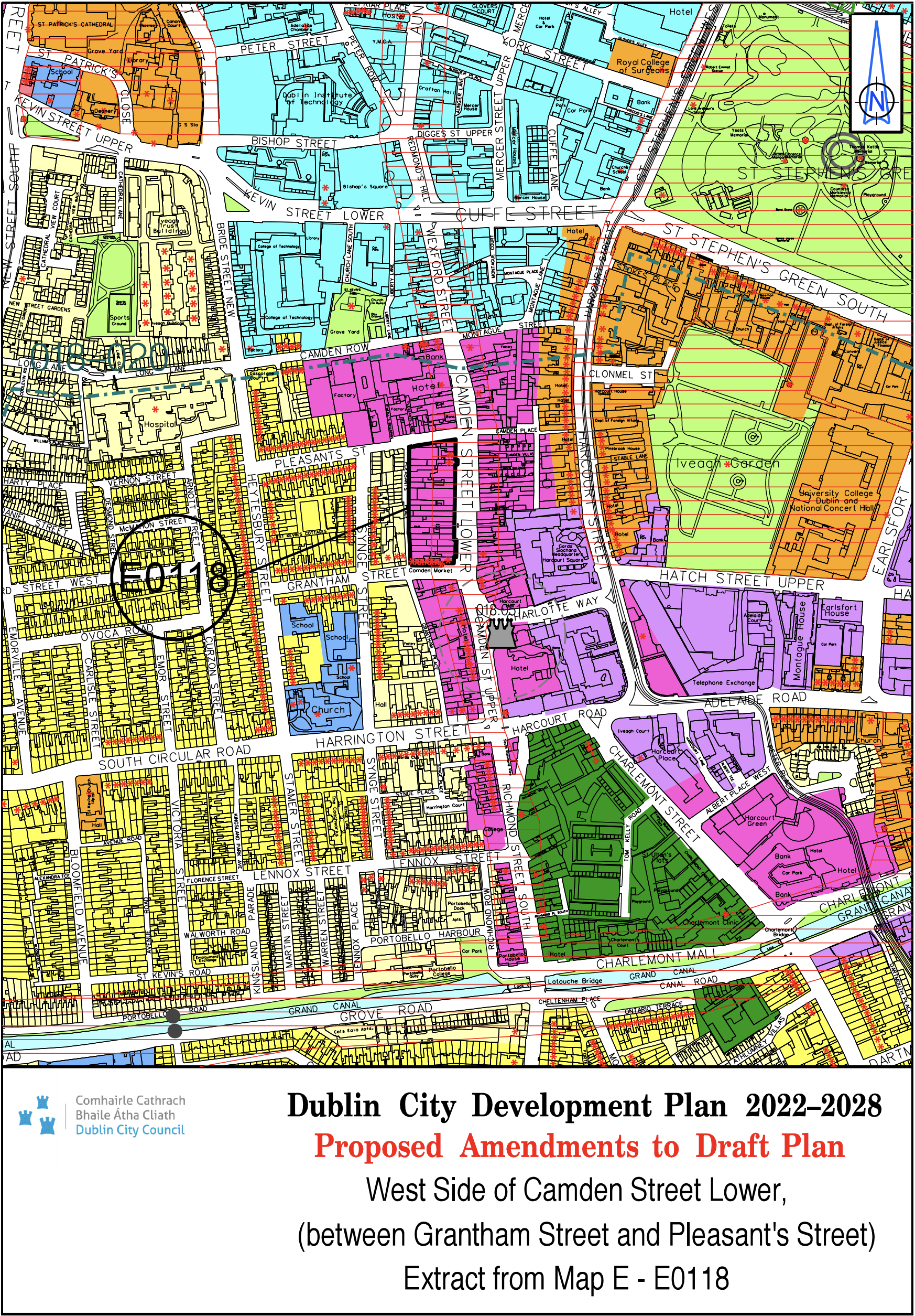
West Side of Camden Street Lower (between Grantham Street and Pleasant’s Street) |
Z1 |
Z4 |
Map E |
E-0118 |
|
Site Address |
Zoning From |
Zoning To |
Map Sheet |
Map Reference |
|
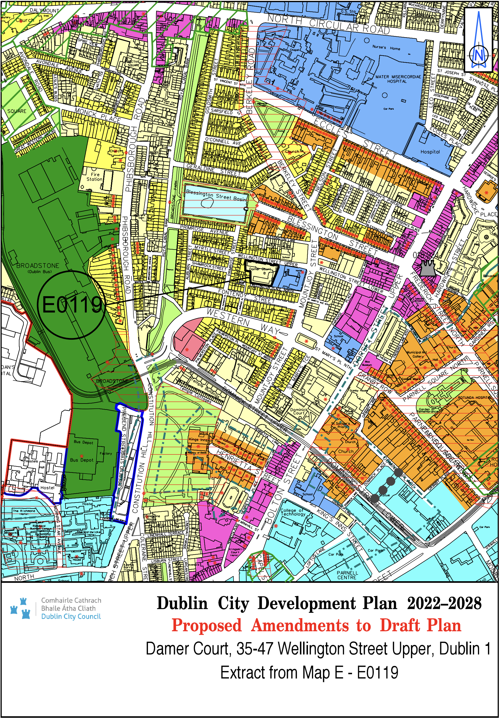
Damer Court, 35-47 Wellington Street Upper, D1 |
Z15 |
Z1 |
Map E |
E-0119 |
|
Site Address |
Zoning From |
Zoning To |
Map Sheet |
Map Reference |
|
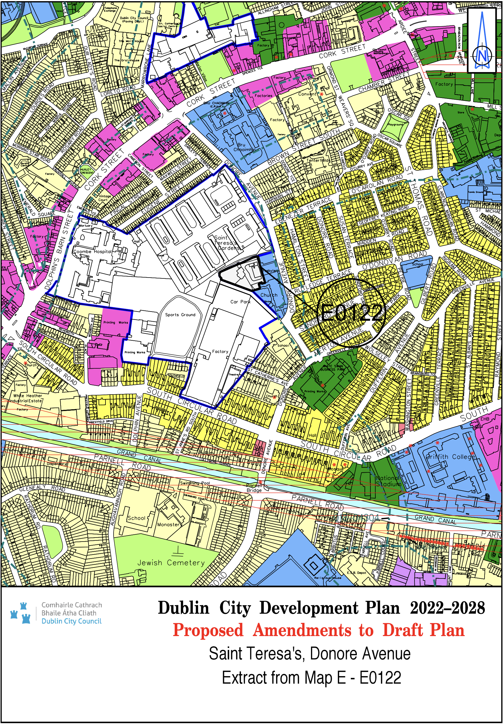
St. Teresa's, Donore Avenue |
Z15 |
Z14 |
Map E |
E-0122 |
|
Site Address |
Zoning From |
Zoning To |
Map Sheet |
Map Reference |
|
Trinity - North Wall Quay |
Z5/Z9 |
Z5/Z9 |
Map E |
E-0123 |

|
Site Address |
Zoning From |
Zoning To |
Map Sheet |
Map Reference |
|
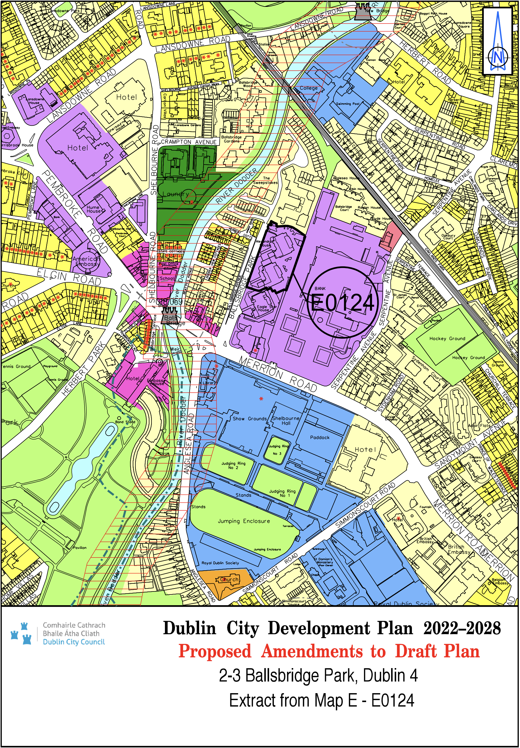
2-3 Ballsbridge Park, Dublin 4 |
Z1 |
Z6 |
Map E |
E-0124 |
|
Site Address |
Zoning From |
Zoning To |
Map Sheet |
Map Reference |
|
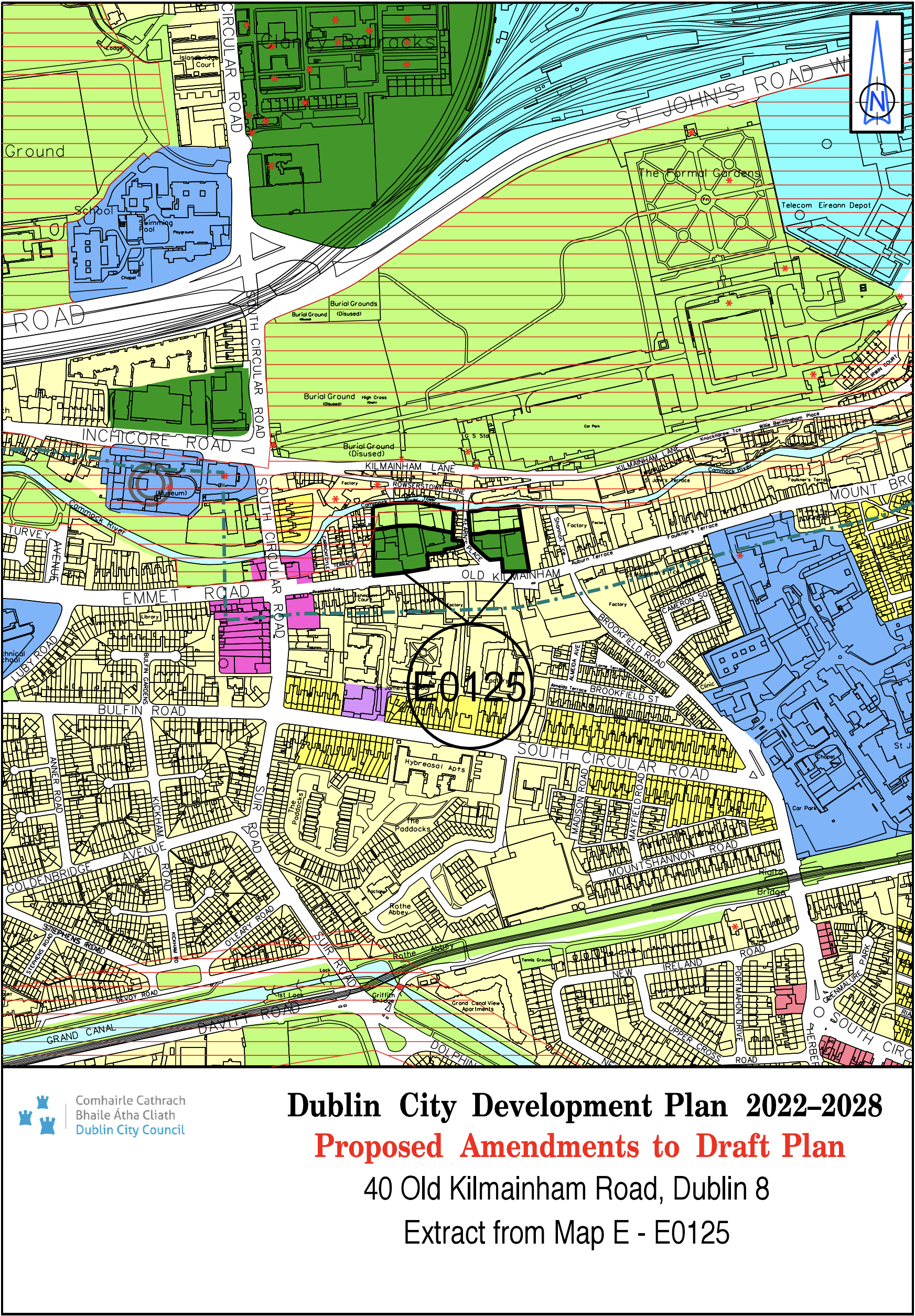
40 Old Kilmainham Road, Dublin 8 |
Z6 |
Z9/Z10 |
Map E |
E-0125 |
|
Site Address |
Zoning From |
Zoning To |
Map Sheet |
Map Reference |
|
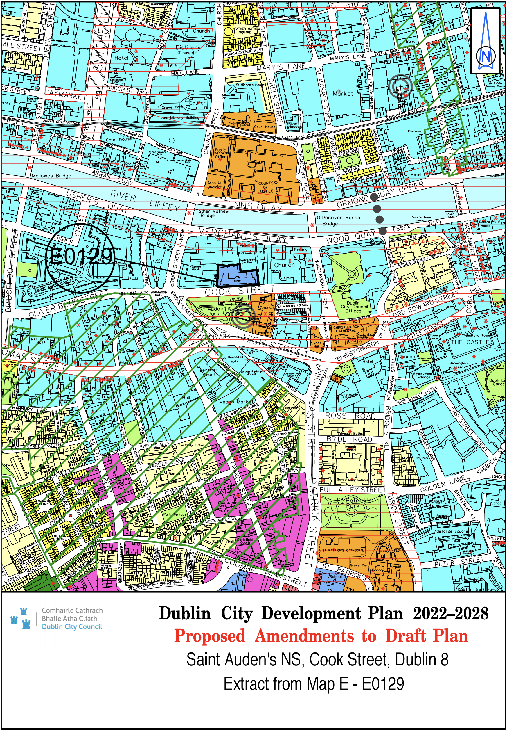
St. Auden’s NS, Cook Street, Dublin 8 |
Z5 |
Z15 |
Map E |
E-0129 |
|
Site Address |
Zoning From |
Zoning To |
Map Sheet |
Map Reference |
|
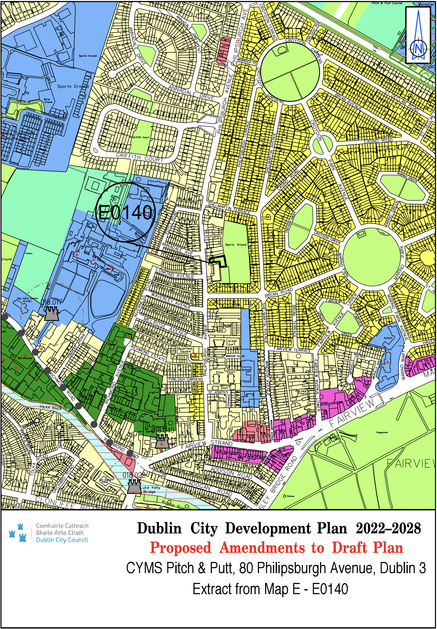
CYMS Pitch and Putt, 80 Philipsburgh Avenue, Dublin 3 |
Z1 |
Z9 |
Map E |
E-0140 |
|
Site Address |
Zoning From |
Zoning To |
Map Sheet |
Map Reference |
|
No. 2 Hanover Street, Grand Canal Dock, Dublin 2 (D02 E860) |
Z1 |
Z5 |
Map E |
E-0142 |
|
Site Address |
Zoning From |
Zoning To |
Map Sheet |
Map Reference |
|
Lands at Alfie Byrne Road, Dublin 3 |
Z9 |
Z15 |
Map E |
E-0144 |
|
Site Address |
Zoning From |
Zoning To |
Map Sheet |
Map Reference |
|
Remove National Monument symbol on St. James’ Graveyard |
N/A |
N/A |
Map E |
E-0145 |
|
Site Address |
Zoning From |
Zoning To |
Map Sheet |
Map Reference |
|
Map E updated to include North Great George’s Street ACA |
N/A |
N/A |
Map E |
E-0146 |
|
Site Address |
Zoning From |
Zoning To |
Map Sheet |
Map Reference |
|
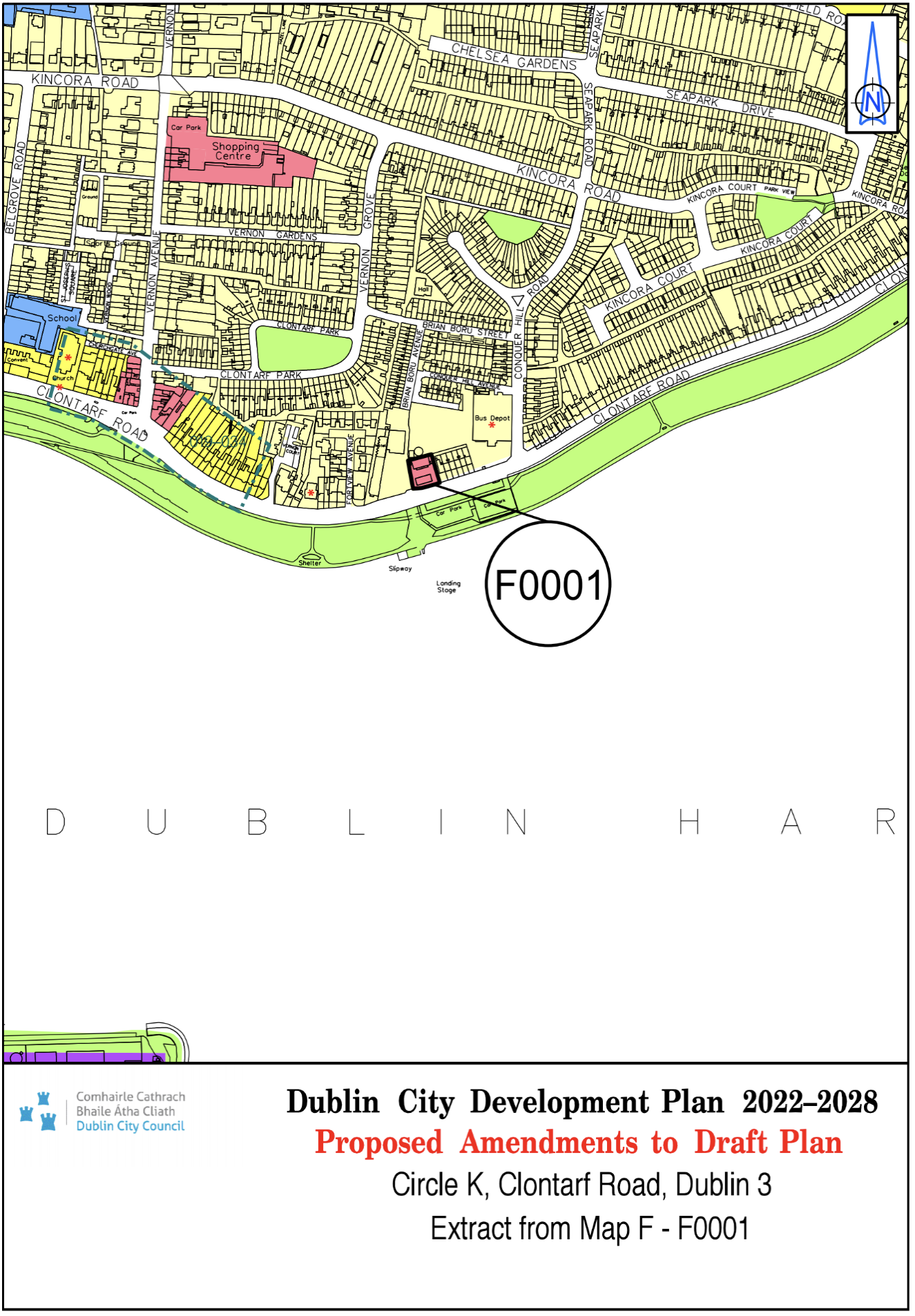
Circle K, Clontarf Road, Dublin 3 |
Z1 |
Z3 |
Map F |
F-0001 |
|
Site Address |
Zoning From |
Zoning To |
Map Sheet |
Map Reference |
|
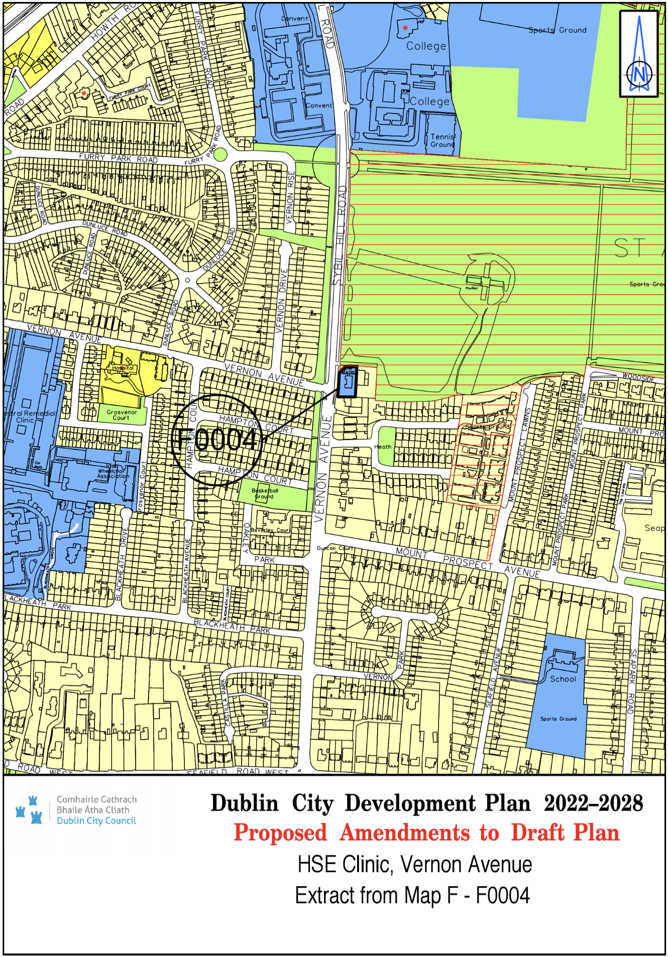
HSE Clinic, Vernon Avenue |
Z1 |
Z15 |
Map F |
F-0004 |
|
Site Address |
Zoning From |
Zoning To |
Map Sheet |
Map Reference |
|
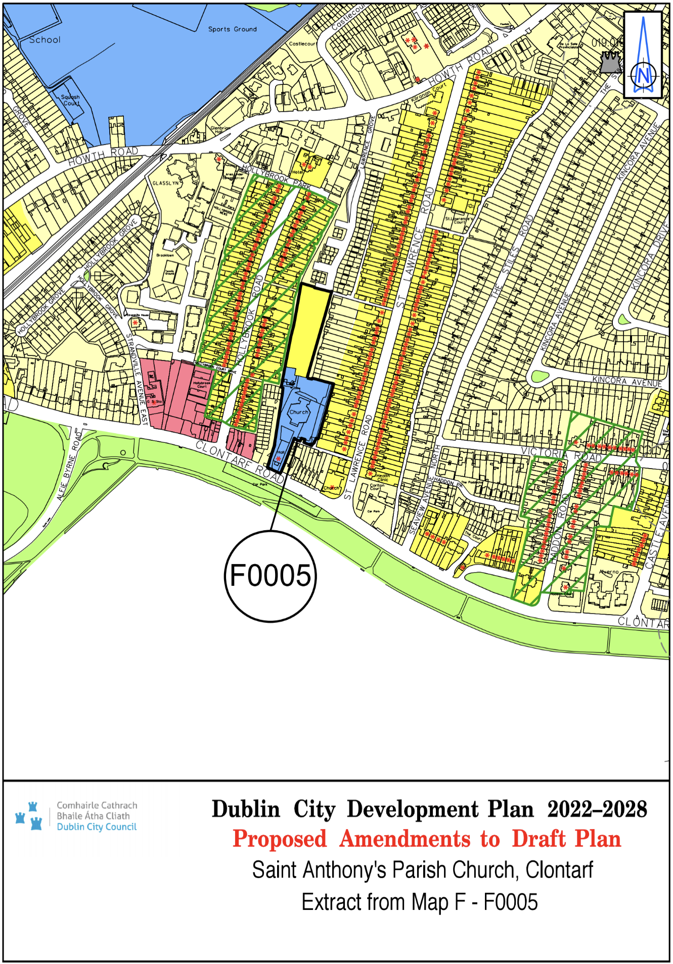
St. Anthony's Parish Church, Clontarf |
Z1 |
Z2/ Z15 |
Map F |
F-0005 |
|
Site Address |
Zoning From |
Zoning To |
Map Sheet |
Map Reference |
|
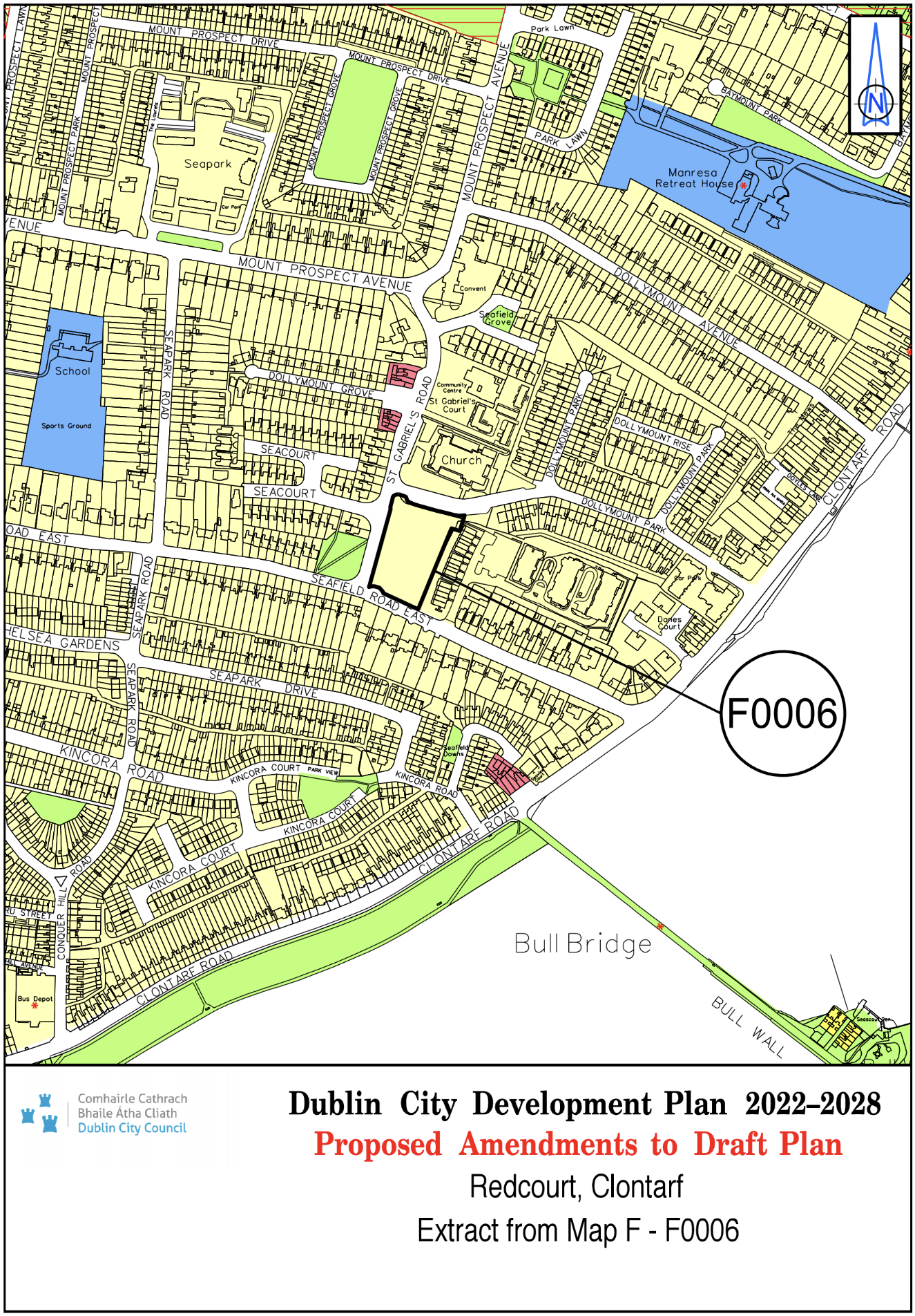
Redcourt, Clontarf |
Z2 |
Z1 |
Map F |
F-0006 |
|
Site Address |
Zoning From |
Zoning To |
Map Sheet |
Map Reference |
|
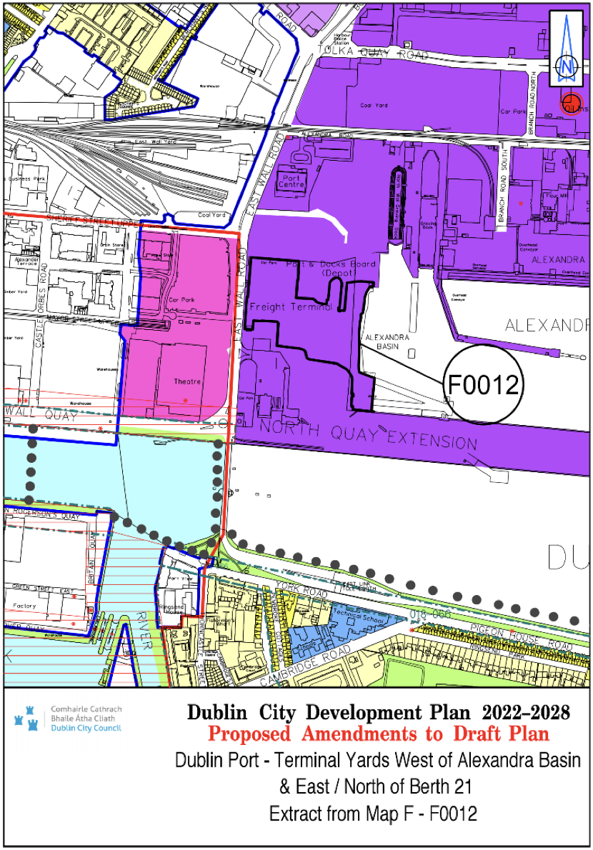
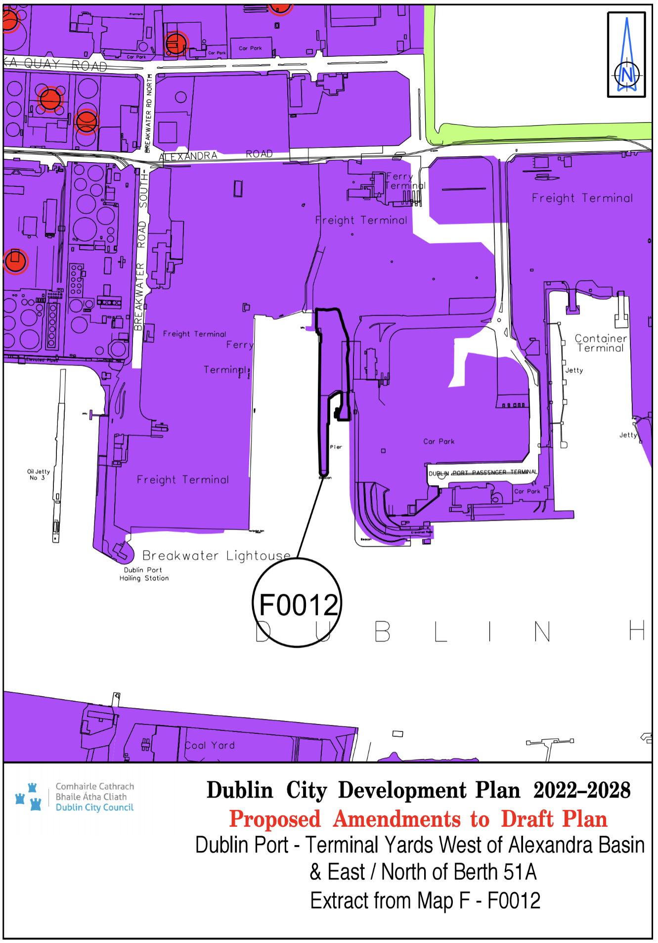
Dublin Port - Terminal Yards west of Alexandra Basin and east/ north of Berth 51A |
White land |
Z7 |
Map F |
F-0012 |
|
Site Address |
Zoning From |
Zoning To |
Map Sheet |
Map Reference |
|
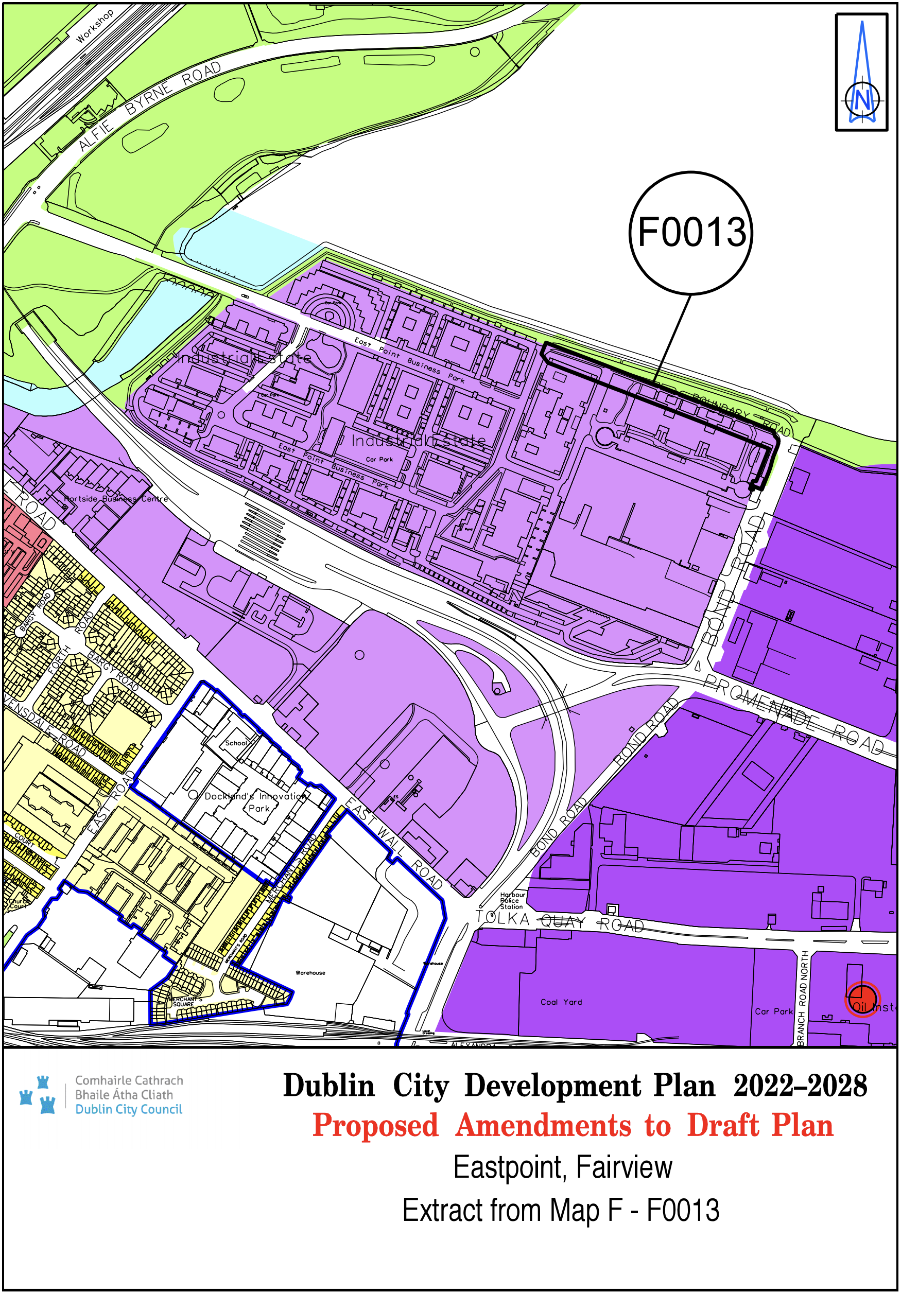
Eastpoint Fairview |
Z6 / Z9 / White land |
Z6 |
Map F |
F-0013 |
|
Site Address |
Zoning From |
Zoning To |
Map Sheet |
Map Reference |
|
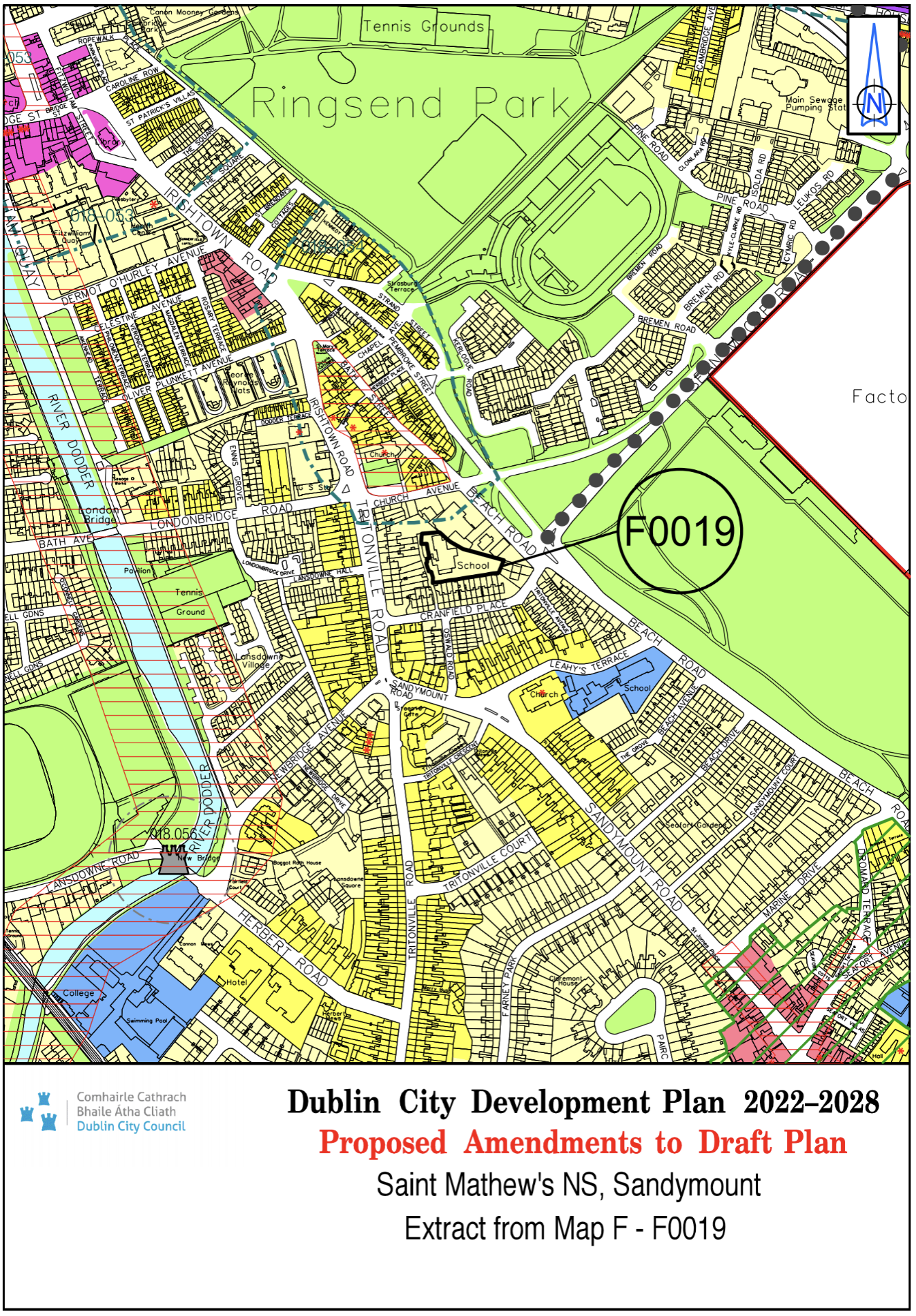
St. Mathew’s National School, Sandymount |
Z15 |
Z1 |
Map F |
F-0019 |
|
Site Address |
Zoning From |
Zoning To |
Map Sheet |
Map Reference |
|
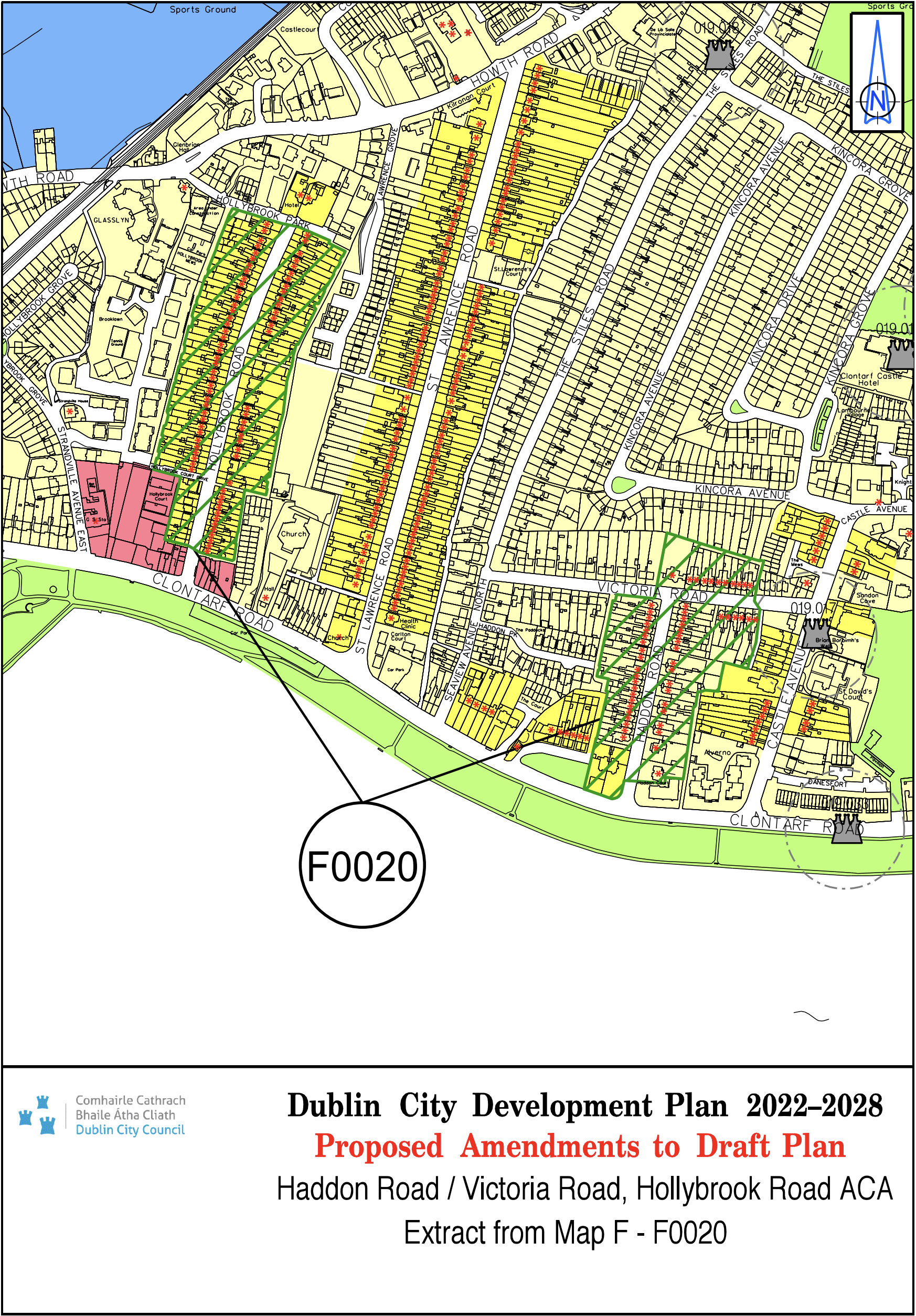
Map updated to include Haddon Road/ Victoria Road, Hollybrook Road ACA |
N/A |
N/A |
Map F |
F-0020 |
|
Site Address |
Zoning From |
Zoning To |
Map Sheet |
Map Reference |
|
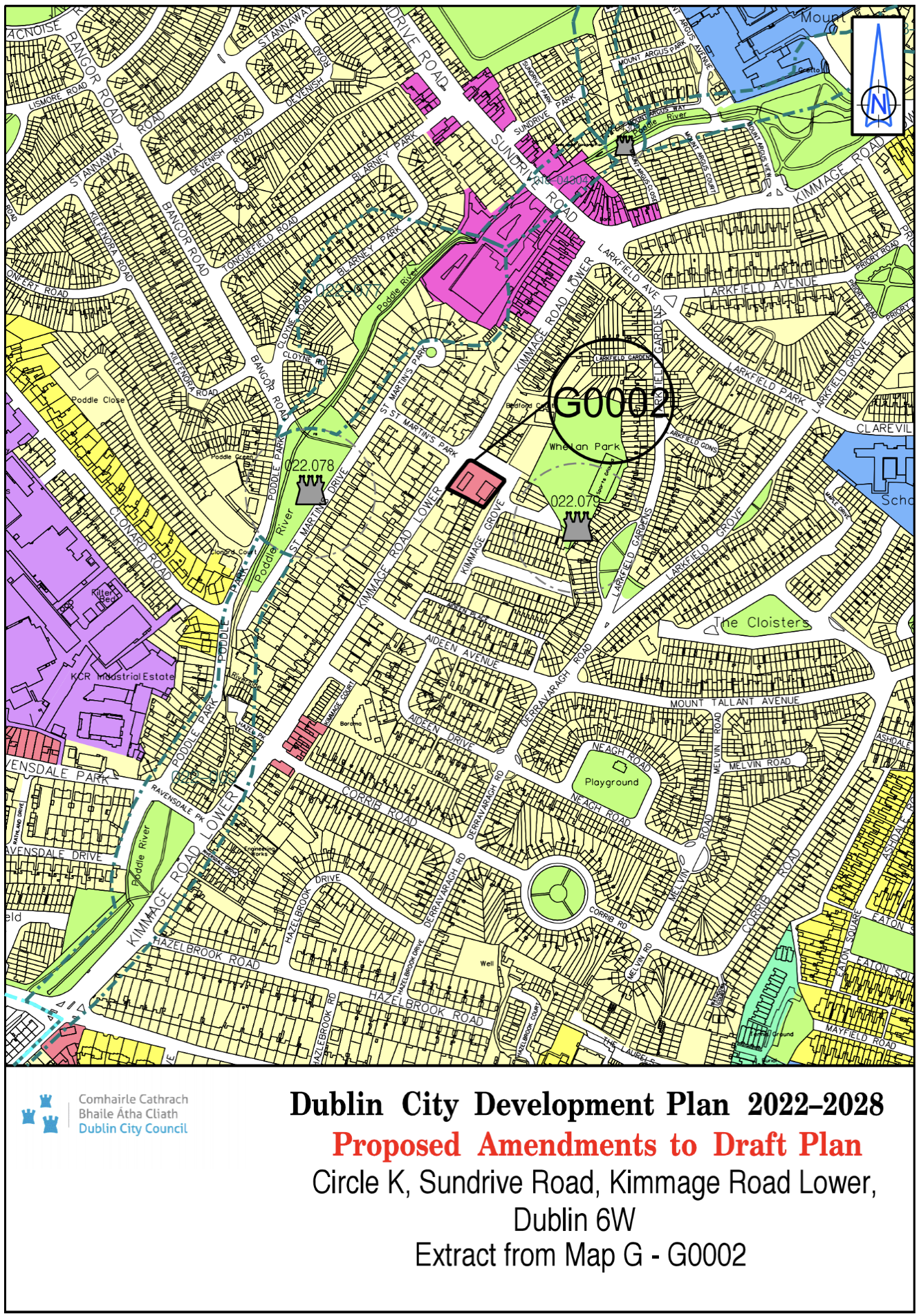
Circle K, Sundrive Road, Kimmage Road Lower Dublin 6W |
Z1 |
Z3 |
Map G |
G-0002 |
|
Site Address |
Zoning From |
Zoning To |
Map Sheet |
Map Reference |
|
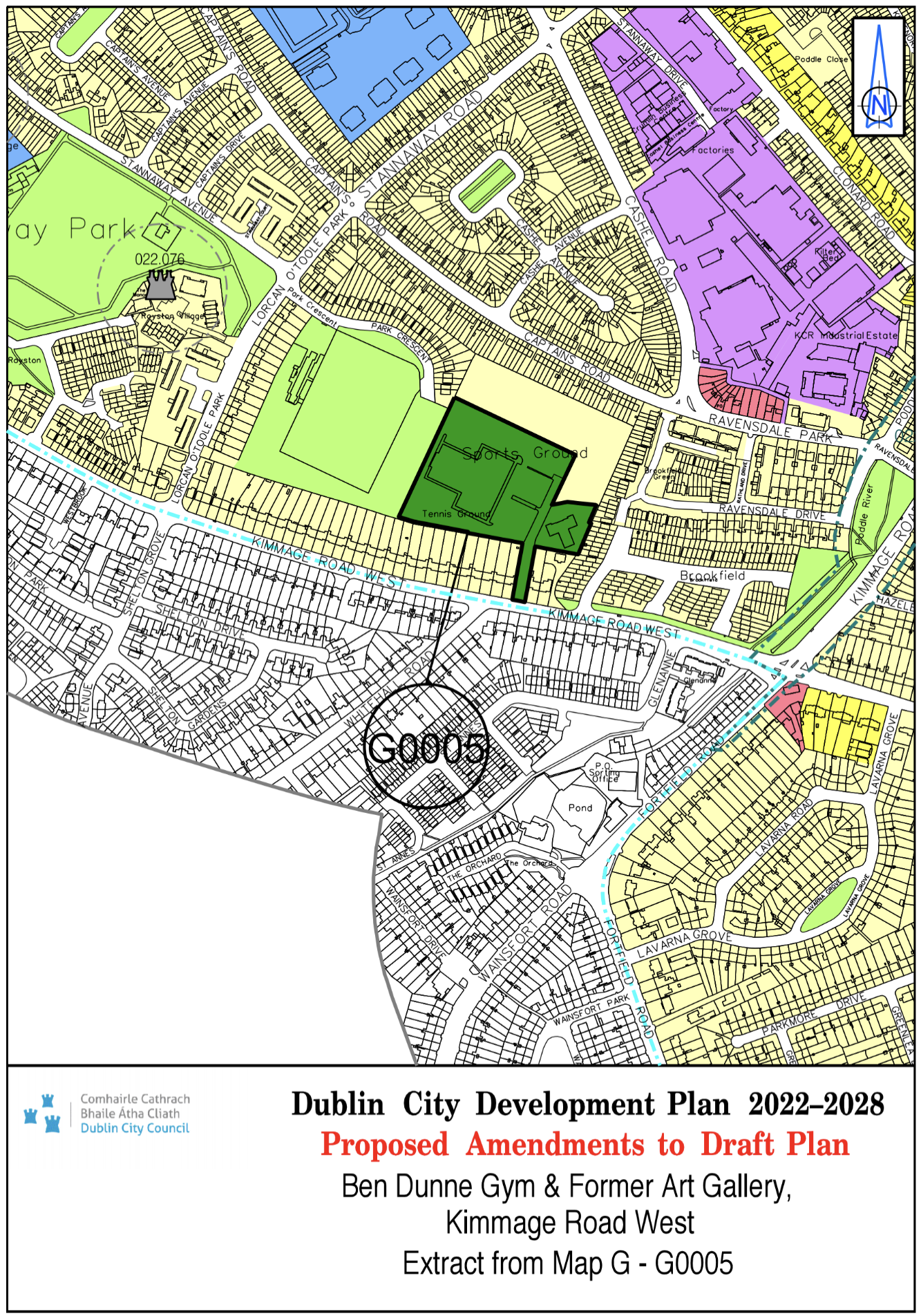
Ben Dunne Gym and Former Art Gallery, Kimmage Road West |
Z1 / Z9 |
Z10 |
Map G |
G-0005 |
|
Site Address |
Zoning From |
Zoning To |
Map Sheet |
Map Reference |
|
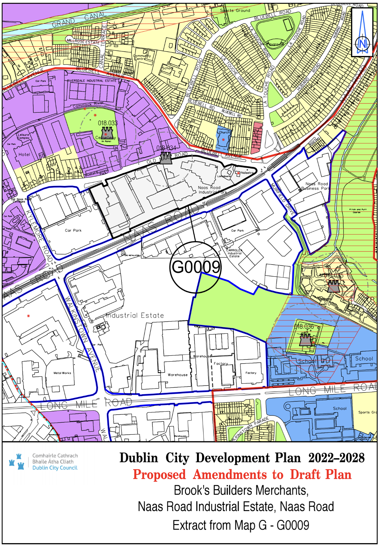
Brook’s Builders Merchants / Naas Road Industrial Estate , Naas Road |
Z6 |
Z14 |
Map G |
G-0009 |
|
Site Address |
Zoning From |
Zoning To |
Map Sheet |
Map Reference |
|
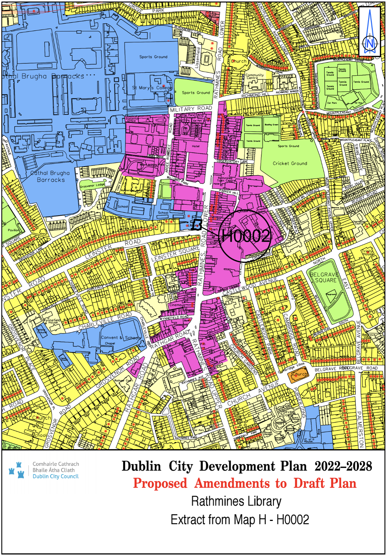
Rathmines Library |
Z4 |
Z15 |
Map H |
H-0002 |
|
Site Address |
Zoning From |
Zoning To |
Map Sheet |
Map Reference |
|
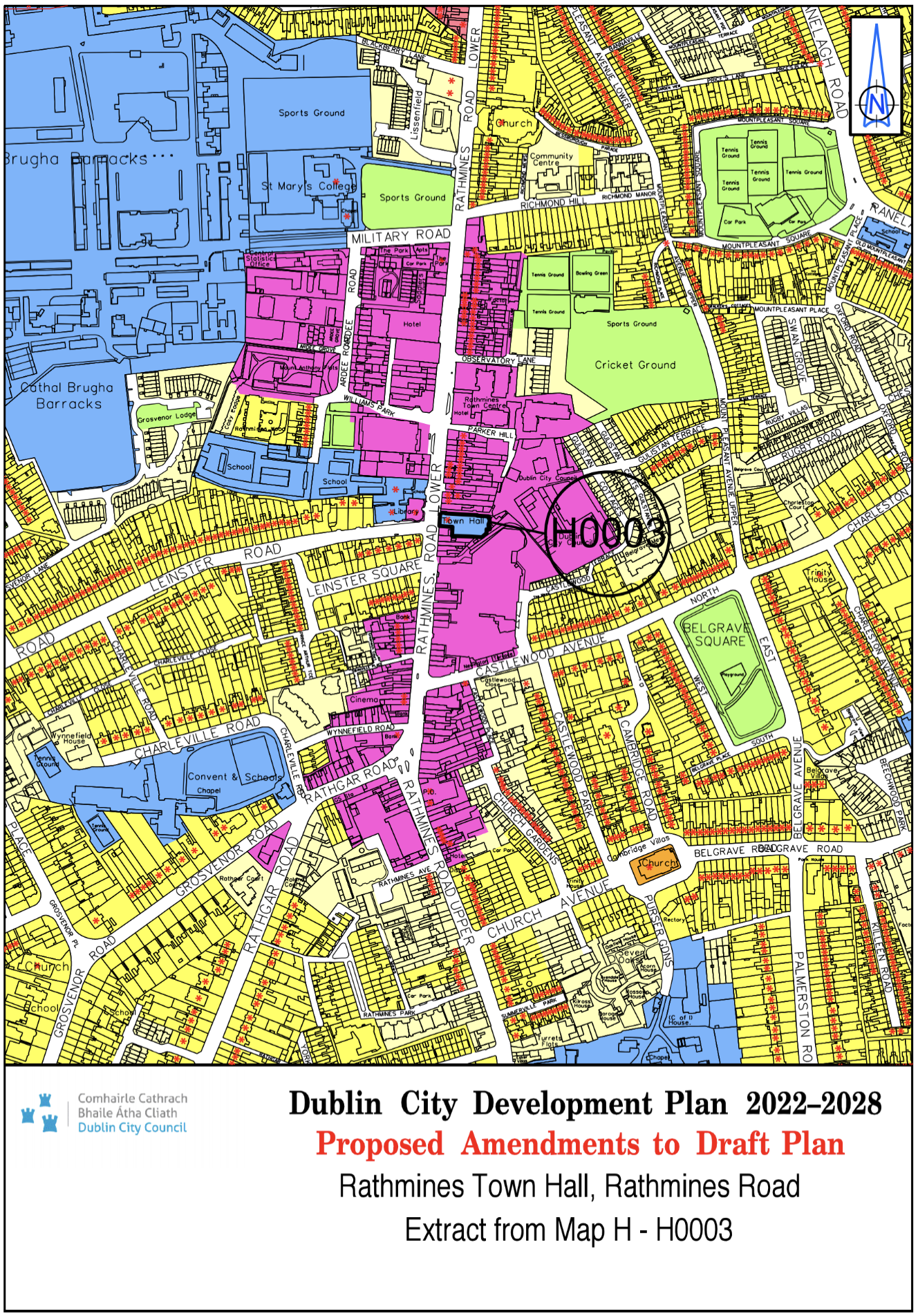
Rathmines Town Hall, Rathmines Road |
Z4 |
Z15 |
Map H |
H-0003 |
|
Site Address |
Zoning From |
Zoning To |
Map Sheet |
Map Reference |
|
Cathal Brugha Barracks |
Z15 |
Z9 |
Map H |
H-0004 |

|
Site Address |
Zoning From |
Zoning To |
Map Sheet |
Map Reference |
|
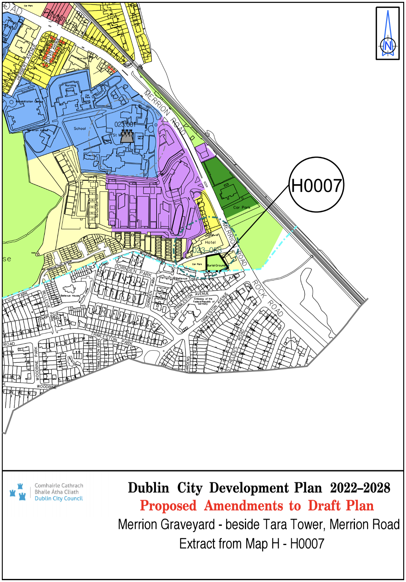
Merrion Graveyard - beside Tara Tower, Merrion Road |
Z1 |
Z9 |
Map H |
H-0007 |
|
Site Address |
Zoning From |
Zoning To |
Map Sheet |
Map Reference |
|
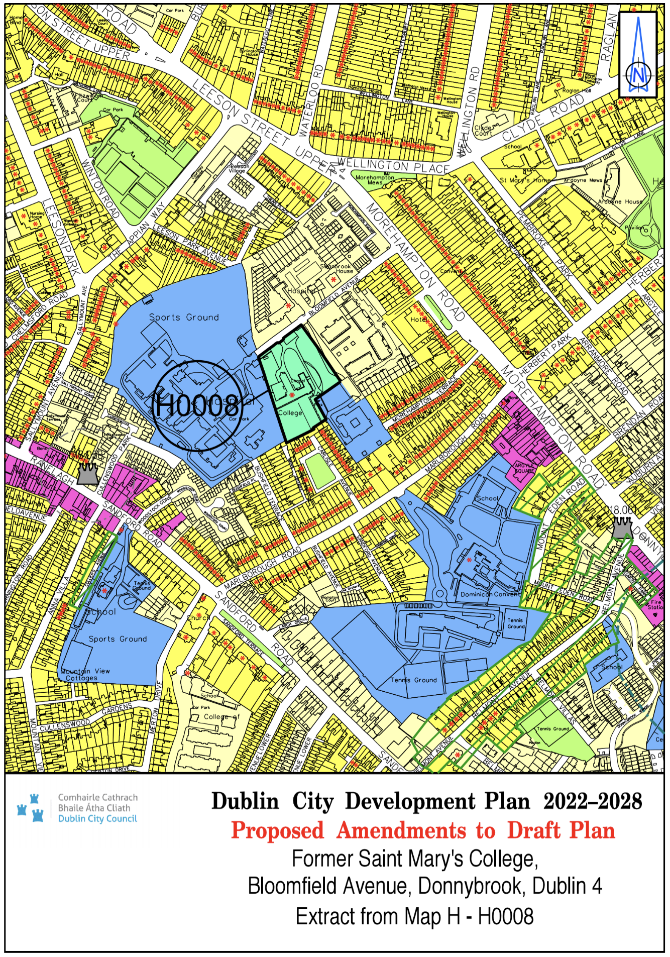
Former St. Mary's College, Bloomfield Avenue, Donnybrook, Dublin 4 |
Z15 |
Z12 |
Map H |
H-0008 |
|
Site Address |
Zoning From |
Zoning To |
Map Sheet |
Map Reference |
|
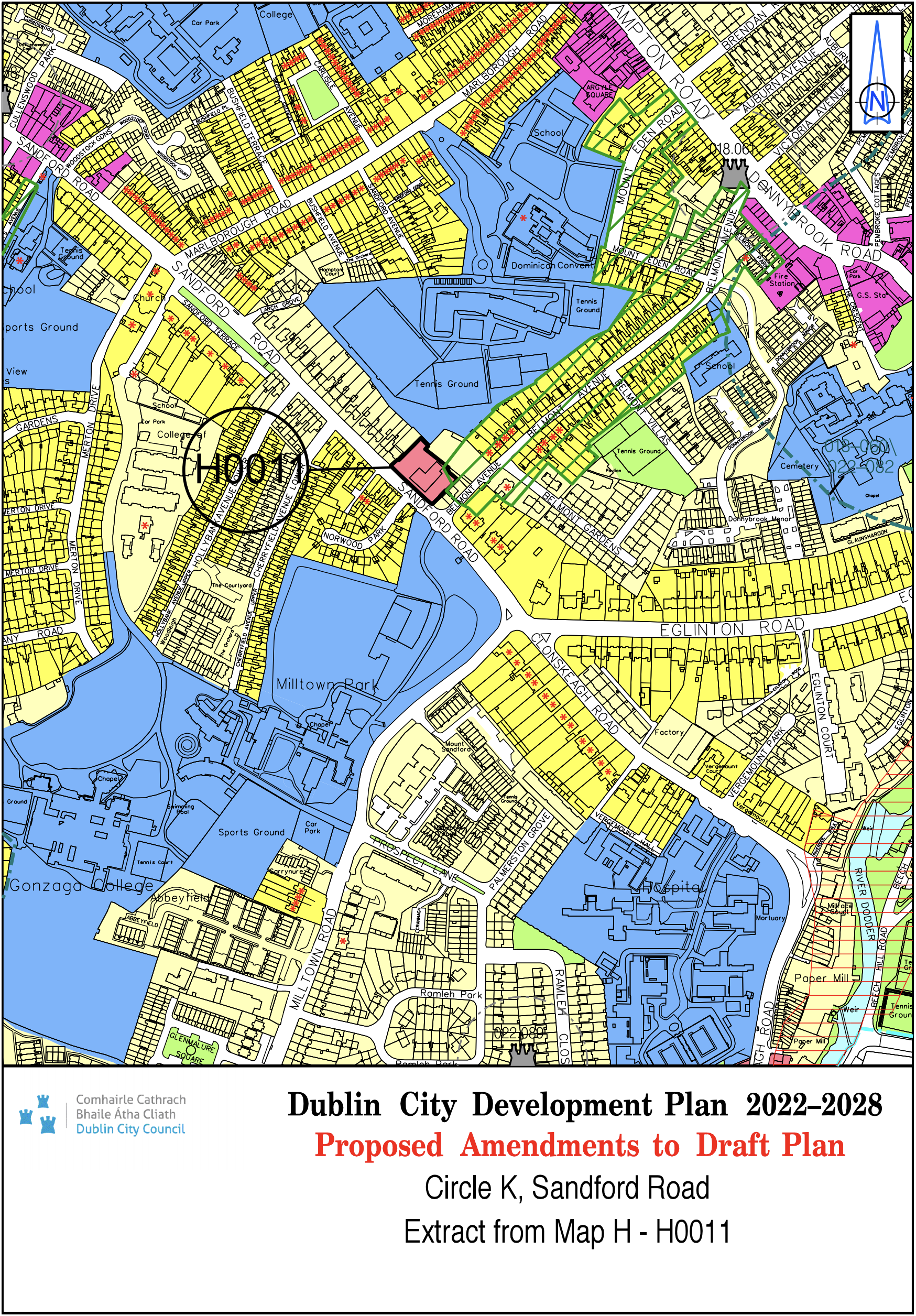
Circle K, Sandford Road |
Z1 |
Z3 |
Map H |
H-0011 |
|
Site Address |
Zoning From |
Zoning To |
Map Sheet |
Map Reference |
|
Former Church of Ireland College Educational Lands, Rathmines Road Upper, Dublin 6 |
Z9 |
Z15 |
Map H |
H-0012 |

|
Site Address |
Zoning From |
Zoning To |
Map Sheet |
Map Reference |
|
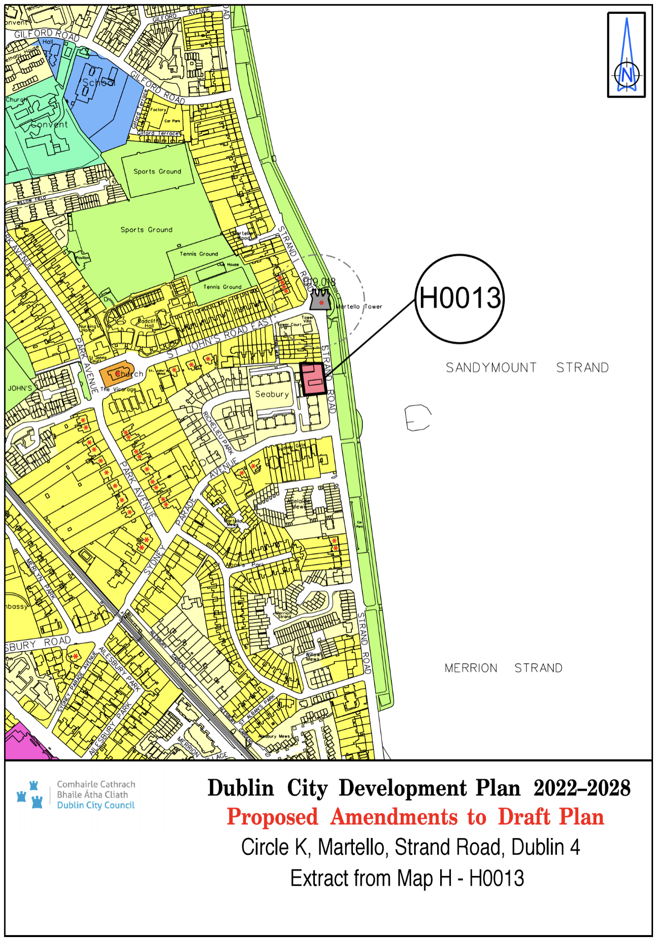
Circle K, Martello, Strand Road, Dublin 4 |
Z1 |
Z3 |
Map H |
H-0013 |
|
Site Address |
Zoning From |
Zoning To |
Map Sheet |
Map Reference |
|
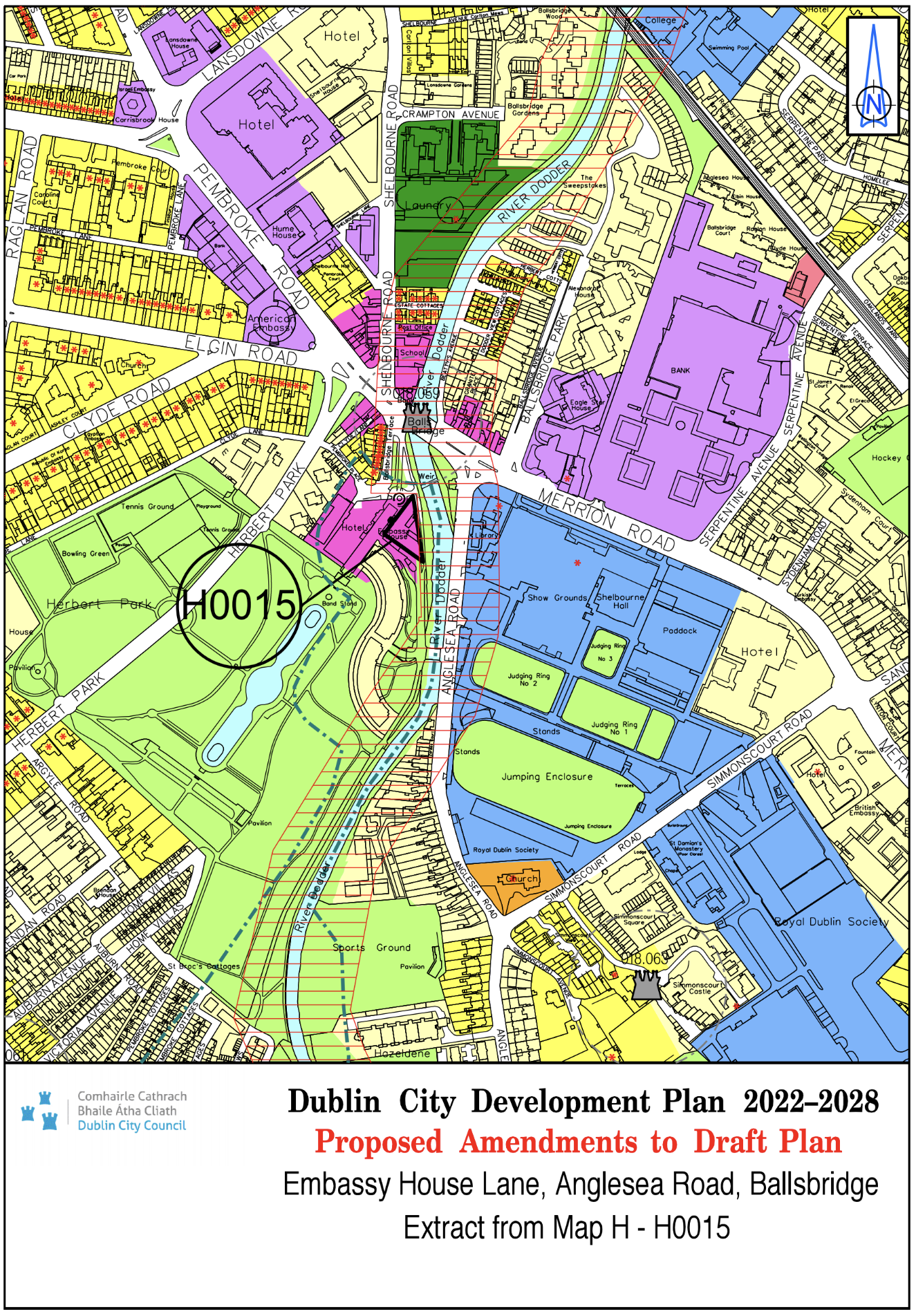
Embassy House Lane, Anglesea Road, Ballsbridge |
Z4/Z9 |
Z4 |
Map H |
H-0015 |
|
Site Address |
Zoning From |
Zoning To |
Map Sheet |
Map Reference |
|
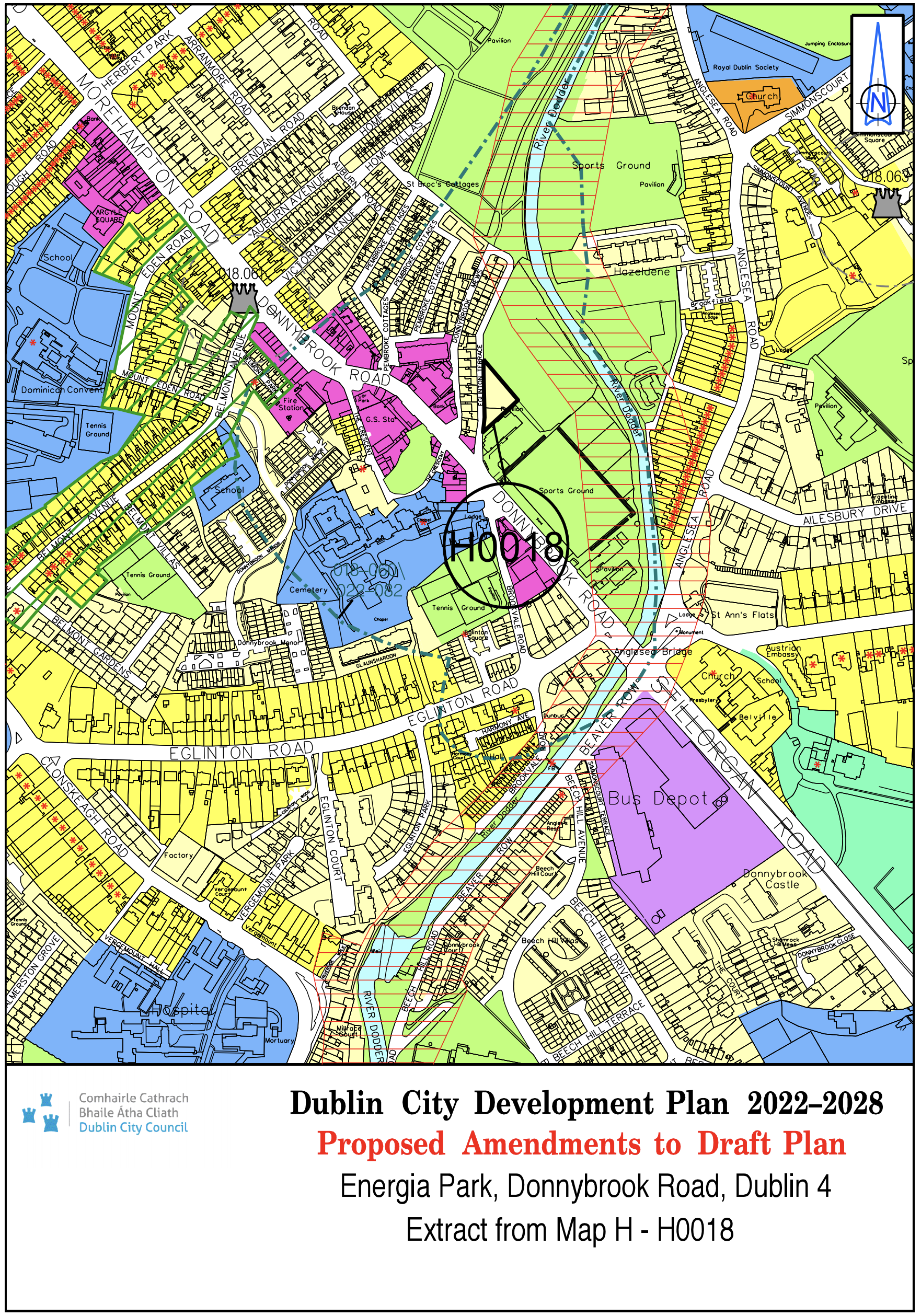
Energia Park, Donnybrook Road, Dublin 4 |
Z9 |
Z1 |
Map H |
H-0018 |
|
Site Address |
Zoning From |
Zoning To |
Map Sheet |
Map Reference |
|
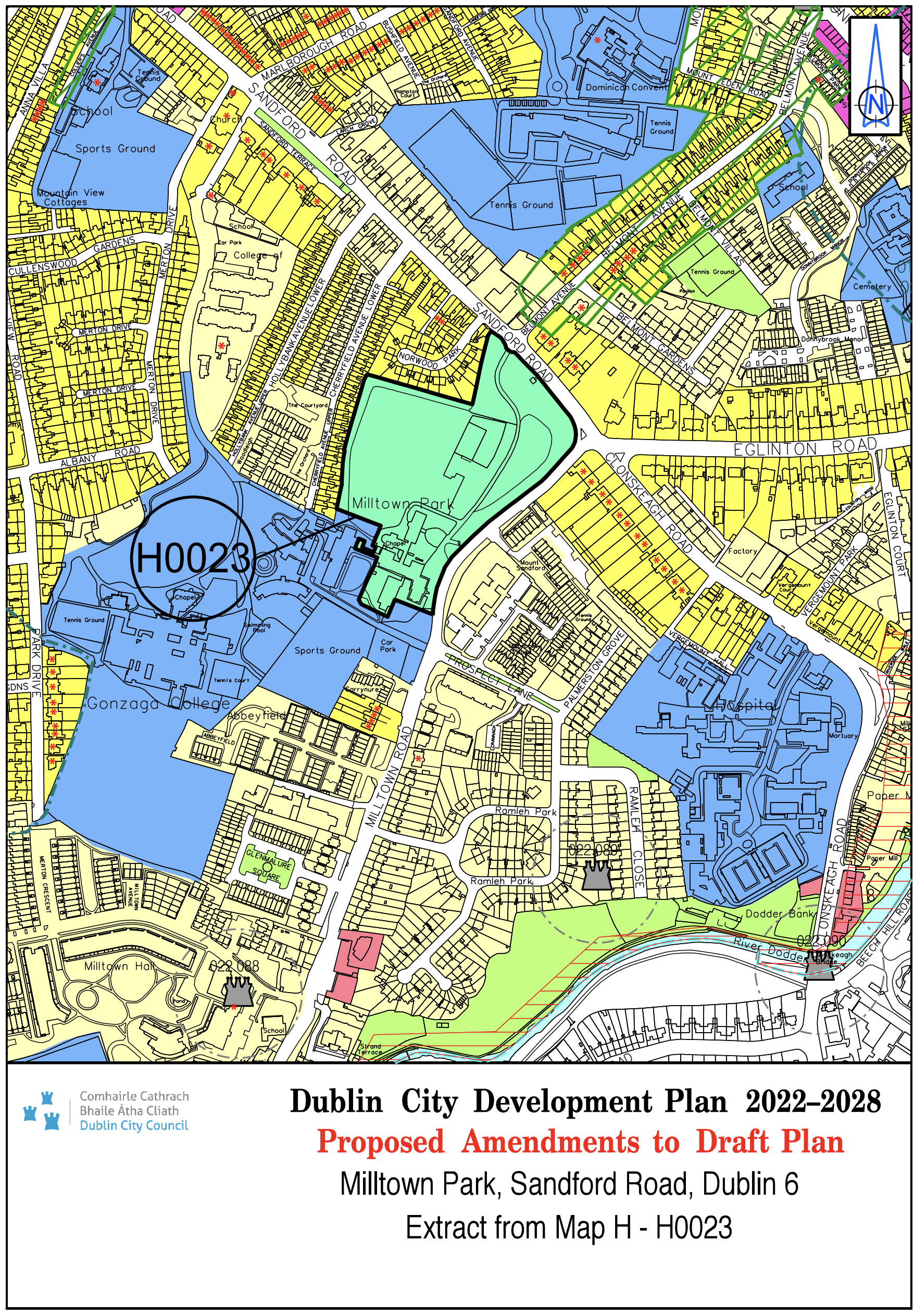
Milltown Park, Sandford Road, Dublin 6 |
Z15 |
Z12 |
Map H |
H-0023 |
|
Site Address |
Zoning From |
Zoning To |
Map Sheet |
Map Reference |
|
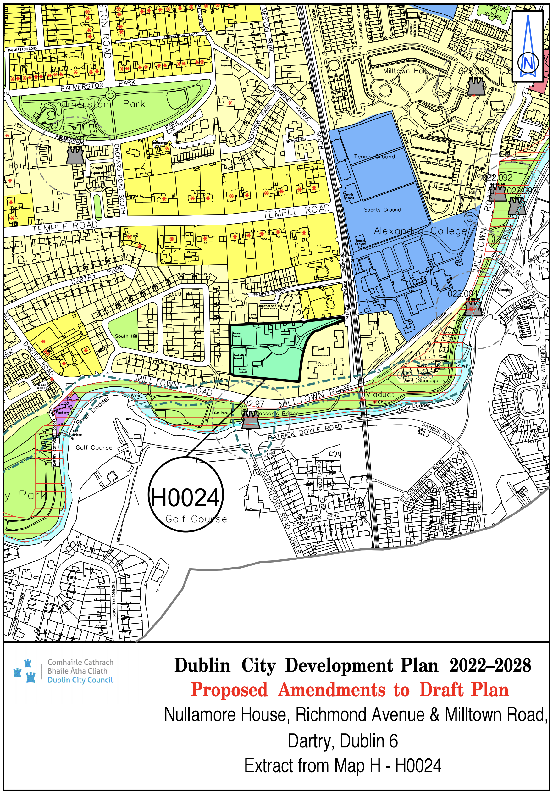
Nullamore House, Richmond Avenue South and Milltown Road, Dartry, Dublin 6 |
Z15 |
Z12 |
Map H |
H-0024 |
|
Site Address |
Zoning From |
Zoning To |
Map Sheet |
Map Reference |
|
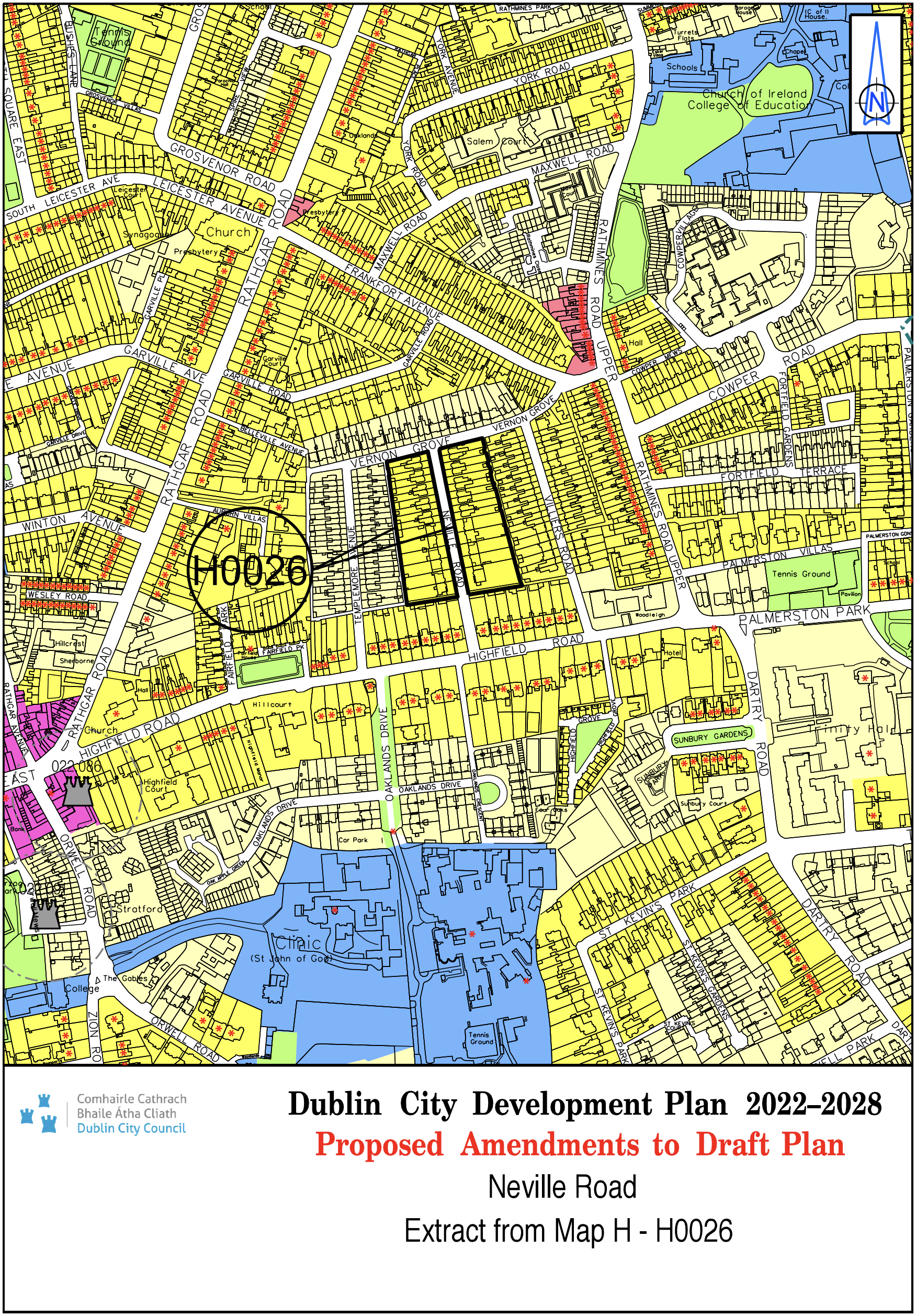
Neville Road |
Z1 |
Z2 |
Map H |
H-0026 |
|
Site Address |
Zoning From |
Zoning To |
Map Sheet |
Map Reference |
|
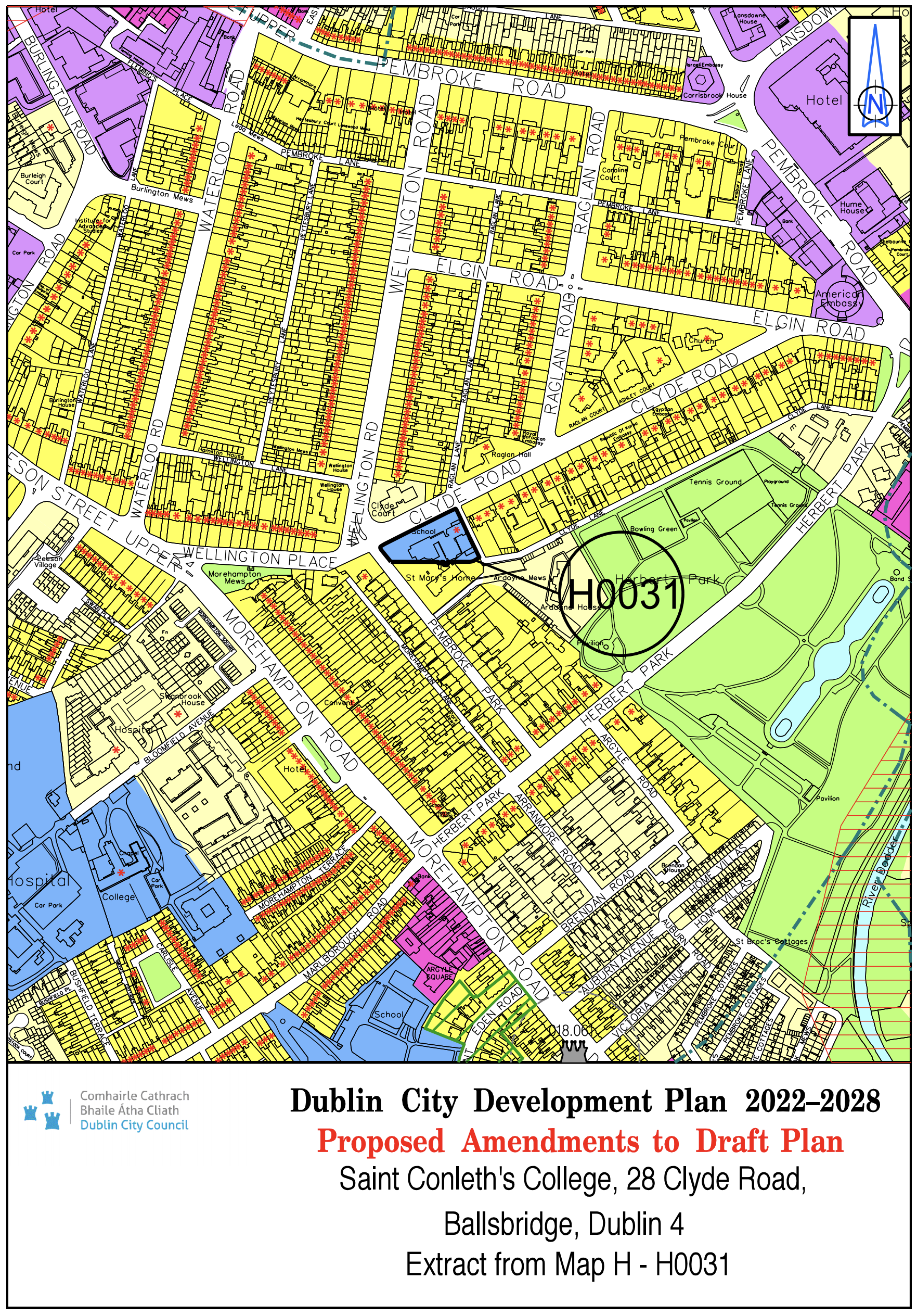
St. Conleth's College, 28 Clyde Road, Ballsbridge, Dublin 4 |
Z2 |
Z15 |
Map H |
H-0031 |
|
Site Address |
Zoning From |
Zoning To |
Map Sheet |
Map Reference |
|
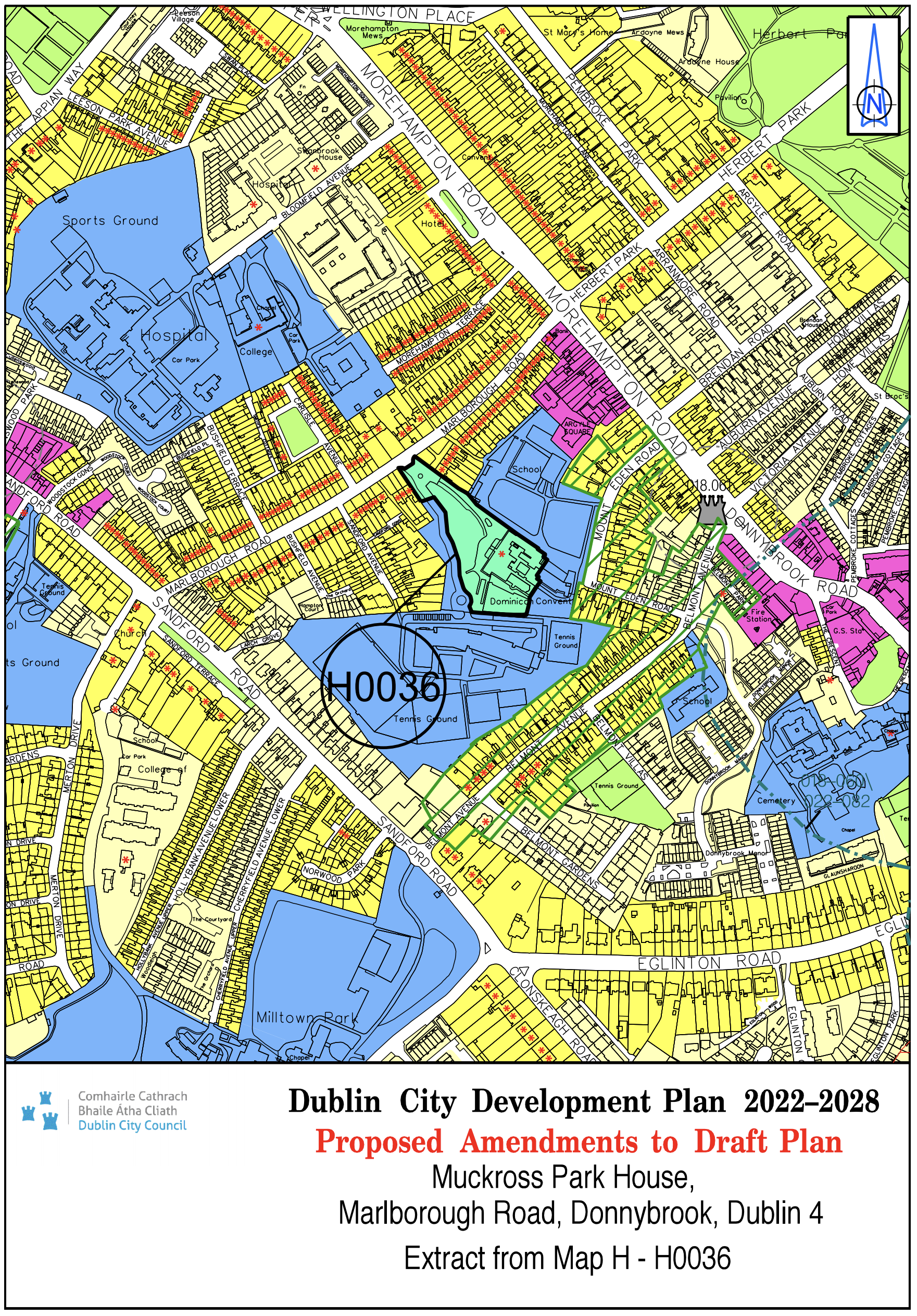
Muckross Park House, Marlborough Road, Donnybrook, Dublin 4 |
Z15 |
Z12 |
Map H |
H-0036 |
|
Site Address |
Zoning From |
Zoning To |
Map Sheet |
Map Reference |
|
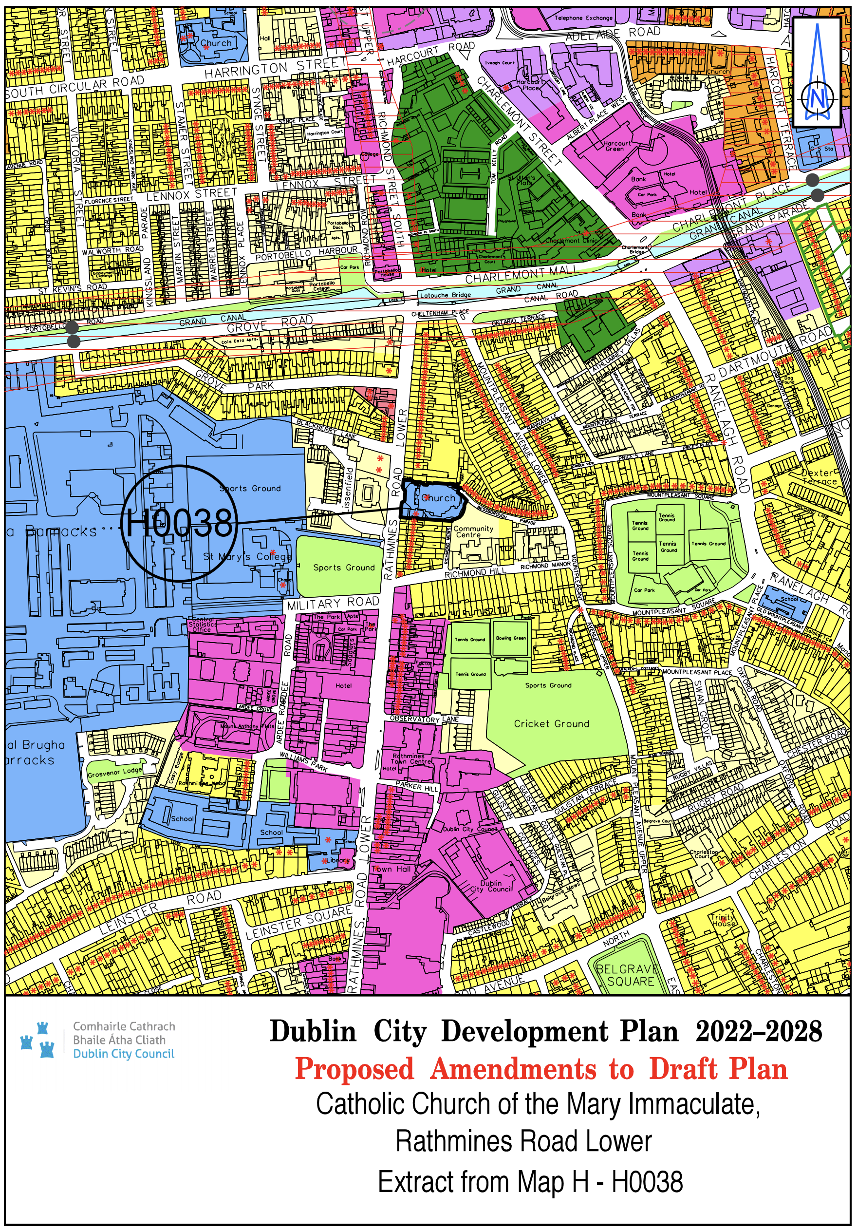
Catholic Church of the Mary Immaculate Rathmines Rd. Lower |
Z2 |
Z15 |
Map H |
H-0038 |
|
Site Address |
Zoning From |
Zoning To |
Map Sheet |
Map Reference |
|
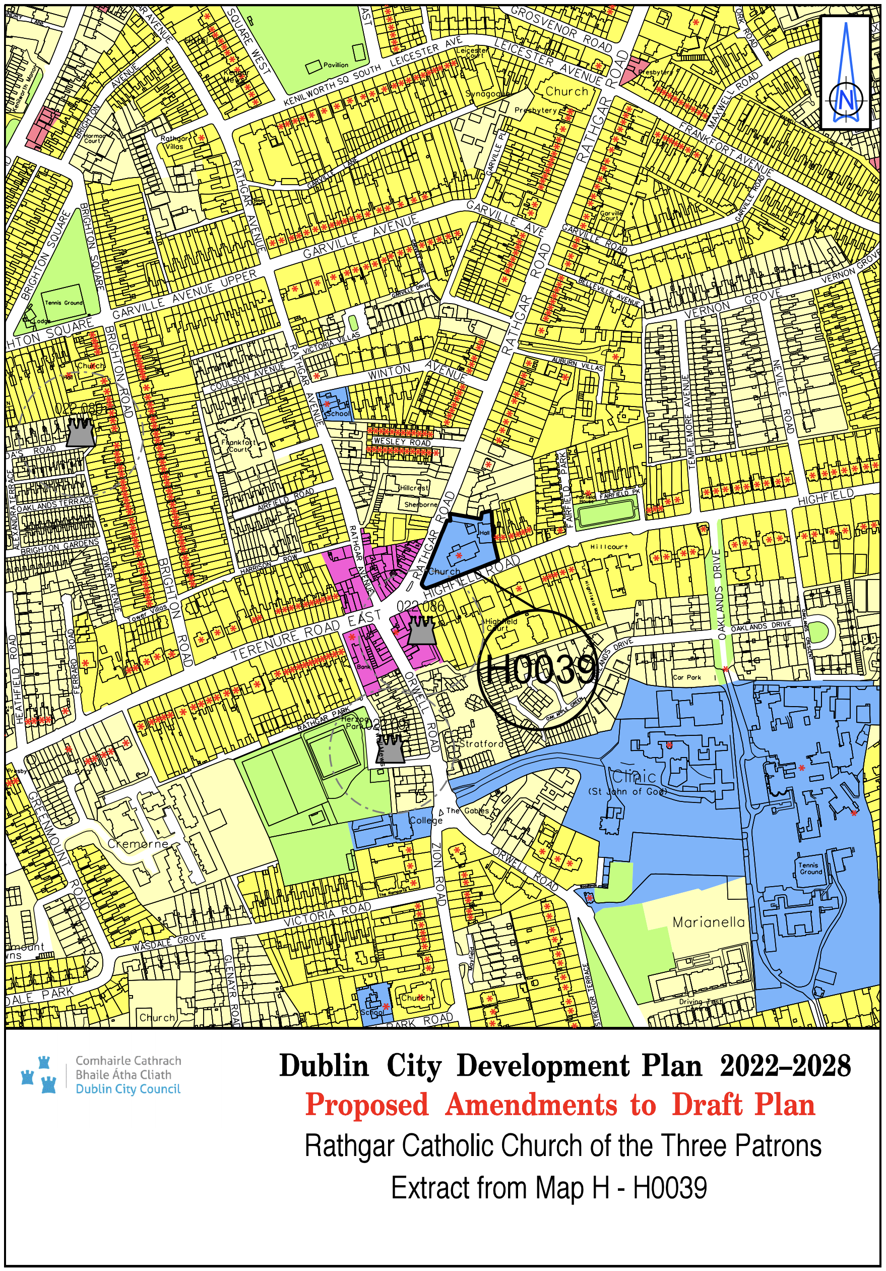
Rathgar Catholic Church of the Three Patrons |
Z2 |
Z15 |
Map H |
H-0039 |
|
Site Address |
Zoning From |
Zoning To |
Map Sheet |
Map Reference |
|
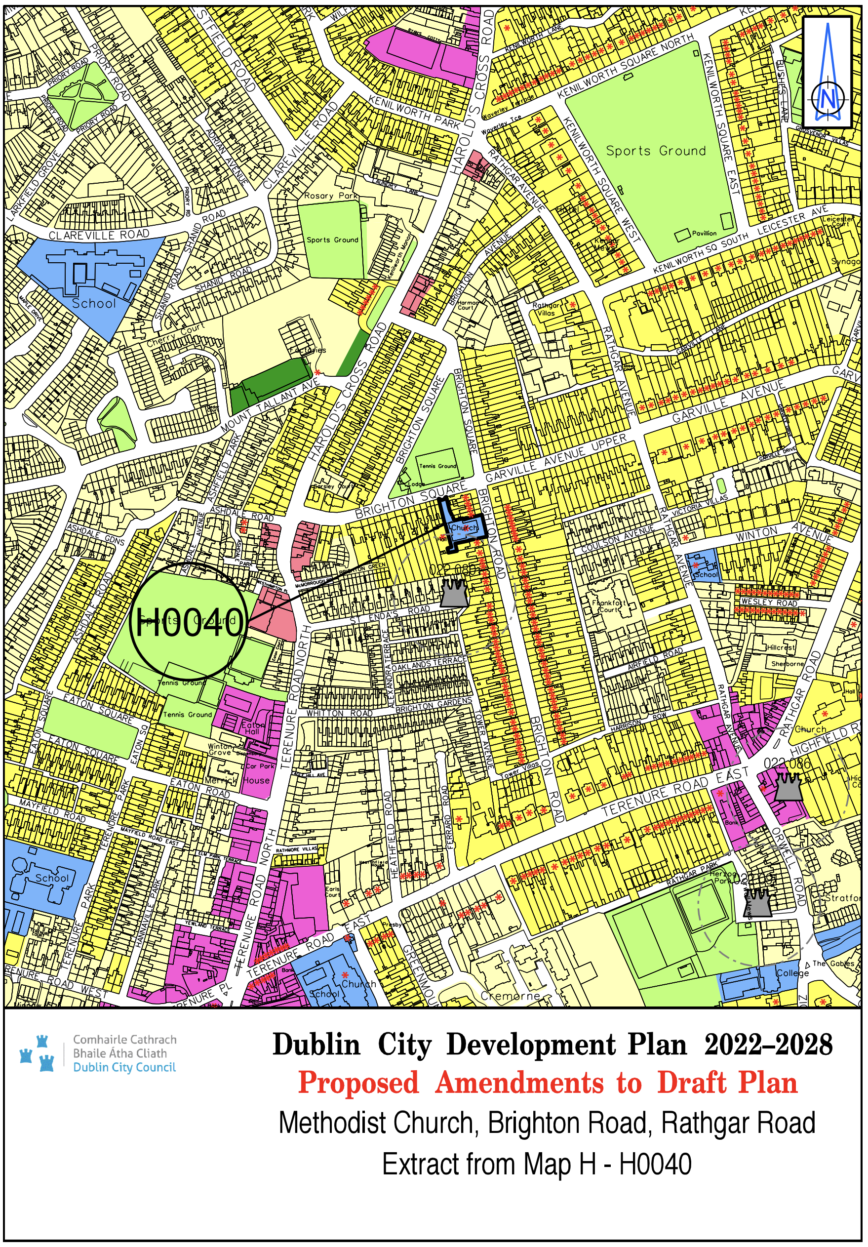
Methodist Church, Brighton Road, Rathgar Road |
Z2 |
Z15 |
Map H |
H-0040 |
|
Site Address |
Zoning From |
Zoning To |
Map Sheet |
Map Reference |
|
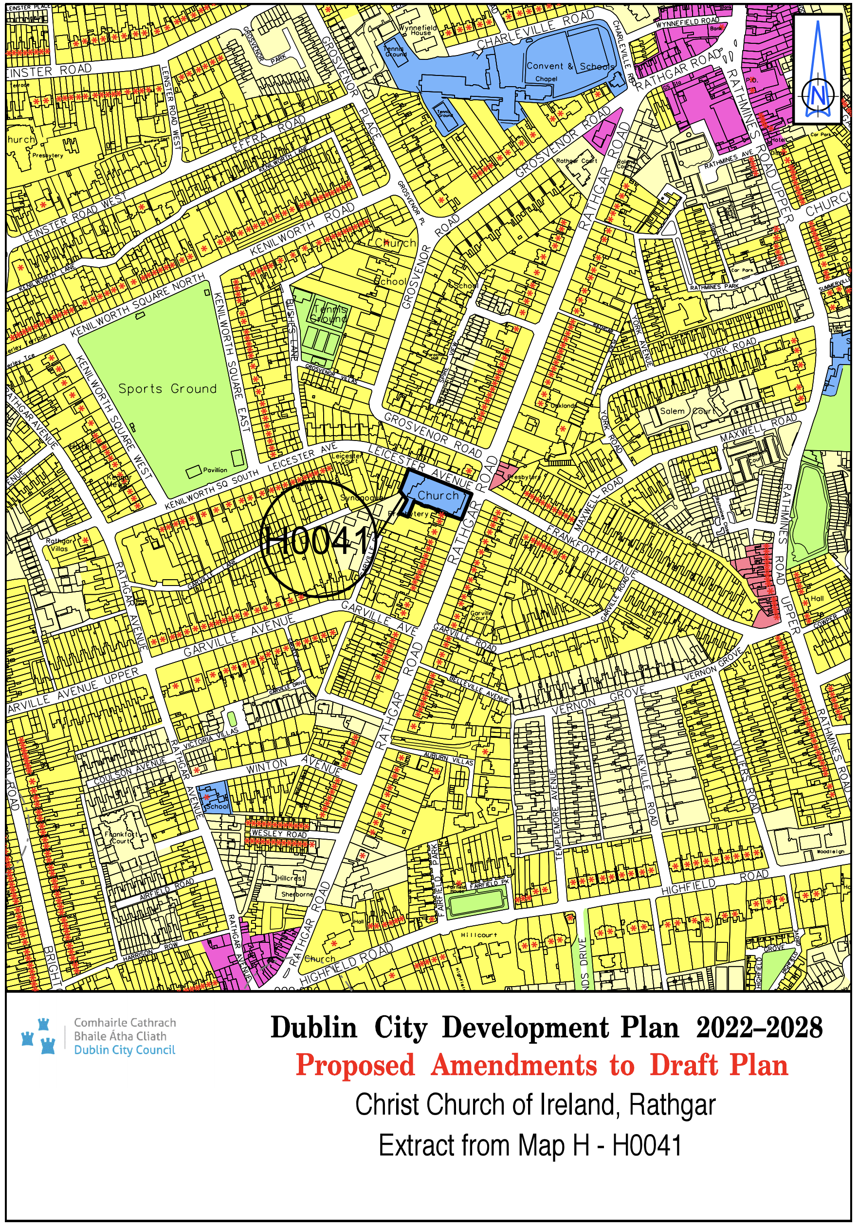
Christ Church of Ireland, Rathgar |
Z2 |
Z15 |
Map H |
H-0041 |
|
Site Address |
Zoning From |
Zoning To |
Map Sheet |
Map Reference |
|
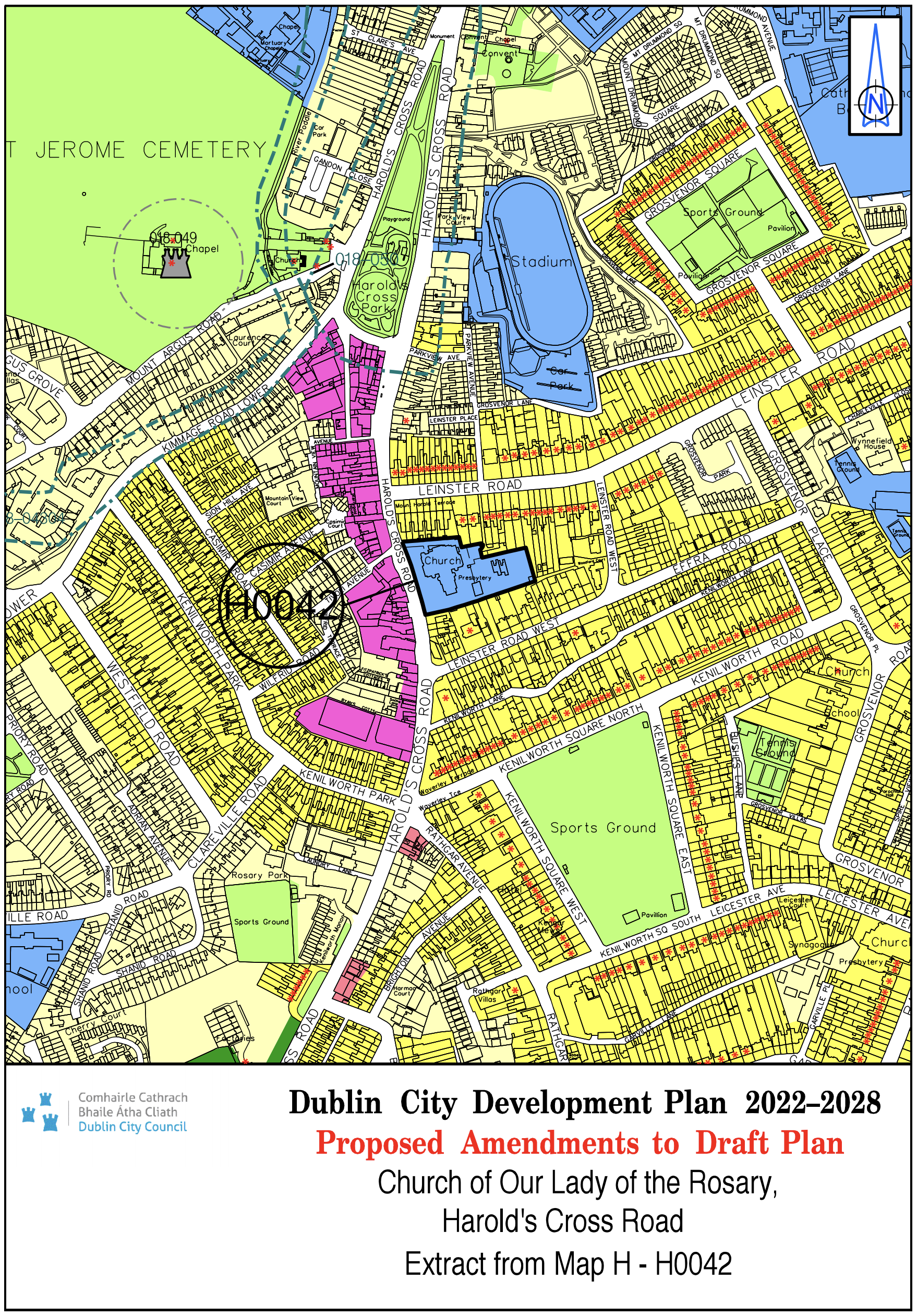
Church of Our Lady of the Rosary, Harold’s Cross Road |
Z2 |
Z15 |
Map H |
H-0042 |
Map J
Material Alteration Reference Number Map J.1
Please seeFull Map J
Key amendments:
- Mapping anomaly in respect to East Wall rail line corrected.
- Railway line extended to the Port.
Map K
Material Alteration Reference Number Map K.1
Please see Full Map K
Key amendments:
- Existing and proposed public transport alignments indicated.
- SDRA 5 Naas Road - Naas Road Key Urban Village boundary amended.
- SDRA 5 Naas Road - minor boundary amendments
- SDRA 6 Docklands– minor boundary amendments.
- SDRA 8 Grangegorman/Broadstone SDRA - boundary amended to include Prussia Street.
- SDRA 9 Emmet Road SDRA - boundary amended to include St. John Bosco Youth and Community Centre on Davitt Road.
- SDRA 10 NEIC – minor boundary amendments.
- SDRA 11 St. Teresa’s Gardens and Environs – minor boundary amendments.
- SDRA 13 Markets Area and Environs – minor boundary amendments.
Map L
Material Alteration Reference Number Map L.1
Please see Full Map L
Key amendments:
- The geographical area on Map L amended to mirror RMP Sheet 3263 as opposed to just 3263B to show the entire RMP area for the historic city (DU018-020).
- RMP sites to replace the HEV sites to ensure consistency across all the development maps.
-
Deletion of
(See Figure 54, Chapter 11 of written statement for detailed illustration).
and replace with
{See Figure 11-2: Dublin’s Historic Core and Figure 11-3: Location of Dublin City Walls, Remains and Features.} -
Delete from the Legend of Maps (A-H & L)
(Sites and Zones of Archaeological Interest)
and replacement with
{Record of Monuments and Places (RMP) as Established under Section 12 of the National Monuments (Amendment) Act 1994.} -
All maps including Map L to include the following legend:
{The RMP does not include all known archaeological sites and monuments, given that further such sites and monuments are found on an ongoing basis. For that reason, it is very important (in the context of considering proposed development) to take account of all information available on the Historic Environment Viewer (HEV). }