Please see attached.
Volume 3 - Zoning maps
Closed25 Nov, 2021, 12:00am - 14 Feb, 2022, 4:30pm
Map A: Land Use Zoning Map
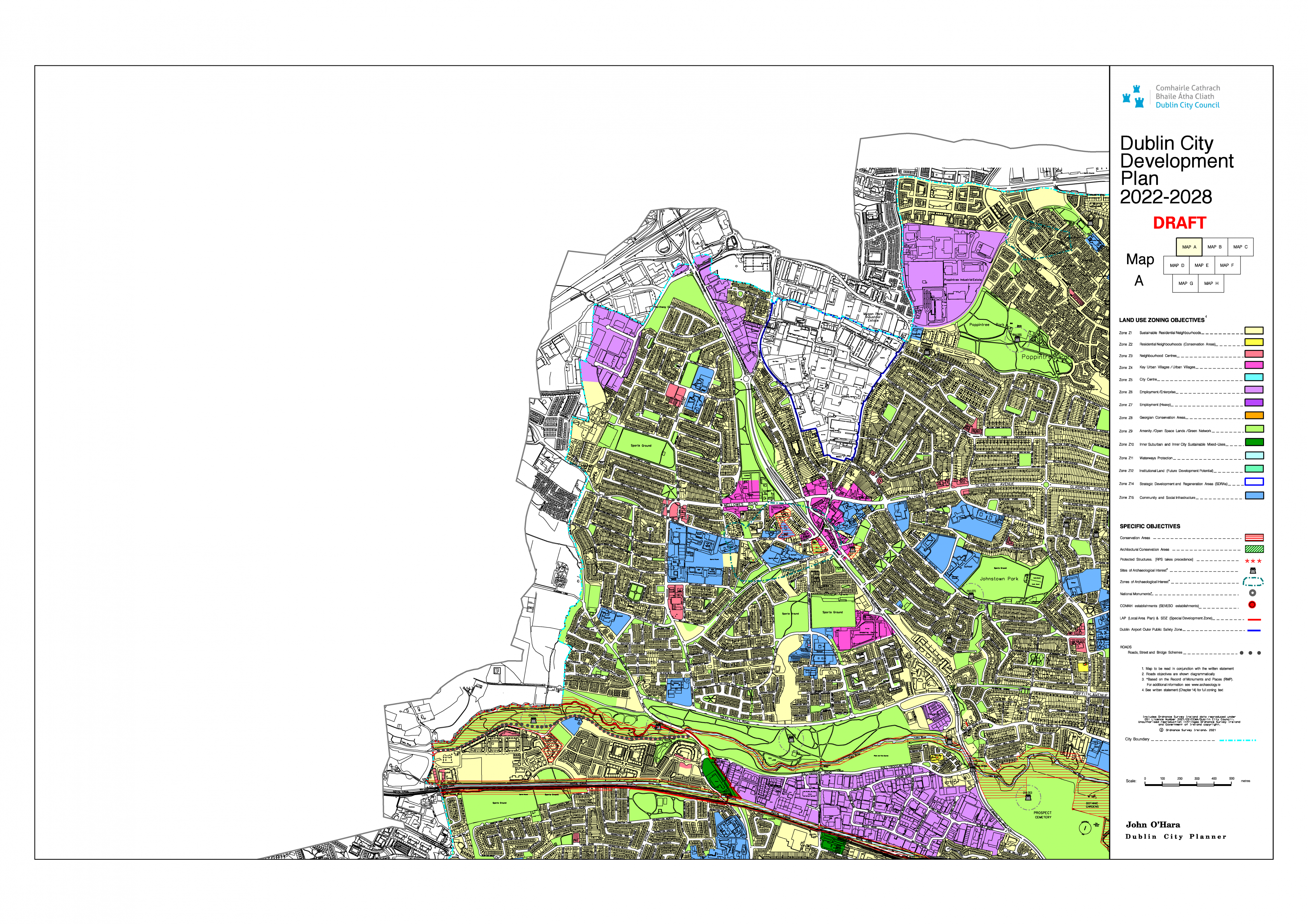
Click on map to enlarge and zoom
Map B: Land Use Zoning Map
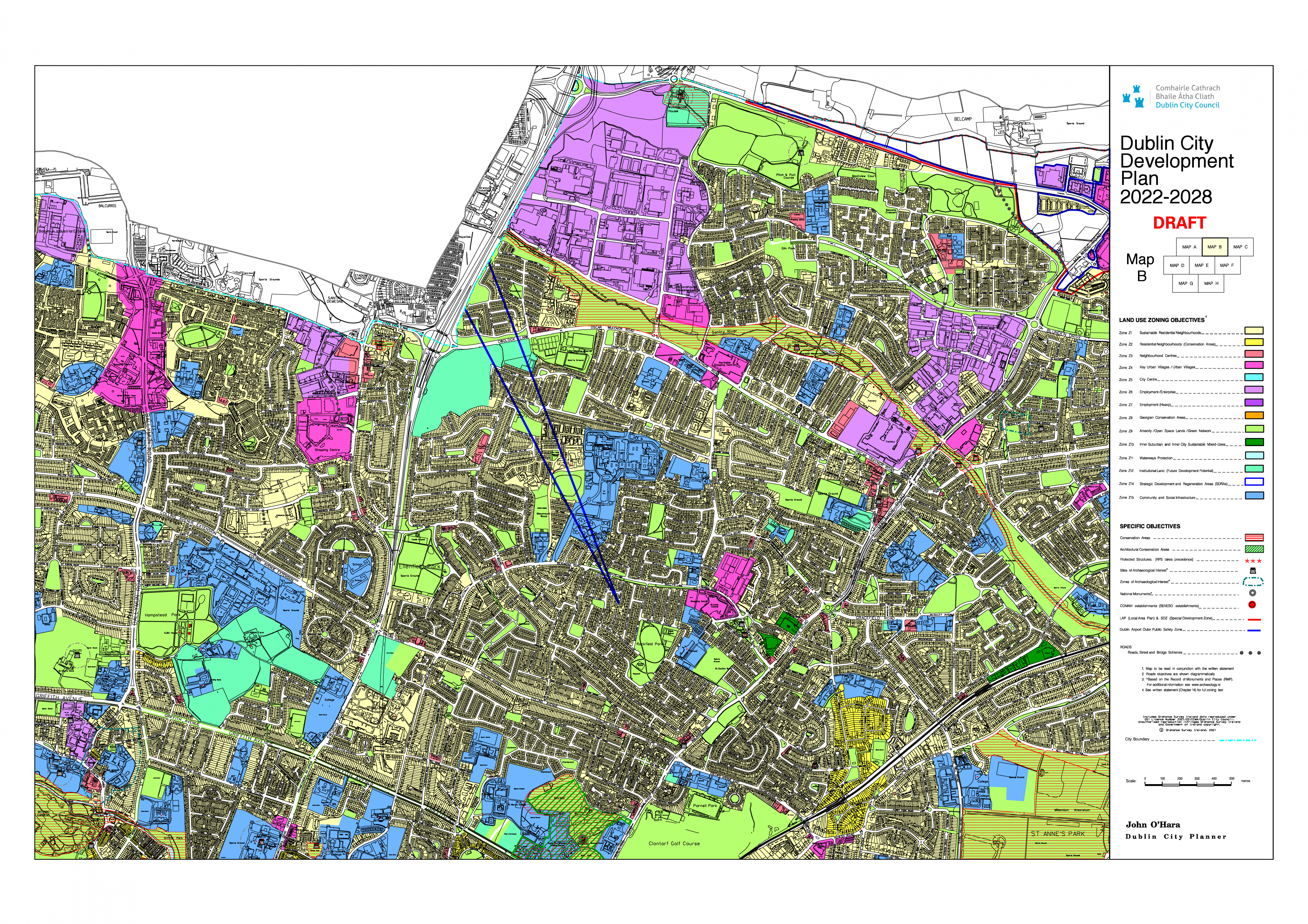
Click on map to enlarge and zoom
Map C - Land Use Zoning Map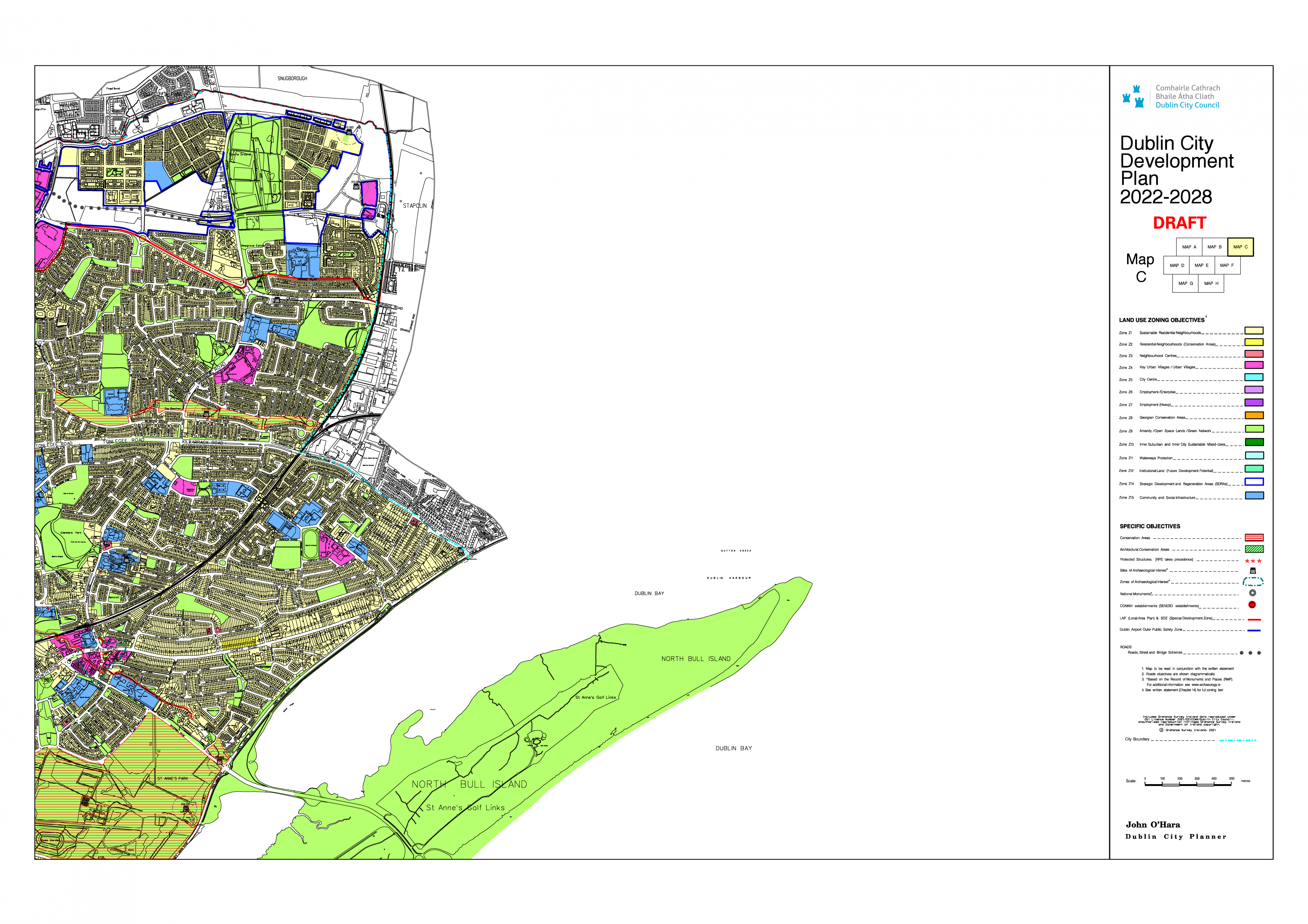
Click on map to enlarge and zoom
Map D - Land Use Zoning Map
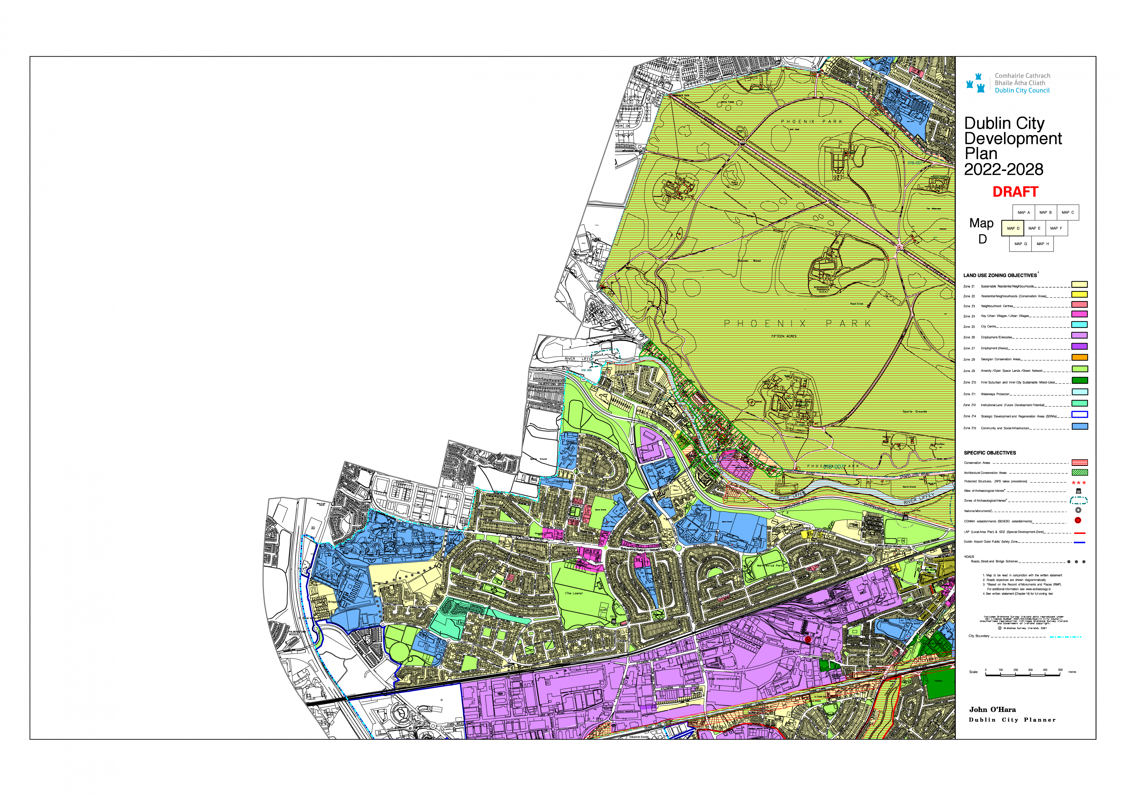
Click on map to enlarge and zoom
Map E - Land Use Zoning Map
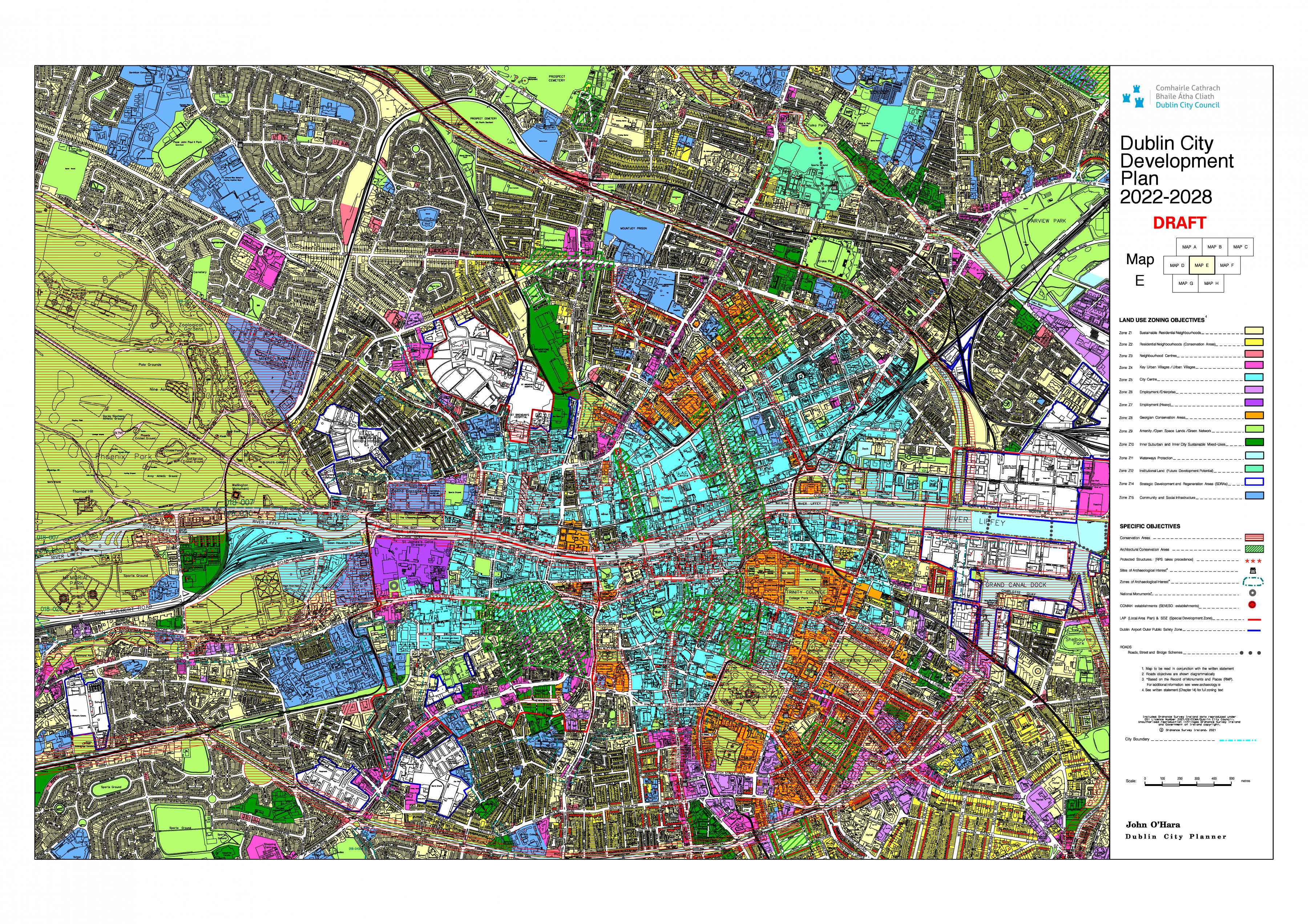
Click on map to enlarge and zoom
Map F - Land Use Zoning Map
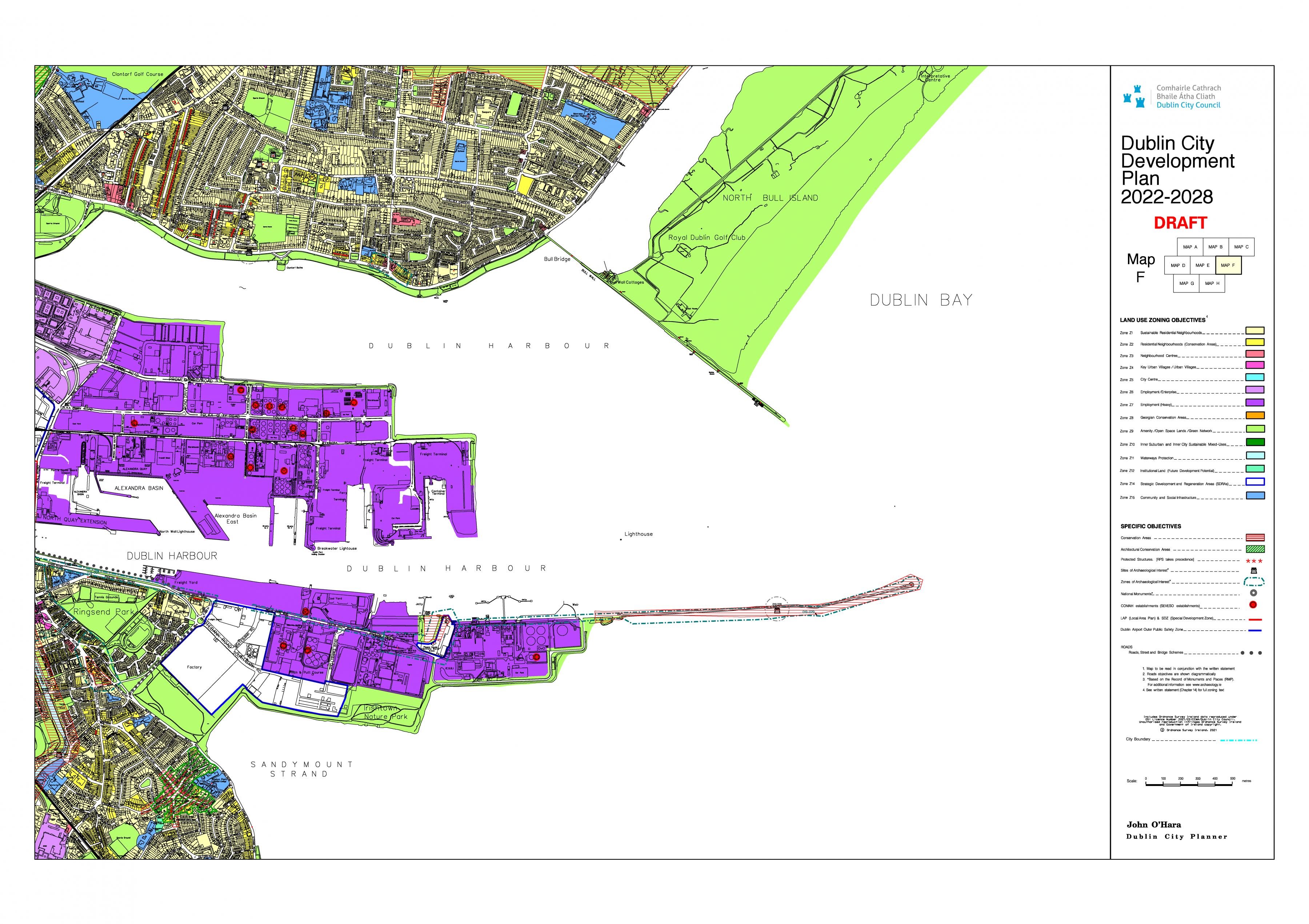
Click on map to enlarge and zoom
Map G - Land Use Zoning Map
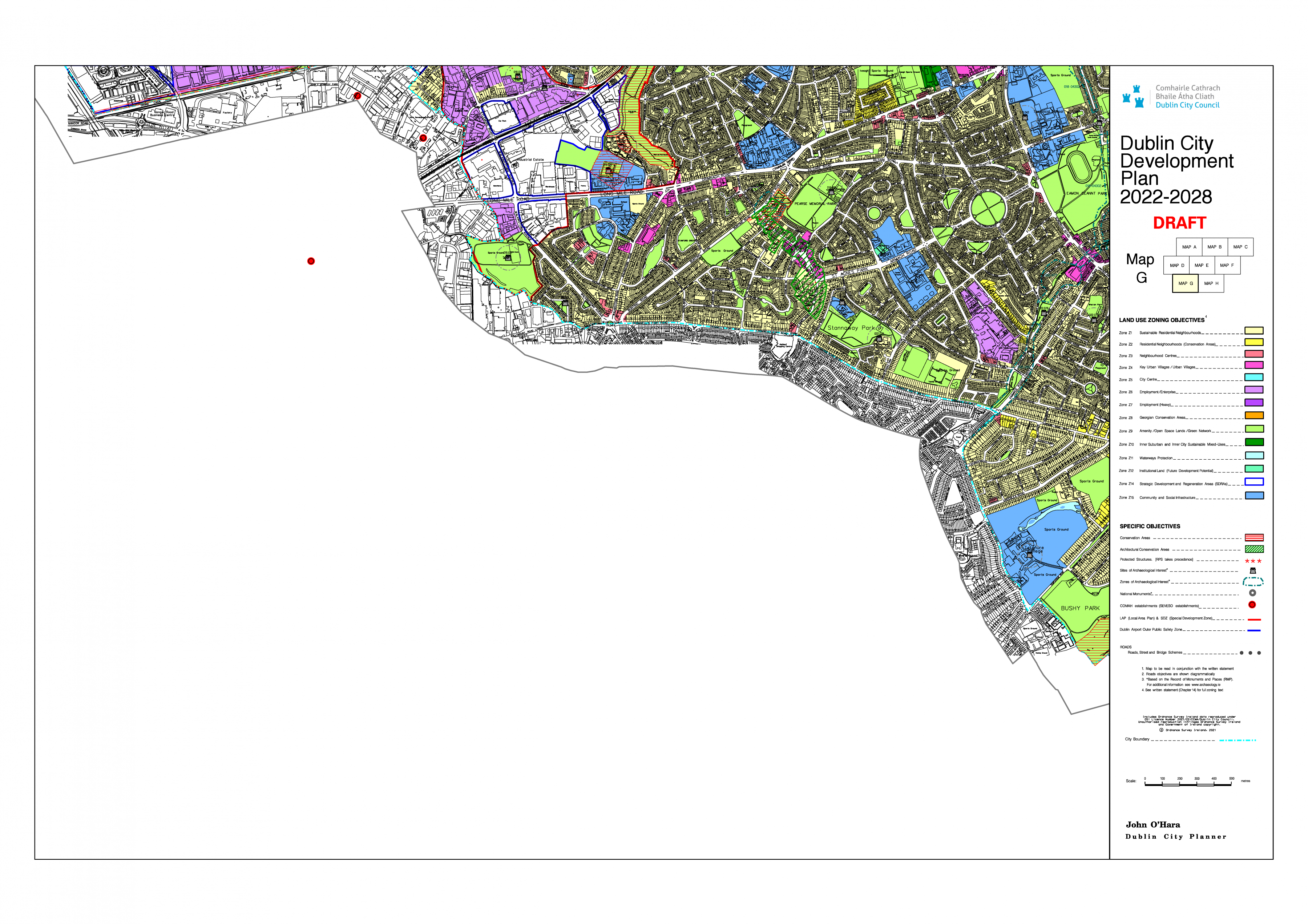
Click on map to enlarge and zoom
Map H - Land Use Zoning Map
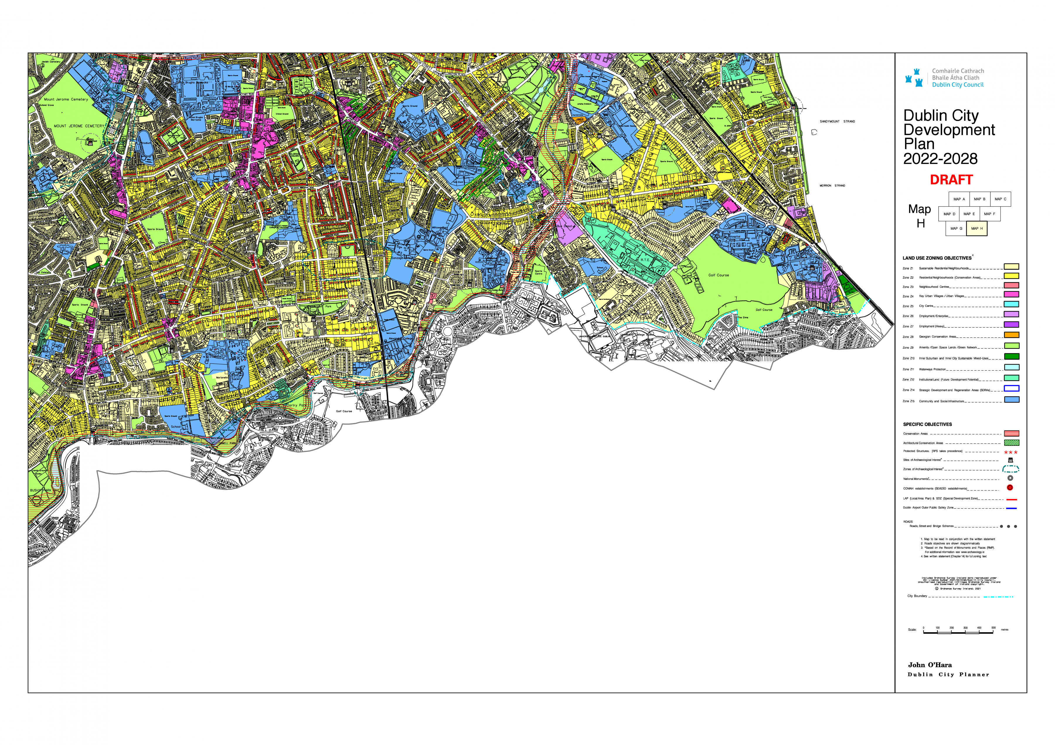
Click on map to enlarge and zoom
Map J - Existing and Future Strategic Transport and Parking Areas
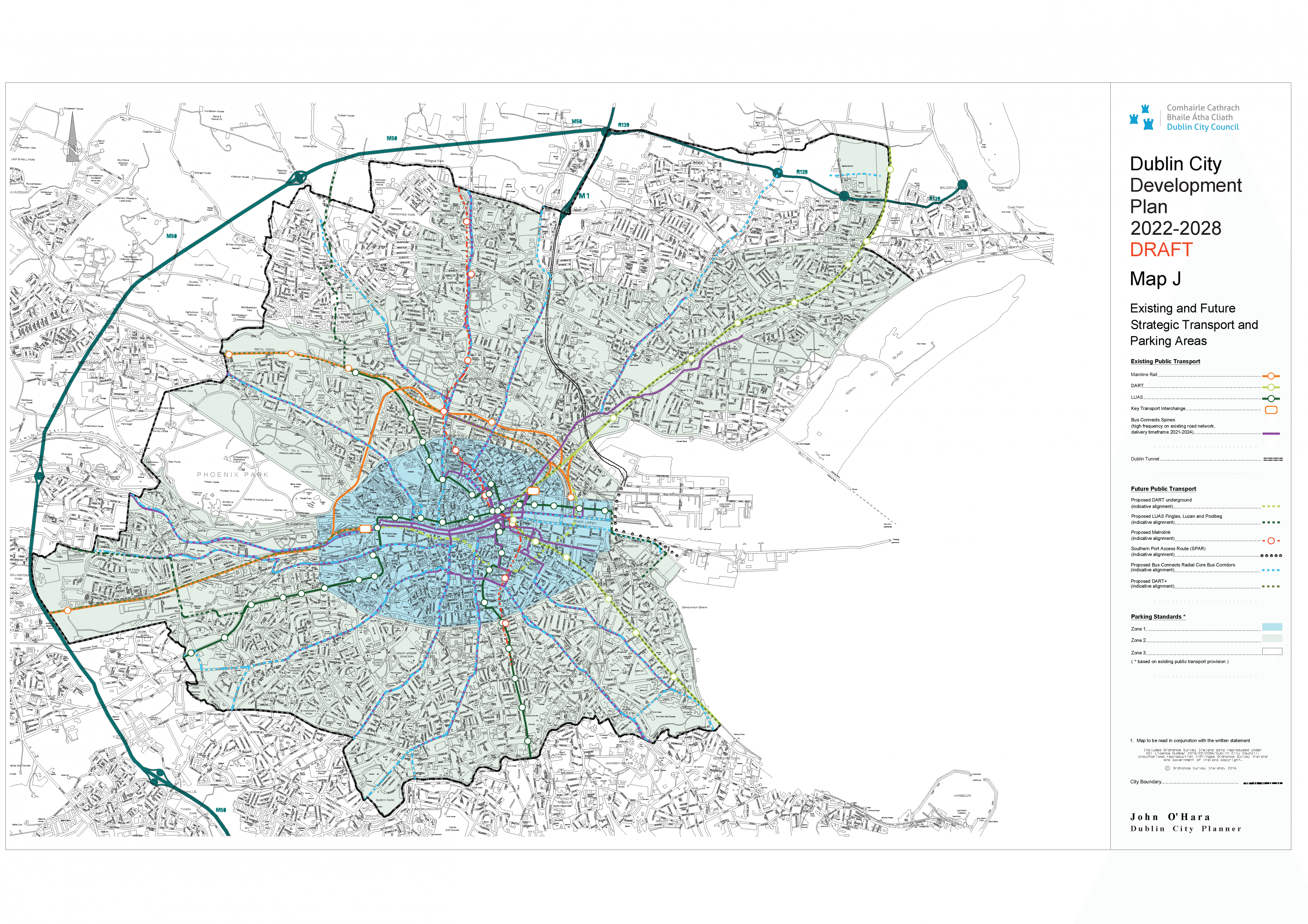
Click on map to enlarge and zoom
Map K - Strategic Development and Regeneration Areas and Key Urban Villages
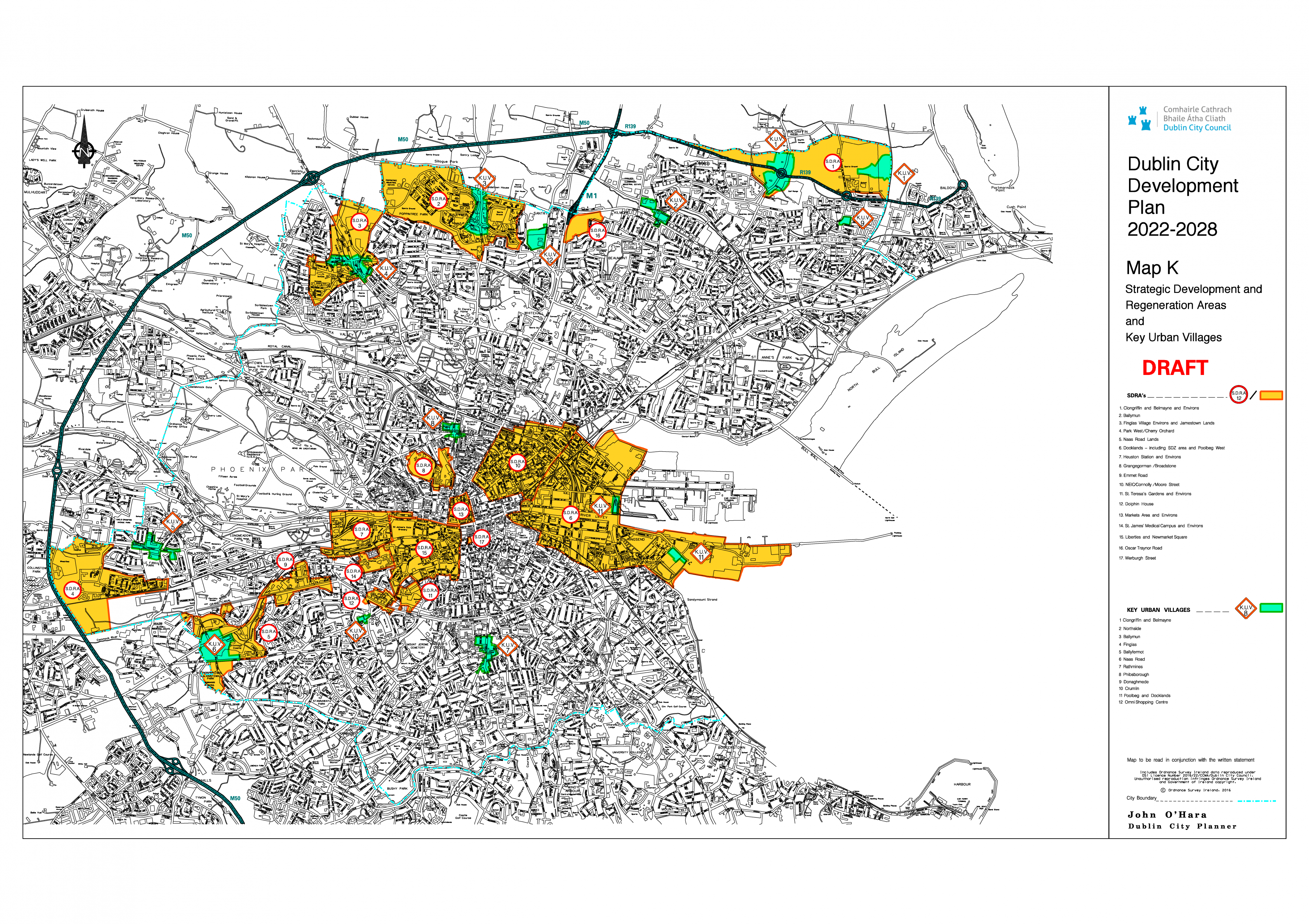
Click on map to enlarge and zoom
Map L - Specific Objectives
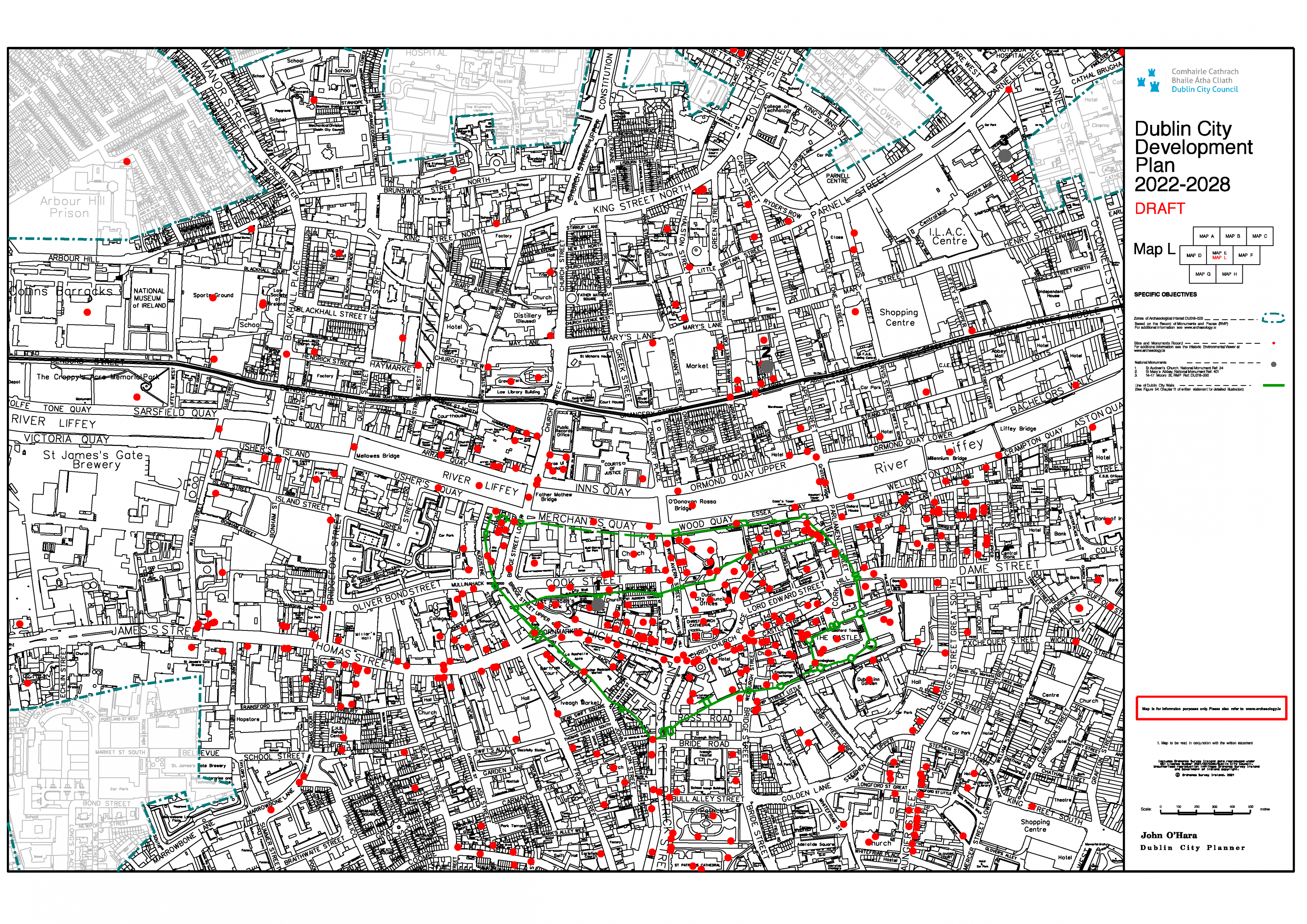
Click on map to enlarge and zoom
Contents
Materials
Observations
Observations
Re proposed re-zoning of the site and grounds of St. John Vianney church Ardlea Road Artane.
We wish to object to the above proposed re-zoning. In...