Height
Dublin is a relatively low-rise city. This draft development plan and earlier development plans have sought to address the issue of height in the city with considerable skill and...
Chapter 4: Shape and structure of the city
Dúnta25 Sam, 2021, 12:00am - 14 Fea, 2022, 4:30pm
4.1 Introduction
This chapter sets out the overarching framework and strategy to guide the future sustainable development of the city. The objective is to ensure that growth is directed to, and prioritised in, the right locations to enable continued targeted investment in infrastructure and services and the optimal use of public transport. The intent is to guide and manage the city’s evolution to ensure that it develops in a sustainable and climate resilient manner in accordance with national and regional policy. High quality ‘placemaking’ will be required to ensure a compact city where people want to live and work.
Guiding principles regarding criteria such as height, density, urban design, quality architecture and public realm are set out. Key goals are to ensure that the city is:
- liveable and inclusive;
- resilient and environmentally sustainable;
- healthy, integrated and connected;
- compact and efficient in its use of resources; and
- strong economically with a vibrant cultural life.
In developing strategies for the shape and structure of the city, it is important to reflect on the changes that have taken place over the past two decades and to set out policies and strategies to ensure that Dublin retains and builds on its renowned urban form and character, while developing new city neighbourhoods which are well connected to their surrounding environment and to the city centre. The development of a strong, dynamic and vibrant city core complemented by an integrated network of well serviced, high quality neighbourhoods (in accordance with the principles of the 15 minute city[1]) is the key spatial and development strategy in this plan.
Spatial Structure of Dublin City
Dublin City spans a geographic area of 115 sq. km and its spatial structure is shaped by both its natural setting and man-made features. The River Liffey, along with the canals, contains both the ‘old’ medieval city and the unique Georgian squares and streets. These features, coupled with the larger areas of Victorian and Edwardian architecture north and south of the canals, and the urban villages, underpin the city’s strong character and identity, which is recognised internationally.
Dublin’s character is derived from its historical layers, ranging from its medieval origins to substantial new contemporary interventions in the built environment in areas such as the Docklands. The basic building blocks of this unique urban character consist of individual buildings, streets, urban spaces, neighbourhoods and landscapes. The development plan aims to protect and enhance the unique character of the city, derived from both the natural and built environments. Opportunities for new development will be required to respect the character of the city by taking account of the intrinsic value of our built heritage, landscape and natural environment.
4.2 Achievements
Following a period of economic stagnation in the recession, the city has seen a substantial transformation over the last number of years and witnessed significant growth and investment. This growth has been underpinned by a clear spatial policy direction of expansion of the city eastwards to the Docklands and westwards to Heuston; creating new development and regeneration areas; consolidating the physical development of the city by tackling brownfield, vacant and under-utilised lands; and developing Key Urban Villages as sustainable hubs to anchor the suburbs.
In this regard, Dublin City Council has made significant progress in supporting the development of a number of successful neighbourhoods with the ongoing implementation of its Local Area Plans (LAPs) and Strategic Development Zones (SDZs) resulting in the creation of new communities at Ashtown-Pelletstown, at Clongriffin-Belmayne and within the North and South Docklands. Further LAPs have been adopted for Ballymun and Parkwest-Cherry Orchard, as well as a new Planning Scheme for the Poolbeg West SDZ. It is envisaged that these key regeneration areas will continue to become the focus of further consolidation through the delivery of new housing and commerce alongside social and community infrastructure. The spatial structure that has evolved in the city over the past number of years will continue to be consolidated and enhanced.
There has also been significant redevelopment of brownfield lands throughout the city, many for higher density residential and mixed-use developments. Many of these projects have had significant environmental and regeneration benefits. The progressive consolidation of the city has also been assisted by a strategic review of all low intensity industrial areas which was undertaken over the last plan period. This review culminated in the rezoning of a number of sites for more intensive development.
One of the areas that has seen some of the most significant growth and investment is the north and south Docklands area which has now been substantially built out under the framework of the North Lotts and Grand Canal Dock SDZ Planning Scheme adopted in 2014. To date, over 2,000 housing units and 400,000 sq. metres of commercial development have been delivered, as well as new streets and urban spaces. Key landmark projects include the redevelopment of the Boland’s Mills complex, a strategic yet long derelict site at Grand Canal Dock that is now being transformed into a major new commercial and residential quarter including a new public waterfront public plaza and the regeneration of a number of historic protected structures. There has also been significant development at the Grangegorman Campus with the ongoing consolidation of the Technological University Dublin, as well as the delivery of significant new public realm improvements.
The city has also continued to expand and consolidate to the west and south west with the regeneration of large brownfield sites in the Liberties and at Heuston Station, including the redevelopment of the Clancy Army Barracks. The City Council has also been active in seeking the regeneration of its designated Strategic Development and Regeneration Areas (SDRAs) via framework development plans and schematic master plans. Key SDRAs that are currently under development include the Clongriffin-Belmayne where significant Strategic Housing Development (SHD) applications have been granted planning permission. The ongoing regeneration of significant regeneration sites including St. Michaels Estate, O’Devaney Gardens, Dolphin House and St. Teresa’s Gardens continues to play an important role in densifying and consolidating the city at a neighbourhood level.
There have also been a number of significant public realm improvement projects undertaken since 2016, including the Grafton Street Quarter Public Realm Masterplan and the Dublin Docklands SDZ Public Realm Plan. Green Infrastructure (GI) development in the City has also been a notable feature including the implementation of the Liberties Greening Strategy with the opening of Weavers Park (playground) and St. Luke’s (public realm enhancements works for the setting of a protected structure) both located off Cork Street and St. Audeon’s / the Peace Park on High Street. A greening strategy for the North East Inner City is also being implemented. The city centre has also been improved through the pedestrianisation of a number of streets to the benefit of the city core. The ongoing roll out of the pedestrian wayfinding scheme across the city centre, has significantly enhanced the urban environment and the attractiveness of the city centre to residents, visitors and investors.
4.3 Challenges
Key challenges for the city include:
- achieving the balance between providing for compact growth, appropriate densification and placemaking in accordance with national and regional policy, yet ensuring innovative and sensitive development that respects the city’s unique character and enhances its natural and heritage assets;
- promoting sustainable building heights in the right locations to ensure efficient use of resources, services and public transport infrastructure;
- ensuring the long-term resilience of the city centre to climate change and ensuring that it is as a place where people want to live, work, invest and visit;
- ongoing issues of dereliction, urban decay, underutilised and vacant sites particularly in the inner city and the need to implement effective active land management to promote balanced and sustainable economic and residential development;
- ensuring the sustainable development and consolidation of Key Urban Villages to provide a focal point to the communities and neighbourhoods that they serve and that such centres are successfully promoted for further investment, regeneration and environmental improvement; and
- cultivating the inner and outer suburbs and providing neighbourhoods with a choice of homes for a diverse mix of households and communities and aligning and prioritising the provision of appropriate physical and social infrastructure, including Green Infrastructure, services and retail, with future development and areas of consolidation and intensification.
4.4 The Strategic Approach
The vision for the urban form and structure of the city is to achieve a high quality, sustainable urban environment, which is attractive to residents, workers and visitors. The key strategic approaches to achieving this vision underpinning the development plan are:
- In accordance with the objectives of the National Planning Framework (NPF), The Regional Spatial and Economic Strategy (RSES) for the Eastern and Midland Region including the Metropolitan Area Strategic Plan (MASP) set out therein, the creation of a more compact city where development is closely aligned and integrated with existing and proposed public transport infrastructure and where residents can live close to their places of work or study and easily move around the city, thereby, reducing urban sprawl and unsustainable travel patterns and ensuring maximum benefit from investment in public transport infrastructure.
- The creation of a consolidated city, whereby infill and brownfield sites are sustainably developed, regenerated and new urban environments are created, and where underutilised sites and buildings are actively repurposed and intensified. This will be facilitated by promoting active land management, including initiatives such the Vacant Site Levy and the Living City Initiative.
- The promotion of development that incorporates appropriate climate adaption and mitigation measures and that will bring about meaningful climate change, including measures to ensure climate resilience and the transition to a low carbon economy.
- The creation and nurturing of sustainable neighbourhoods and healthy communities in line with the principle of the 15 minute city, which are designed to facilitate walking and cycling close to public transport (insofar as possible) and include a range of community infrastructure, all in quality, more intensive mixed-use environments.
- The promotion of development that enhances and nurtures our natural heritage assets, which improves biodiversity and which develops a green infrastructure network for recreation and amenity.
- To promote the development of a well-designed and defined network of streets and quality urban spaces, together with the achievement of a good mix of uses to encourage vitality, in well-designed and appropriately scaled buildings, which are appropriate to their context and which foster good placemaking.
- To ensure that the city’s civic importance as the State’s capital is reinforced and augmented through appropriate public realm and healthy placemaking interventions[2].
- To support and maintain a strong economy in the city and provide a critical mass of development to support investment, innovation and the smart economy.
- To encourage development that enhances, integrates and respects the city’s heritage and cultural assets and that is sensitive to the setting and context of buildings and features of conservation and archaeological merit.
- To continue to extend the form and structure of the city for the benefit of communities in the new developing areas such as Belmayne-Clongriffin, Ballymun and Cherry Orchard-Park West, including connectivity to these developing areas, and in doing so, embrace the potential for quality urban design and placemaking.
- To support the creation of sustainable communities with adequate access to a range of sports and recreational amenities, educational facilities and retail services, and that new residential development is delivered in tandem with commensurate social and community infrastructure.
4.5 Policies and Objectives
4.5.1 Approach to the Inner City and Docklands
The Inner City
Dublin, as the capital city, is at the heart of the city region. It is an international city and plays a significant administrative, economic and retail role in the State. The inner city, comprising the city centre and its immediately surrounding neighbourhoods within the canals, performs the function of a capital city core.
The city centre and its environs has seen remarkable growth and investment since the mid-1980s when there was extensive dereliction and vacancy. The strong economy in the years leading up to and following the millennium, together with planning mechanisms such as Integrated Area Plans (IAPs), SDZs and strategic land-use zoning policies, as well the delivery of the Luas system has stimulated investment throughout the inner city. Whilst there was undoubtedly a period of stagnation during the Global Financial Crisis of the mid 2000’s, the city has recovered well and is thriving. Although a tremendous amount of urban regeneration has lifted many areas of the inner city, investment has not always been balanced with pockets of excellence contrasting with areas still in need of rejuvenation.
The Covid-19 crisis has brought new challenges to the vitality and viability of the city particularly to the retail, hospitality, entertainment and culture sectors. The focus of the strategy for the inner city will be to encourage a more liveable inner city, balanced economic investment and an increased focus on residential development coupled with significantly enhanced public realm and mobility measures to encourage more pedestrians and cyclists.
In the post Covid-19 environment, the objective will be to:
- continue to position Dublin as a world class European capital city and build on the success of the significant investment and regeneration seen in the city over the last number of years;
- promote compact growth, appropriate climate action measures and the continued consolidation of the inner city;
- encourage sustainable patterns of mixed use development to ensure a strong, vibrant and economically resilient inner city; and
- encourage high quality, sustainable residential development in accordance with the principles of the 15 minute city in order to enliven the city, create vitality and contribute to the evening economy of the city and to counterbalance the loss of any physical employment space.
It is anticipated that the ongoing implementation of the Dublin City Public Realm Strategy in conjunction with the further expansion of the city cycle network and continued improvements in public transport infrastructure will help achieve these goals by enhancing linkages and making both recently developed and established areas more coherent and connected. Other measures such as greening city strategies will further improve and enhance the physical urban environment. The development plan also seeks to strengthen placemaking in the city in order to consolidate and enhance the city centre, at the heart of the city region.
A key element of the strategy for the inner city is the continued consolidation and development of brownfield lands. This will be facilitated where appropriate through active land measures such as the Vacant Site Levy. The appropriate re-development of such lands represents an opportunity to significantly enhance the built environment of the inner city, especially those areas most in need of regeneration, by bringing housing and employment to them. The Living City Initiative will also incentivise residential occupation of vacant upper floors and encourage the upgrade of existing accommodation to bring derelict/disused properties back into use (see Chapter 2: Core Strategy for further policies regarding active land measures.) Social housing regeneration projects will also bring significant improvement to the inner city.
It is also envisaged that there will be further development of the Technological University Dublin campus at Grangegorman over the plan period. The development of the new university in this area and the provision of other services and facilities connected with it, has anchored the ongoing regeneration of this part of the city. Opportunities to develop clusters of economic development, employment and innovation in the fields of higher education will be encouraged in and around the campus. The development of the National Children’s Hospital at St. James is also a significant investment for the inner city and opportunities for a health cluster aligned with the children’s hospital and the future proposed National Maternity Hospital will be fully exploited.
There will also be a focus in developing and strengthening the inner city’s retail and cultural attractions. Major new developments including the Parnell Cultural Quarter and the redevelopment of the city Victorian Fruit Market as well as land mark developments such as the redevelopment of Clery’s Department Store and the Central Bank will be pivotal in reinforcing Dublin’s role as the primary retail and cultural destination in the state. It is envisaged that Moore Street Market will also be developed as a significant new cultural and historical amenity with associated public realm upgrades as well as high quality mixed use development. The North East Inner City, to include Moore Street, is identified as a Strategic Development Regeneration Area with the objective to promote the significant development potential of this area and harness further potential funding opportunities. Connections and linkages between the north and south core will be enhanced through further interventions at Liffey Street and open space improved through the redevelopment of Wolfe Tone Square.
Docklands and Dublin Port
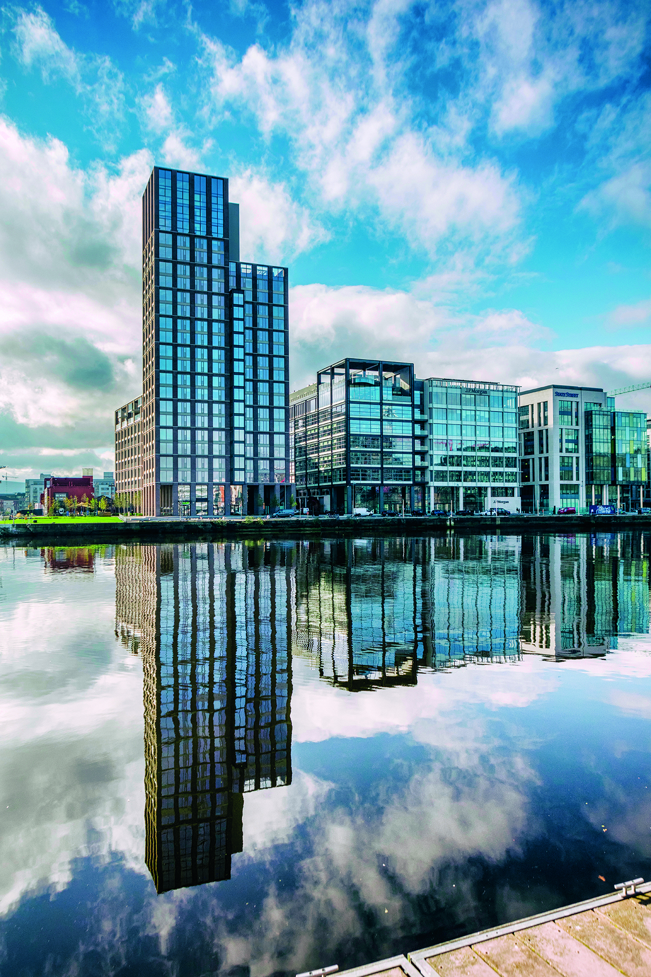
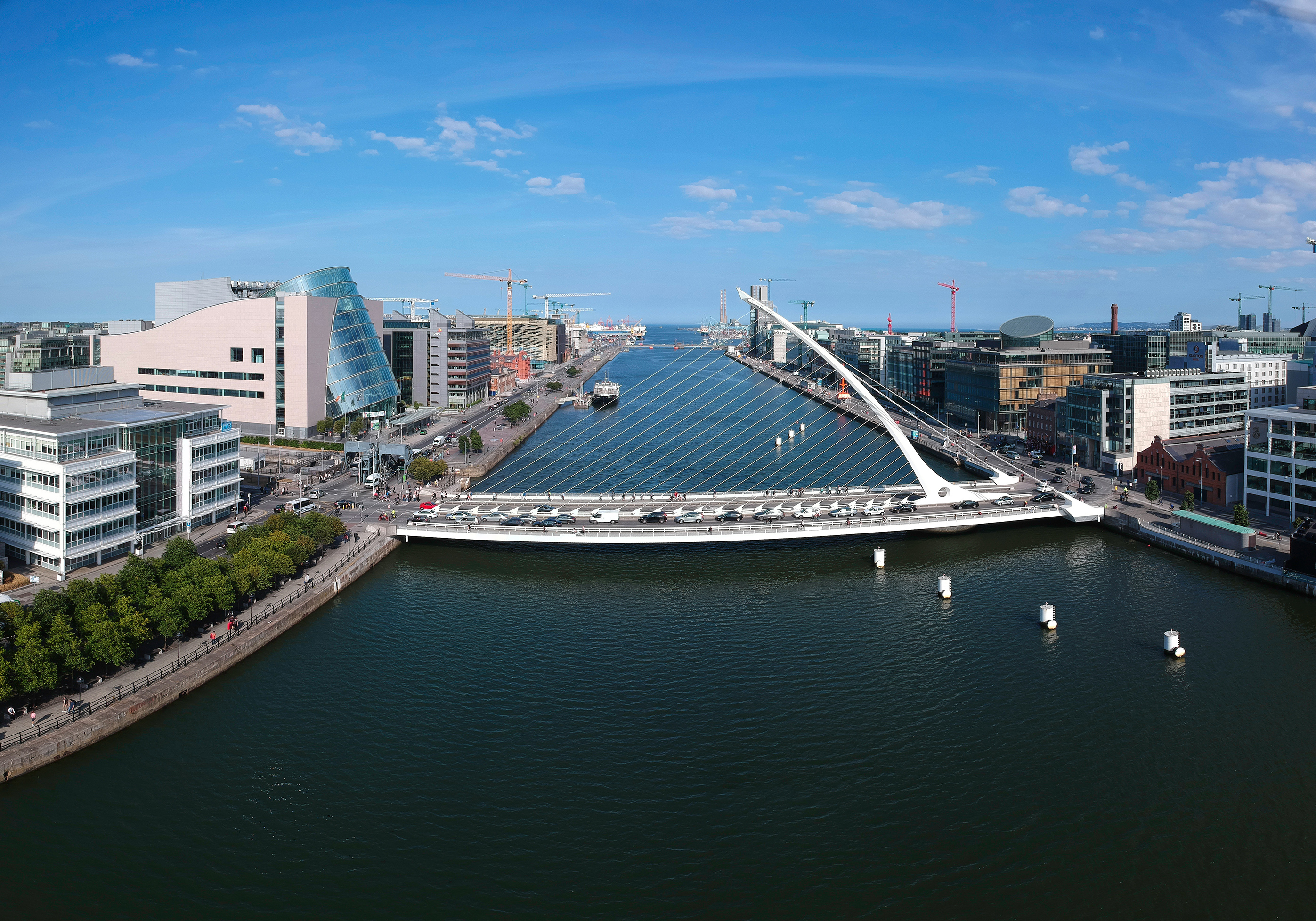
The Docklands is often viewed as a new urban quarter, where the wider River Liffey and larger block structure, together with the juxtaposition of the Docklands to other waterbodies such Grand Canal Dock and the River Dodder, combine to create the potential for a completely new identity. The area has been rapidly transformed in recent years and it is now home to a significant number of multinational corporations with notable clusters in the technology and finance sectors. Residential development has also been extensive. Further development of the historic Docklands area is proposed under the Poolbeg West SDZ Planning Scheme. It is envisaged that this area will accommodate over 3,500 new homes as well as 80,000–100,000 sq. m. of commercial floorspace, providing employment for up to 8,000 workers.
The challenge is to ensure that the character of the Docklands is retained and is enhanced, and that good connectivity between the city centre and the Docklands is achieved such that this area is successfully integrated and connected with the city centre. In this regard, significant achievements have been made in recent years, not only in the scale of commercial and apartment development, but also in creating a strong sense of place in this new urban quarter.
The active use of the public realm in the Docklands to host events and the use of the waterbodies, such as the Grand Canal Dock, for leisure and recreational uses significantly enhances the vitality of this evolving urban environment and will be encouraged. The strategic approach to the future development of Docklands will build on these successes. Connections will continue to be enhanced and it is envisaged that new bridges over the Liffey and at the mouth of the Dodder will be delivered over the next plan period.
Dublin City Council fully supports and recognises the important national and regional role of Dublin Port in the economic life of the region and the consequent need in economic competitiveness and employment terms to facilitate port activities. Dublin Port will have a significant role to play in the future development and growth of the city and it is considered prudent to plan the structure of this part of the city, including the proposed public transport network, to fully integrate with the developing city structure and character, while having regard to the Dublin Port Company Masterplan 2012-2040. Further policies and objectives regarding Dublin Port are set out in Chapter 6: City Economy and Enterprise.
|
It is the Policy of Dublin City Council: |
|
|---|---|
|
SC1 |
Consolidation of the Inner CityTo consolidate and enhance the inner city, promote compact growth and maximise opportunities provided by existing and proposed public transport by linking the critical mass of existing and emerging communities such as Docklands, Heuston Quarter, Grangegorman, Stoneybatter, Smithfield, the Liberties and the North East Inner City with each other, and to other regeneration areas. |
|
SC2 |
City’s CharacterTo develop the city’s character by:
|
|
SC3 |
Mixed Use DevelopmentTo promote a mixed-use land use policy in the city centre, including the provision of high quality, sustainable residential development. |
|
SC4 |
Recreational and Cultural EventsTo promote and support a variety of recreational and cultural events in the city’s civic spaces; as well as the development of new and the retention and enhancement of existing civic and cultural spaces. |
|
SC5 |
Urban Design and Architectural PrinciplesTo promote the urban design and architectural principles set out in Chapter 15, and in the Dublin City Public Realm Strategy 2012, in order to achieve a climate resilient, quality, compact, well-connected city and to ensure Dublin is a healthy and attractive city to live, work, visit and study in. |
|
SC6 |
DocklandsTo recognise the distinctive character of the Docklands regeneration area and to work with the relevant authorities to increase connectivity with the city centre. |
|
SC7 |
Dublin PortTo support and recognise the important national and regional role of Dublin Port in the economic life of the city and region and to facilitate port activities and development, having regard to the Dublin Port Masterplan 2012-2040. |
4.5.2 Approach to the Inner Suburbs and Outer City as Part of the Metropolitan Area
The inner suburbs comprise the established suburban communities located outside of the canal belt and the outer city refers to the newly developing areas on the fringe of the city administrative area including Clongriffin-Belmayne, Ashtown-Pelletstown, Park West and Cherry Orchard.
These areas have seen significant development over the past number of years for intensive higher density housing, particularly at Clongriffin-Belmayne and Ashtown-Pelletstown. Within the inner suburbs, there has also been significant investment with a number of infill and former industrial sites being regenerated for high quality housing and mixed use development.
A key objective will be to ensure that these large suburban areas are integrated into the structure of the city, both in relation to the city centre and the metropolitan area. Future development will be aligned with the strategic development areas and corridors set out under the Dublin MASP and further opportunities for intensification of infill, brownfield and underutilised land fully explored, particularly where it aligns with existing and future public transport infrastructure.
In developing the inner suburbs and outer city, there will be an increased focus on the importance of the strategic green network and it is acknowledged that such features contribute to the built and natural landscape of the city and play an integral role in addressing the challenges of climate change.
Over the next plan period, the strategic approach is also to strengthen the hierarchy of urban villages in the inner suburbs and outer city and consolidate and develop them as key focal points for the communities that they serve. The urban centres can provide opportunities for good urban placemaking, are centres for local services and form a basis for sustainable city living. 12 Key Urban Villages (KUVs) have been identified in the city suburbs (refer to Chapter 7: The City Centre, Urban Villages and Retail and Appendix 2: Retail Strategy). It is envisaged that these will be strong spatial hubs and provide a range of retail, commercial, employment, community and other services. Urban villages will play a key role in developing the concept of a 15 minute city.
Notwithstanding the potential of these centres, some have not benefited from investment and some remain underdeveloped and degraded. In many instances, there are significant opportunities for consolidation and for physical and environmental enhancement. Opportunities to upgrade, consolidate and improve cycling and pedestrian infrastructure from these centres to surrounding neighbourhoods will be fully exploited. These centres should be capable of achieving a distinctive spatial identity with a high quality physical environment.
Also within the outer city are the smaller neighbourhood centres. These support the other higher order urban villages. They provide an important role for local communities for day to day needs and are considered appropriate localities for a range of community services. The strategic approach of the plan is to continue to consolidate and environmentally upgrade these local centres.
|
It is the Policy of Dublin City Council: |
|
|---|---|
|
SC8 |
Development of the Inner SuburbsTo support the development of the inner suburbs and outer city in accordance with the strategic development areas and corridors set out under the Dublin Metropolitan Area Strategic Plan and fully maximise opportunities for intensification of infill, brownfield and underutilised land where it aligns with existing and pipeline public transport infrastructure. |
|
SC9 |
Key Urban Villages, Urban Villages and Neighbourhood CentresTo develop and support the hierarchy of the suburban centres, including Key Urban Villages, Urban Villages and Neighbourhood Centres, in order to:
|
4.5.3 Urban Density
Dublin’s City core is characterised by a low to medium rise built form. Densities vary across the city and are typically much lower in the suburbs, and increase in the city centre, particularly in new developing areas such as Dublin Docklands. The environmental and sustainability benefits of increasing urban densities are now well accepted principles and enshrined in policy terms under the Guidelines for Planning Authorities on Sustainable Urban Development (Cities, Towns and Villages), (Department of Environment, Heritage and Local Government, 2009), and its companion document, Urban Design Manual: A Best Practice Guide.
The NPF recognises that there is a need to increase densities on underutilised lands within core urban areas in order to promote consolidation and compact growth, prevent further sprawl and address the challenges of climate change. It is a requirement under the NPF that at least half of all future housing and employment growth in Dublin be located within and close to the existing ‘built up’ area of the city, specifically within the canals and the M50 ring. The RSES and Dublin MASP also promotes greater densification and more intensive forms of development particularly on infill, brownfield and underutilised lands along key strategic public transport corridors. It is recognised at a national and regional policy level, that land-use and transport are critical inter-linked policy tools that need to work together to better realise economic success, environmental protection and quality of life.
It is acknowledged that good quality, higher density developments can make a positive contribution to the evolving urban form and structure of the city and can help to achieve sustainable land use and movement patterns. Increasing density can however, bring challenges in terms of ensuring appropriate levels of amenity for existing and future residents and integrating higher density schemes successfully with the existing built fabric.
The objective is to provide opportunities for increased density in a sustainable manner whilst ensuring the highest standards of design as well as the protection of existing amenities and the natural and historical assets of the city. There will be continued consolidation of the city to optimise the efficient use of urban land. Higher densities will be promoted in the city centre, within KUVs, certain SDRAs and within the catchment of high capacity public transport. The goal is to provide for a compact city with attractive mixed-use neighbourhoods, a variety of housing types and tenure, adequate social and community infrastructure and adaptable housing, where people of all ages will choose to live as a matter of choice.
There are a number of inter-linked sustainable standards and safeguards throughout the development plan, all designed to ensure that quality density and placemaking is delivered through a variety of mechanisms such as contextual streetscapes, urban form, stepped heights in transitional zones, together with open space and amenity standards. There will also be an increased focus on creating an enhanced green infrastructure network as a key mechanism for addressing climate change and providing for quality recreation, biodiversity, sustainable drainage and decarbonisation as an integral part of the city form and structure (see Chapter 10: Green Infrastructure and Recreation).
In some instances, higher density development will be informed by Architectural Conservation Areas (ACAs), the Record of Protected Structures and other heritage designations. In this regard, such development will be required to minimise potential adverse impacts through appropriate siting, scale and massing. Further guidance regarding urban density is set out in Appendix 3 - Achieving Sustainable Compact Growth: Policy for Density and Building Height in the City.
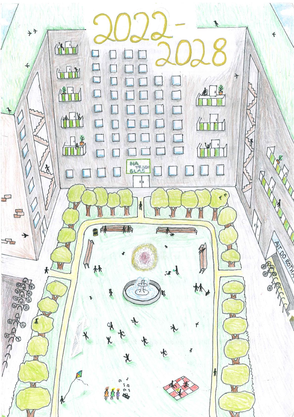
Picture by Saoirse Nic Uilliam, Gaelscoil Lios na nÓg, Raghnallach.
|
It is the Policy of Dublin City Council: |
|
|---|---|
|
SC 10 |
Urban DensityTo ensure appropriate densities and the creation of sustainable communities in accordance with the principles set out in Guidelines for Planning Authorities on Sustainable Urban Development (Cities, Towns and Villages), (Department of Environment, Heritage and Local Government, 2009), and its companion document, Urban Design Manual: A Best Practice Guide and any amendment thereof. |
|
SC 11 |
Compact GrowthIn alignment with the Metropolitan Area Strategic Plan, to promote compact growth and sustainable densities through the consolidation and intensification of infill and brownfield lands, particularly on public transport corridors, which will:
|
|
SC 12 |
Housing MixTo promote a variety of housing and apartment types and sizes , as well as tenure diversity and mix, which will create both a distinctive sense of place in particular areas and neighbourhoods, including coherent streets and open spaces and provide for communities to thrive. |
|
SC 13 |
Green InfrastructureTo recognise and promote Green Infrastructure and landscape as a key mechanism to address climate change and as an integral part of the form and structure of the city, including streets and public spaces. |
4.5.4 Increased Height as Part of the Urban Form and Spatial Structure of Dublin
Aligned with the principle of greater densification, will be the requirement to consider greater height in appropriate locations. It is important to note however, that higher density does not necessarily equate to high rise buildings and plot ratio and site coverage all contribute to the density of a particular built form. Appropriate higher density schemes can often be achieved by using mid-rise typologies and key to the success of such development is high quality design and placemaking.
The Urban Development and Building Height Guidelines for Planning Authorities published in December 2018 state that increasing prevailing building heights has a critical role to play in addressing both the scale and density of development. The guidelines also note that increased building height is a factor in assisting modern placemaking and improving the overall quality of our urban environments. The strategic approach, therefore, is to promote more intensive forms of development, including increased height, whilst ensuring that high quality places and a good quality of life are achieved.
Policy and guidance regarding building height is set out in Appendix 3. The City Council advocates that when considering building height, regard must be had to the prevailing context within which the site is located and broader consideration must also be given to potential impacts such as overshadowing and overlooking, particularly in the lower scaled suburban areas of the city.
The appropriateness of building heights is also a key consideration within the historic core, particularly in key sensitive areas of the city such as the Georgian core, the Liffey Quays and medieval centre. Proposals for increased height in these areas must demonstrate that they do not have an adverse impact on these sensitive environments and that they make a positive contribution to the historic context. The City Council remains committed to the need to protect and enhance conservation areas, architectural conservation areas and the historic core of the city.
Furthermore, the strategic approach pursued under this plan will be to ensure a design led approach to optimising height. Appropriate heights should be based on an evaluation of the sites attributes and its function, its surrounding context and capacity for growth and the most appropriate development form. It is a requirement that a masterplan will be prepared for any site greater than 0.5ha to allow for the early testing of appropriate open space, sunlight, daylight, visual impacts wind effect etc. and that this is used to inform design development.
Proposals seeking to optimise height in achieving higher densities must demonstrate how they will assist in delivering vibrant and equitable neighbourhoods that are walkable, compact, green, accessible, mixed and balanced and that respond positively to the existing or emerging context. Appendix 3 also sets out a detailed set of performance based criteria for the assessment of proposals of enhanced scale and height so as to ensure the protection of the natural and heritage assets of the city.
Appendix 3 sets out specific guidance regarding the appropriate locations where enhanced density and scale including increased height will be promoted and also performance criteria for the assessment of such development. Appendix 3 also details the different classifications of building height in the city i.e. prevailing height in a given area; locally higher buildings (which are typically up to 50m); and landmark/tall buildings which are significant features in the city scape.
Landmark/Tall Buildings
Dublin City Council acknowledges that taller landmark buildings can play an important visual role and can make a positive contribution to the skyline of a city. A landmark/tall building is defined as a building that is substantially taller than its surroundings and that causes a significant change to the skyline. As such, landmark/tall buildings shall be used to signal major urban functions such as high capacity public transport interchanges or to create a civic statement. Dublin City Council recognises the merit of taller buildings, including landmark/tall buildings, in a very limited number of locations, at a scale appropriate for Dublin.
Accordingly, the spatial approach to landmark/tall buildings in the city is in essence to protect the vast majority of the city as a predominantly low-rise city, including established residential areas and conservation areas within the historic core, while also recognising the potential and the need for taller landmark buildings to deliver more sustainable compact growth. It is considered that landmark/tall buildings are most appropriately located in areas identified for large scale regeneration and redevelopment; that are well connected centres of employment; which have the capacity to create their own character and identity and where the existing character of the area would not be adversely impacted by the scale, mass and height of such tall building/s. Clustering of taller buildings of the type needed to promote significant densities of commercial and residential space are likely to be achieved in a limited number of areas only.
In all cases, all proposals for enhanced scale and height, including landmark/tall buildings must respect their context and address the assessment criteria set out in Appendix 3, to ensure that such developments achieve high standards in relation to design, sustainability, amenity, impacts on the receiving environment and the protection or framing of important views.
|
It is the Policy of Dublin City Council: |
|
|---|---|
|
SC 14 |
Building Height StrategyTo ensure a strategic approach to building height in the city that accords with The Urban Development and Building Height Guidelines for Planning Authorities (2018) and in particular, SPPR 1 to 4. |
|
SC 15 |
Building Height UsesTo support the development of an adequate mix of uses in proposals for larger scale development which are increasing height or proposing a taller building in accordance with SPPR 2. |
|
SC 16 |
Building Height LocationsTo recognise the predominantly low rise character of Dublin City whilst also recognising the potential and need for increased height in appropriate locations including the city centre, Strategic Development Zones, Strategic Development Regeneration Areas, Key Urban Villages and other locations as identified in Appendix 3, provided that proposals ensure a balance between the reasonable protection of existing amenities and environmental sensitivities, protection of residential amenity and the established character of the area. |
|
SC 17 |
Building HeightTo protect and enhance the skyline of the city, and to ensure that all proposals with enhanced scale and height:
All new proposals in the inner city must demonstrate sensitivity to the historic city centre, the River Liffey and quays, Trinity College, the cathedrals, Dublin Castle, the historic squares and the city canals, and to established residential areas and civic spaces of local and citywide importance. |
|
SC 18 |
Landmark/Tall BuildingsTo promote a co-ordinated approach to the provision of landmark/tall buildings through Local Area Plans, Strategic Development Zones and the Strategic Development and Regeneration Area principles, in order to prevent visual clutter or cumulative negative visual disruption of the skyline and that such proposals comply with the performance based criteria set out in Appendix 3. |
4.5.5 Urban Design and Architecture
Well-considered urban design and architecture, including use of high quality materials and finishes, and well-designed buildings, spaces and landscapes make a positive contribution to the urban environment and improve the environmental performance, competitiveness and attractiveness of the city.
The quality of urban design and architecture improves economic value and is a key element in regeneration proposals. Good design can improve the experience of all the city’s communities in everyday life. Furthermore, it is important to consider the economic and environmental benefits of future-proofing the design of a building or project, if costs to retro-fit or re-design an existing scheme are to be avoided in the future. The City Council will strive to ensure exemplar design quality across the city, with the aim of achieving excellence in the ordinary, including the creation of new landmarks, streets and public spaces where appropriate.
Quality design and healthy placemaking are core principles of the NPF and the RSES, improving quality of life for all. The strategic approach is also to ensure that the principles of healthy placemaking are embraced and that high quality urban design that supports active lifestyles through good quality pedestrian and cycle links, particularly to places of work, education and recreation are promoted. Placemaking and sustainable communities are also supported through the creation of vibrant, safe and accessible spaces which facilitate recreation and social interaction. The City Council will actively promote the adherence to such core principles.
Design principles, policies and standards for urban design and architecture are set out in Chapter 15: Development Standards. Chapter 11: Built Heritage and Archaeology includes further guidance on development in Architectural Conservation Areas and protected structures
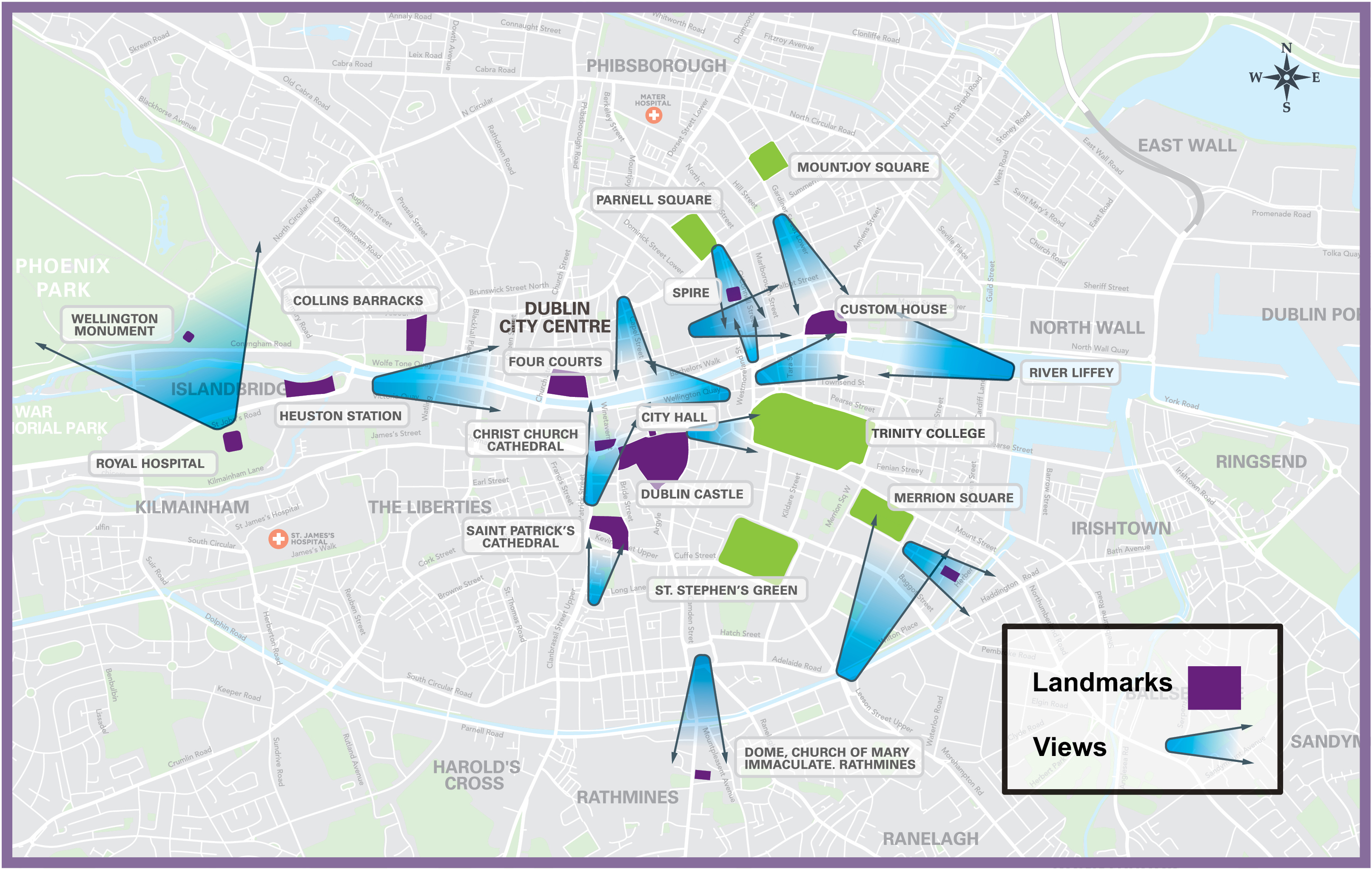
Figure 4-1: Key Views and Prospects
A Design Statement should be submitted with all large scale residential and commercial developments including schemes in excess of 50 residential units and 1,000 sq. metres of commercial development setting out the development strategy for the site and providing details of the architectural and urban design approach. The statement should provide detail of how the development aligns with the Urban Design Manual – A Best Practice Guide 2009 and Design Manual for Urban Roads and Streets (2013). Further guidance on such Design Statements is set out in Chapter 15.
|
It is the Policy of Dublin City Council: |
|
|---|---|
|
SC 19 |
High Quality ArchitectureTo promote development which positively contributes to the city’s built and natural environment, promotes healthy placemaking and incorporates exemplar standards of high-quality, sustainable and inclusive urban design and architecture befitting the city’s environment and heritage and its diverse range of locally distinctive neighbourhoods. |
|
SC 20 |
Urban DesignPromote the guidance principles set out in the Urban Design Manual – A Best Practice Guide and in the Design Manual for Urban Roads and Streets (2013). |
|
SC 21 |
Architectural DesignTo promote and facilitate innovation in architectural design to produce contemporary buildings which contribute to the city’s character and which mitigates and is resilient to, the impacts of climate change. |
|
SC 22 |
Historical Architectural CharacterTo promote understanding of the city’s historical architectural character to facilitate new development which is in harmony with the city’s historical spaces and structures. |
|
SC 23 |
Design StatementsThat Design Statements shall be submitted for all large scale residential (+50 units) and commercial development proposals (+1,000 sq. m.) in accordance with the principles set out in Chapter 15. |
4.5.6 The Public Realm
A high-quality public realm makes the city a more attractive place to live, work and visit, and provides for an improved quality of life for all. It is an integral part of healthy placemaking as supported under the RSES. The public realm can have a very positive impact on Dublin’s competiveness with other city regions internationally, both for tourism and for investment.
Improvements to the public realm in recent years include the renovation of Grafton Street and implementation of the Docklands Public Realm Masterplan. The ongoing implementation of Your City - Your Space’, Dublin City’s Public Realm Strategy (2012), will continue to result in significant upgrading of the city’s public realm.
Proposals to improve the public realm will take account of the Urban Design Manual - A Companion Document to the Guidelines for Planning Authorities on Sustainable Residential Development in Urban Areas (Department of Environment, Heritage and Local Government, 2009) and the Design Manual for Urban Roads and Streets (Department of Environment, Community and Local Government and Department of Transport, Tourism and Sport, 2013). Accessibility is also a key issue, and ease of access to persons of all ages and abilities is a significant indicator as to how inclusive Dublin is as a city. A universal design approach will be adopted to ensure the public realm is accessible and inclusive for a range of users.
It is desirable that the perceived extent of the city core expands over the coming years, due in part to very high footfall and relatively limited pedestrian space in the core. Proposals to create a new cultural quarter at Parnell Square, to include the re-location of the City Library from the ILAC Centre, redevelop Moore Street and its environs and to renovate and create a new food hall and café/restaurant destination at the Victorian Wholesale Fruit and Vegetable Market at Mary’s Lane, will significantly expand the public’s perception of the city core, and will create new destination points in the city. The strengthening of links between the north and south retail core will also be a priority.
The key objective will be to ensure that the City Council endorses the principles of healthy placemaking and continues to develop public realm strategies and to invest in the urban environment, in order to ensure that a coherent and walkable city centre is created which allows for ease of movement and is inviting to persons of all abilities.
Further policies regarding the city’s public realm are set out in Chapter 7: The City Centre, Urban Villages and Retail.
Picture by Saoirse Nic Uilliam, Gaelscoil Lios na n-Óg, Raghnallach
[1] The 15-minute city concept envisages that within 15 minutes on foot or bike from where they live that people should have the ability to access most of their daily needs. Refer to Chapter 5 - Quality Housing and Sustainable Communities.
[2] ‘Healthy placemaking’ is a key principle of the RSES with the objective of promoting people’s quality of life through the creation of healthy and attractive places to live, work, visit and study in.
Clár ábhair
Observations
Observations